
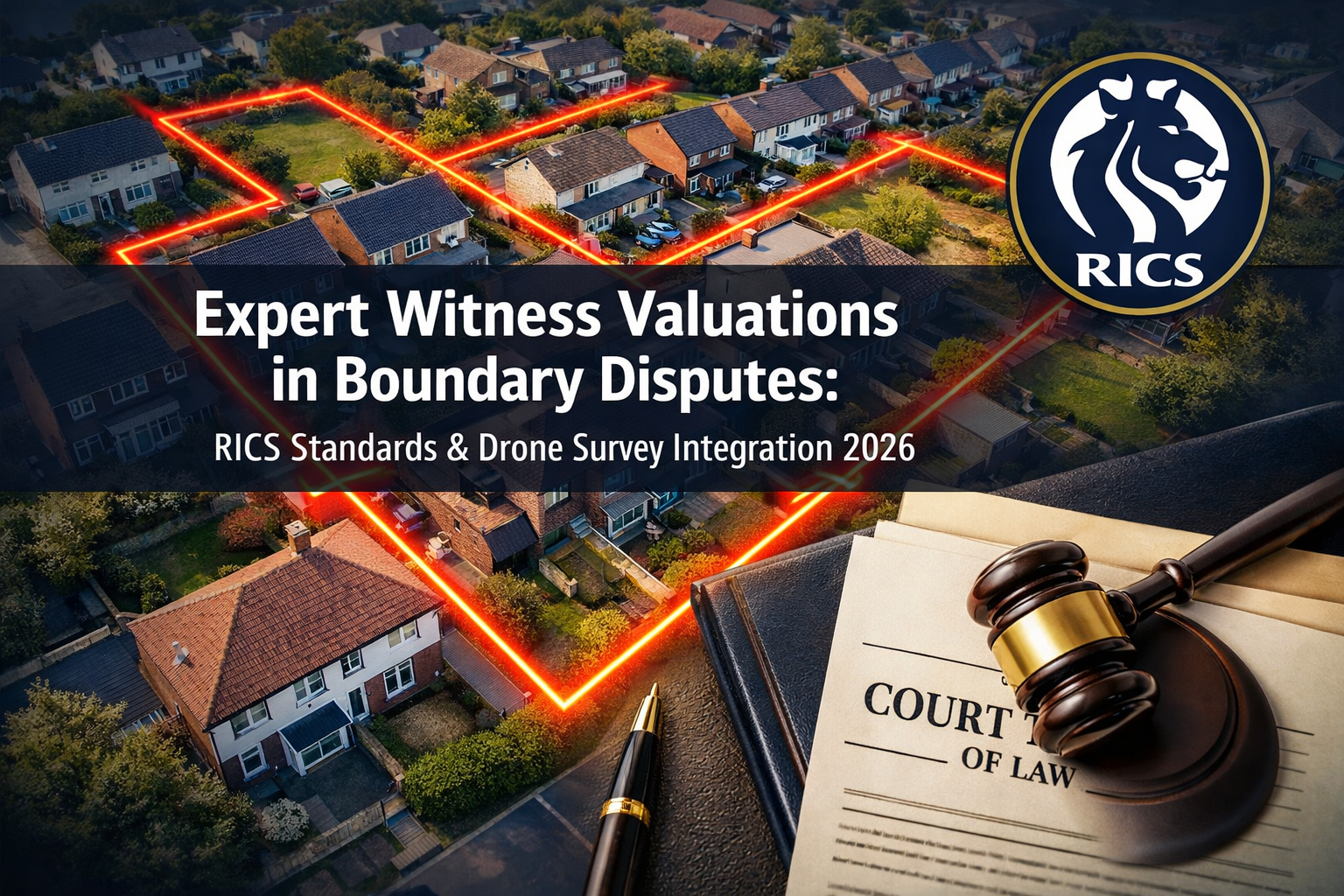
Boundary disputes between neighbours cost UK property owners an estimated £3 billion annually in legal fees, lost property value, and prolonged litigation — yet the majority of these cases hinge on a single document: the expert witness valuation report. In 2026, that report looks very different from what courts saw even three years ago. Expert Witness Valuations in Neighbour Boundary Disputes: RICS Standards and Drone Survey Integration for 2026 Cases has become a rapidly evolving discipline, shaped by updated RICS professional standards, new Civil Procedure Rules (CPR) Part 35 compliance demands, and the mainstream adoption of drone-based survey technology as court-admissible evidence.
Whether a dispute involves a fence line moved by six inches or a contested strip of land worth hundreds of thousands of pounds, the quality and credibility of the expert witness valuation can determine the outcome entirely.
Key Takeaways 📌
- RICS Red Book Global Standards remain the benchmark for all expert witness valuations in UK boundary dispute proceedings in 2026.
- CPR Part 35 governs how expert evidence is presented in civil court — non-compliance can render a valuation report inadmissible.
- Drone survey technology now provides centimetre-accurate boundary measurements that significantly strengthen expert witness reports.
- Early engagement of a RICS-accredited expert witness can reduce litigation costs and improve settlement prospects before reaching court.
- Boundary disputes are rising in 2026 alongside increased construction activity, making professionally prepared expert reports more critical than ever [4].
What Is an Expert Witness Valuation in a Boundary Dispute?
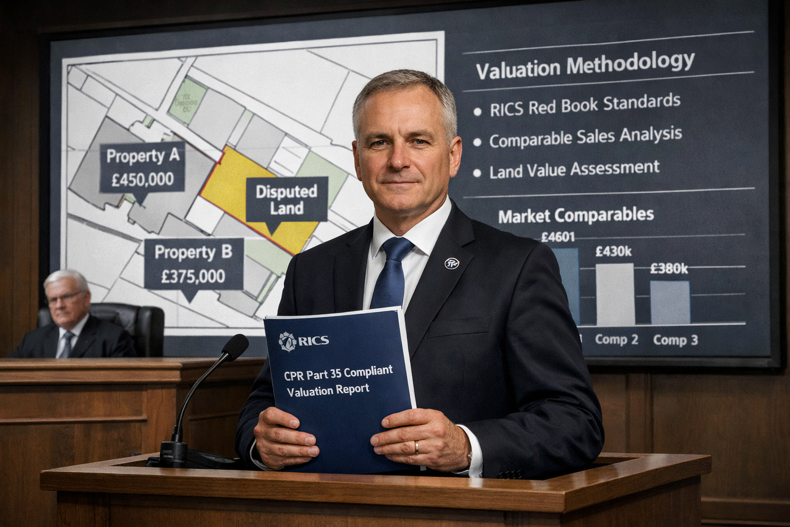
An expert witness valuation in a boundary dispute is a formal, court-admissible report prepared by a qualified professional — typically a RICS-accredited chartered surveyor — that provides an independent opinion on the location, ownership, and financial impact of a disputed boundary.
Unlike a standard property valuation, this type of report must satisfy dual obligations: it must be technically rigorous enough to withstand cross-examination, and it must comply with the procedural requirements of CPR Part 35, which governs expert evidence in civil proceedings in England and Wales.
The Role of the Expert Witness
An expert witness is not an advocate for the party who instructs them. Their primary duty is to the court, not the client. This distinction is fundamental. RICS offers formal training and certification through its Expert Witness Certificate programme, equipping surveyors with the skills to prepare compliant, impartial reports [2].
Key responsibilities include:
- ✅ Providing an independent, objective opinion on boundary location
- ✅ Quantifying any diminution in property value caused by the disputed boundary
- ✅ Presenting findings clearly for a non-specialist judge or tribunal
- ✅ Complying fully with CPR Part 35 and the accompanying Practice Direction
Professional land surveyors with boundary dispute experience can prepare these expert witness reports for court, drawing on skills in mapping, surveying, and spatial analysis [3]. Understanding UK boundary wall rules is foundational knowledge for any surveyor entering this field.
When Is an Expert Witness Valuation Required?
Not every boundary disagreement requires a formal expert witness report. However, one becomes essential when:
| Scenario | Expert Witness Required? |
|---|---|
| Dispute proceeds to county court or First-tier Tribunal | ✅ Yes |
| Mediation or RICS Dispute Resolution Service (DRS) | Often recommended [6] |
| Party Wall Act dispute with financial claim | ✅ Yes |
| Informal neighbour negotiation | ❌ Usually not |
| Mortgage lender requires boundary clarification | Sometimes |
RICS Standards Governing Expert Witness Valuations in 2026
The RICS framework for expert witness work in boundary disputes is built on several interlocking standards. Understanding these is non-negotiable for any surveyor accepting an instruction in this area.
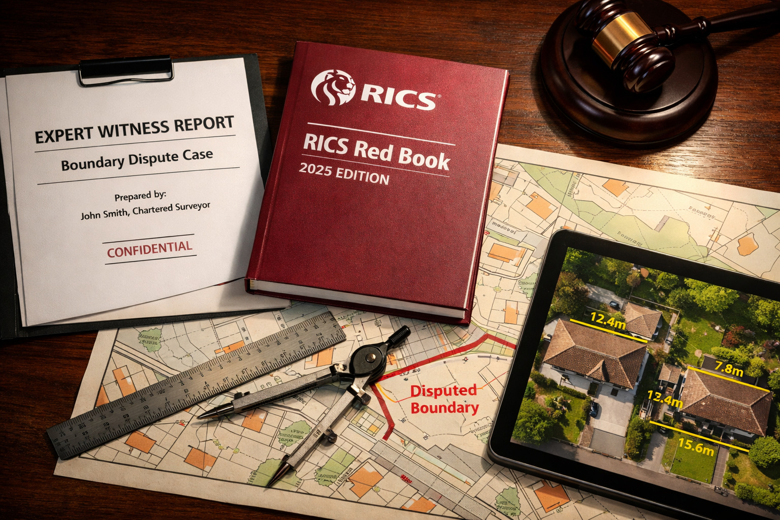
RICS Red Book Global Standards (2022, Effective 2026)
The RICS Valuation — Global Standards (Red Book) provides the overarching methodology for all valuations, including those prepared as expert evidence. In 2026, surveyors must ensure full compliance with:
- VPS 1–5: Core valuation standards covering bases of value, inputs, and reporting
- VPGA 10: Specific guidance on valuations for use in financial statements and legal proceedings
- PS 1 and PS 2: Mandatory professional standards applying to all RICS members
💬 "The Red Book is not a suggestion — it is the professional and ethical backbone of every valuation report that enters a courtroom."
CPR Part 35: The Legal Framework
The Civil Procedure Rules Part 35 sets out strict requirements for expert evidence in civil litigation. For Expert Witness Valuations in Neighbour Boundary Disputes: RICS Standards and Drone Survey Integration for 2026 Cases, compliance with CPR Part 35 means:
- Single joint expert (SJE) preference: Courts increasingly favour a single expert appointed by both parties to reduce costs and conflict.
- Written questions: Opposing parties can submit written questions to the expert within 28 days of the report.
- Discussions between experts: Where each party has their own expert, the court may order a without-prejudice meeting to narrow issues.
- Declaration of independence: Every report must contain the Part 35 declaration confirming the expert's duty to the court.
Failure to include the CPR Part 35 declaration is one of the most common — and most damaging — errors in expert witness reports submitted to UK courts [1].
RICS Dispute Resolution Services
The RICS Dispute Resolution Service (DRS) provides an alternative to litigation, offering adjudication, arbitration, and independent expert determination. The DRS application process is formal and structured, requiring supporting documentation that mirrors the standards expected in court [6]. Many boundary disputes are resolved through DRS at significantly lower cost than full litigation.
For complex disputes in London, engaging surveyors with deep local knowledge — such as building surveyors in Knightsbridge or property surveyors in Chelsea — can make a meaningful difference to report quality and local market insight.

Drone Survey Integration for 2026 Boundary Dispute Cases
The single most significant technical development in boundary dispute evidence over the past three years is the mainstream adoption of Unmanned Aerial Vehicle (UAV) surveys — commonly known as drone surveys — as a source of precise, court-admissible spatial data.
Why Drones Are Transforming Boundary Evidence
Traditional boundary surveys relied on ground-based total stations, tape measures, and Ordnance Survey (OS) data. While still valid, these methods have limitations in dense urban environments, overgrown gardens, or where physical access is contested. Drones overcome many of these barriers.
Key advantages of drone surveys in boundary disputes:
- 📐 Centimetre-level accuracy using Real-Time Kinematic (RTK) GPS positioning
- 🗺️ Orthomosaic mapping: Creates georeferenced aerial images accurate to ±2cm
- 📊 3D point cloud models: Provides measurable three-dimensional representations of boundary features
- 📷 Photographic evidence: High-resolution imagery captures encroachments, structures, and vegetation
- ⏱️ Speed: A full residential property survey can be completed in under two hours
Integrating Drone Data into CPR Part 35 Reports
For drone survey data to be admissible and persuasive in court, it must be integrated into the expert witness report correctly. Best practice in 2026 requires:
- Equipment calibration records: Documenting the drone model, sensor specifications, and calibration date
- Ground control points (GCPs): Using physical reference markers to validate aerial measurements against known OS coordinates
- Processing methodology: Clearly explaining the photogrammetry software used (e.g., Pix4D, DJI Terra) and accuracy parameters
- Chain of custody: Maintaining an unbroken record of data from capture to report to ensure integrity
- CAA compliance: Confirming the survey was conducted in compliance with UK Civil Aviation Authority (CAA) regulations for commercial drone operations
💬 "Drone-derived orthomosaic maps, when properly calibrated and documented, carry significant evidential weight — they are difficult to challenge and easy for a judge to understand."
Limitations and Challenges
Drone surveys are not without limitations. Surveyors must be transparent about:
- Canopy obstruction: Dense tree coverage can obscure boundary features
- Weather dependency: Wind, rain, and low light affect data quality
- CAA flight restrictions: Some urban areas have airspace restrictions requiring prior authorisation
- Data interpretation: Raw drone data requires expert processing — the methodology must be explained clearly in the report
Combining drone data with traditional ground survey methods produces the most robust boundary evidence. For properties in areas with complex histories, a condition survey report may also provide useful supplementary context about physical boundary features.
Preparing a Compliant Expert Witness Report: Step-by-Step
Producing an Expert Witness Valuation in Neighbour Boundary Disputes that meets RICS Standards and integrates drone survey data requires a structured approach.
Stage 1: Instruction and Conflict Check
Before accepting any instruction, the surveyor must:
- Confirm they have no conflict of interest with either party
- Agree the scope of the report in writing
- Clarify whether they are acting as a single joint expert or party-appointed expert
Stage 2: Document Review
Key documents to review include:
- Title deeds and Land Registry title plans
- Historic conveyances and transfer documents
- Planning applications and approved drawings
- Previous survey reports or correspondence
Understanding legal requirements for boundary walls is essential at this stage, as historic conveyance language often contains ambiguous boundary descriptions.
Stage 3: Site Investigation
The site visit should combine:
- Physical measurement using total station or GPS equipment
- Drone survey (where appropriate and permitted)
- Photographic record of all boundary features
- Interviews with parties (if instructed as SJE)
Stage 4: Valuation Analysis
Where the dispute has a financial dimension — such as a claim for diminution in value — the surveyor must apply RICS Red Book methodology to quantify:
- Loss of amenity value from the encroachment
- Cost of reinstatement where structures have been built on disputed land
- Market value impact on the affected property
For comprehensive property valuation support, RICS property valuations provide the methodological foundation for this analysis.
Stage 5: Report Writing and CPR Compliance
The final report must include:
| Required Element | CPR Part 35 Requirement |
|---|---|
| Expert's qualifications | ✅ Mandatory |
| Summary of instructions | ✅ Mandatory |
| Statement of facts relied upon | ✅ Mandatory |
| Expert's opinion and reasoning | ✅ Mandatory |
| Range of opinion (if applicable) | ✅ Mandatory |
| CPR Part 35 declaration | ✅ Mandatory |
| Appendices (drone data, maps, photos) | Best practice |
The Rising Demand for Expert Witness Valuations in 2026
Construction activity across the UK has increased significantly in 2026, bringing with it a corresponding rise in neighbour disputes, party wall issues, and boundary conflicts [4]. This trend is particularly pronounced in London and the South East, where high land values mean that even centimetres of disputed boundary can represent tens of thousands of pounds.
The Party Wall Act 1996 continues to generate a significant proportion of neighbour disputes, particularly in terraced and semi-detached properties where boundaries are shared and construction works are common. Understanding when a party wall agreement is needed is often the first step in avoiding a dispute that escalates to expert witness proceedings.
Cost Considerations
Expert witness valuations are not inexpensive. Typical costs in 2026 include:
- Initial report (single expert): £2,500–£6,000 depending on complexity
- Drone survey integration: £800–£2,500 additional
- Court attendance and cross-examination: £1,500–£3,500 per day
- Expert discussions and supplementary reports: £500–£1,500
Early resolution through RICS DRS or mediation almost always costs less than full litigation. However, where court proceedings are unavoidable, a well-prepared expert witness report — particularly one incorporating drone survey evidence — can be the decisive factor in achieving a favourable outcome [7].
Conclusion: Actionable Steps for 2026 Boundary Disputes
Expert Witness Valuations in Neighbour Boundary Disputes: RICS Standards and Drone Survey Integration for 2026 Cases represents a discipline that demands both technical excellence and procedural precision. The convergence of RICS Red Book methodology, CPR Part 35 compliance, and drone survey technology has raised the standard of evidence expected by courts — and raised the bar for surveyors accepting these instructions.
Actionable next steps for property owners and legal professionals:
- 🔍 Engage a RICS-accredited expert early — before positions become entrenched and costs escalate.
- 📋 Request a CPR Part 35 compliant report from the outset, even if court proceedings are not yet contemplated.
- 🚁 Ask about drone survey capability — not all surveyors are equipped or CAA-authorised for UAV work.
- ⚖️ Consider RICS DRS as a faster, cheaper alternative to litigation for disputes where both parties are willing.
- 📂 Gather all title documents before the first expert meeting to maximise the efficiency of the instruction.
- 💼 Work with locally experienced surveyors who understand the specific property market and boundary conventions in the relevant area.
The combination of rigorous RICS standards and cutting-edge drone technology means that boundary dispute evidence in 2026 is more accurate, more persuasive, and more defensible than ever before. The key is ensuring it is prepared by the right expert, in the right way, from the very beginning.
References
[1] Neighbour Boundary Disputes – https://www.jspubs.com/expert-witness/si/n/neighbour-boundary-disputes/
[2] Expert Witness Certificate – https://www.rics.org/training-events/training-courses/expert-witness-certificate
[3] How To Resolve Boundary Disputes – https://srb.co.uk/how-to-resolve-boundary-disputes/
[4] Party Wall Surveys And Neighbour Disputes During 2026s Construction Uptick Rics Compliance Framework – https://nottinghillsurveyors.com/blog/party-wall-surveys-and-neighbour-disputes-during-2026s-construction-uptick-rics-compliance-framework
[5] Boundary Disputes – https://www.eastonbevins.co.uk/boundary-disputes/
[6] Application Forms – https://www.rics.org/dispute-resolution-service/drs-services/application-forms
[7] Rics Valuation Expert Witness Services – https://edsltd.com/rics-valuation-expert-witness-services/


