


By 2026, the global GIS market is projected to surpass $14 billion — a figure that underscores just how deeply geographic information systems have embedded themselves into the fabric of modern land management. The era of paper maps and manual boundary measurements is firmly behind us. Today, GIS advancements in property surveying: enhancing data analysis for smarter land use decisions is not just a technical talking point — it is the operational backbone of how cities grow, farms are managed, and property disputes are resolved.
From centralized geospatial data platforms to AI-powered pattern detection and immersive 3D visualisation tools, the surveying profession has been fundamentally reshaped. This article explores those changes in depth, covering the key technologies driving the shift, their real-world applications in urban planning and precision agriculture, and what they mean for property professionals across the UK and beyond.
Key Takeaways 📌
- GIS has evolved from basic digital mapping into a multi-layered, AI-integrated platform for real-time land analysis.
- LiDAR, drones, and digital twins are now standard tools in advanced property surveying workflows.
- Centralized geospatial data management reduces duplication, improves accuracy, and accelerates decision-making.
- Urban planners and agricultural managers both benefit from GIS-driven pattern detection and predictive modelling.
- Property professionals who embrace these tools deliver faster, more accurate, and more defensible survey outputs.

The Foundation: How GIS Transformed Property Surveying Data Management
From Paper Maps to Centralised Geospatial Platforms
The history of GIS in surveying stretches back further than most people realise. The U.S. Geological Survey (USGS) played a pivotal early role, introducing digital line graphs (DLGs), digital elevation models (DEMs), and nationwide land-cover datasets that formed the foundation for the rapid GIS expansion of the 1980s [7]. What started as a way to digitise topographic maps has grown into a fully integrated ecosystem of spatial data collection, storage, and analysis.
The most significant structural change in recent years has been the move toward centralised geospatial data management. Rather than individual surveyors maintaining siloed datasets, modern GIS platforms allow entire organisations — and sometimes entire municipalities — to work from a single, continuously updated spatial database.
💡 "Centralised GIS platforms eliminate data duplication, reduce human error, and give every stakeholder — from planners to solicitors — access to the same verified spatial record."
This shift has profound implications for land surveying practice. When a surveyor in the field updates a boundary record, that change is immediately visible to the planning department, the legal team, and the client. There is no version-control problem, no risk of acting on outdated maps, and no delay in communicating findings.
The Role of GNSS, SLAM, and Automated Data Collection
The evolution of geospatial surveying has been driven by a succession of technology upgrades. The field has transitioned from manual theodolites to Global Navigation Satellite Systems (GNSS), then to Simultaneous Localisation and Mapping (SLAM) scanning, and now to AI-powered data processing [5]. Each step has increased both the speed and the precision of spatial data collection.
| Technology | Primary Use | Key Benefit |
|---|---|---|
| GNSS | Positioning & boundary marking | Sub-centimetre accuracy |
| LiDAR | Terrain & structure mapping | Dense 3D point clouds |
| SLAM Scanning | Indoor & complex environments | Real-time 3D model building |
| Drone (UAV) Imagery | Aerial surveys | Large-area coverage, fast deployment |
| AI Processing | Pattern detection & data analysis | Automated feature extraction |
These tools do not operate in isolation. Their real power emerges when they are integrated within a GIS framework — where each data source becomes a layer that can be queried, compared, and visualised alongside every other layer. Understanding surveying technology at this integrated level is now a core competency for any professional working in property assessment.
GIS Advancements in Property Surveying: Enhancing Data Analysis for Smarter Land Use Decisions Through LiDAR and Drone Integration
LiDAR: Seeing the Land in Three Dimensions
Light Detection and Ranging (LiDAR) technology has arguably been the single most transformative hardware advancement in modern surveying. By emitting laser pulses and measuring their return time, LiDAR sensors generate extraordinarily dense 3D point clouds — digital representations of terrain and structures with millimetre-level detail.
The Bureau of Land Management (BLM) has been a leading adopter, incorporating LiDAR into cadastral surveying to enable detailed terrain mapping, riverbank monitoring, fire investigation support, and the creation of high-resolution Digital Elevation Models (DEMs) [2]. These are not niche applications — they represent the kind of multi-purpose spatial intelligence that land managers at every level now expect.
For property surveyors, LiDAR delivers several concrete advantages:
- ✅ Accurate flood risk modelling — precise elevation data reveals which parcels sit within flood zones
- ✅ Subsurface feature detection — vegetation filtering reveals ground-level features hidden from aerial photography
- ✅ Structural assessment support — building facades and roof geometries captured in detail
- ✅ Boundary dispute resolution — unambiguous spatial records that hold up under legal scrutiny
This last point is particularly relevant for professionals dealing with boundary disputes or property boundary disputes, where the precision of spatial evidence can be the deciding factor in a legal proceeding.
Drones + GIS: Speed Meets Intelligence
The integration of unmanned aerial vehicles (UAVs) with GIS platforms has compressed project timelines that once took weeks into a matter of days. Environmental and engineering consulting firms like Dudek have demonstrated this clearly — by combining drone data collection with GIS analysis workflows, they achieved faster project completion and measurably improved decision-making outcomes [1].
In Texas, the integration of LiDAR mapping, drone imaging, and GIS data systems has become central to land development practice. Survey teams now work more efficiently, spend less time in the field, and deliver highly detailed digital models from the very start of a project [4]. The same pattern is emerging across the UK, where urban density and complex land ownership structures make efficient aerial data collection especially valuable.
Digital Twins: The Next Frontier in Property Intelligence
Perhaps the most exciting development in GIS-integrated surveying is the rise of digital twins — virtual replicas of physical assets or environments that are updated in real time using sensor data and GIS feeds. The geospatial industry is undergoing a significant transformation through the adoption of AI, digital twins, and reality capture technologies, all of which are improving accuracy and optimising workflows [3].
For urban planners and property developers, a digital twin of a development site means:
- Scenario testing before a single brick is laid
- Infrastructure clash detection between utilities, drainage, and proposed structures
- Regulatory compliance checking against zoning and planning rules in real time
- Stakeholder visualisation — non-technical audiences can understand complex spatial data intuitively
This capability is especially powerful when combined with building survey data, allowing surveyors to integrate structural condition information directly into the spatial model of a property.
GIS Advancements in Property Surveying: Enhancing Data Analysis for Smarter Land Use Decisions in Urban Planning and Precision Agriculture
Pattern Detection and Urban Planning Applications
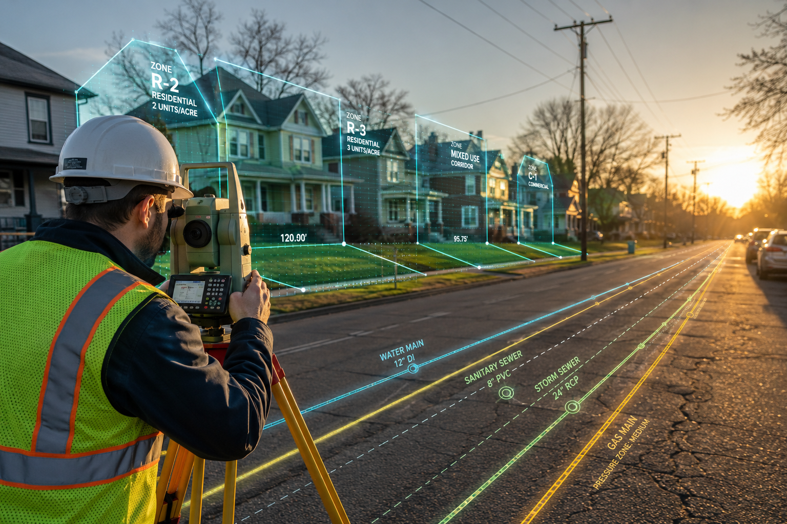
One of the most powerful — and often underappreciated — capabilities of modern GIS platforms is automated pattern detection. By layering multiple datasets (land use, ownership records, infrastructure, demographics, environmental risk) and applying machine learning algorithms, GIS systems can identify patterns that would be invisible to human analysts working with individual datasets.
In urban planning, this manifests in several high-value applications:
🏙️ Urban Heat Island Mapping
GIS layers combining satellite thermal imagery with land cover data reveal which neighbourhoods experience dangerous heat accumulation — critical information for green infrastructure planning.
🚦 Traffic and Access Modelling
Spatial analysis of road networks, population density, and proposed development footprints helps planners predict congestion and design more efficient transport corridors.
🌊 Flood and Climate Risk Overlays
Multi-layered GIS analysis integrating LiDAR elevation data, historical flood records, and climate projections gives planners a defensible evidence base for development restrictions.
📐 Zoning Compliance and Change Detection
Automated comparison of current land use against zoning designations flags non-compliant development — a function that previously required manual inspection of individual parcels.
GIS technology is transforming commercial land surveys by providing real-time, multi-layered analysis that includes high-resolution aerial imagery, real-time boundary mapping, utility and infrastructure overlays, and 3D visualisation of land elevations and structures [6]. This level of data richness supports genuinely smarter decisions — not just faster ones.
For property professionals operating across London and the South East, these capabilities are directly relevant. Whether conducting assessments in Bromley, Enfield, or Richmond, the ability to contextualise a single property within its broader spatial environment adds significant value to every survey report.
Precision Agriculture: GIS Beyond the City
GIS advancements in property surveying are not limited to urban environments. In the agricultural sector, the same technologies that map city boundaries and detect urban heat islands are being applied to optimise crop yields, manage soil health, and plan irrigation infrastructure.
Precision agriculture uses GIS-integrated tools to:
- 🌾 Map soil variability across a single field using drone-collected multispectral imagery
- 💧 Model drainage patterns using LiDAR-derived DEMs to identify waterlogging risk
- 🗺️ Delineate land parcels with GPS accuracy for lease agreements and subsidy claims
- 📊 Track yield data spatially, linking production outcomes to specific field zones
The application of GIS in surveying has evolved significantly, moving from manual, labour-intensive methods to highly precise, automated, and integrated processes [8]. In agricultural contexts, this evolution means that a land agent or rural surveyor can now deliver spatial insights that directly influence farm management decisions — not just boundary records.
This is particularly relevant when combined with accurate property condition assessment data for rural buildings and infrastructure, where the physical condition of assets must be understood in their spatial and environmental context.
The Convergence: Smart Land Use Decision-Making
The most significant outcome of all these GIS advancements is a fundamental shift in how land use decisions are made. The old model — collect data, produce a static report, hand it to a decision-maker — has been replaced by a dynamic, iterative, spatially-aware process.
Key characteristics of modern GIS-enabled land use decisions:
| Old Approach | GIS-Enhanced Approach |
|---|---|
| Static paper or PDF reports | Interactive, queryable spatial dashboards |
| Single-point-in-time data | Continuously updated live data feeds |
| Siloed departmental datasets | Centralised, integrated spatial database |
| Manual boundary identification | Automated feature extraction and change detection |
| Reactive risk identification | Predictive modelling and scenario analysis |
This convergence of data streams — from drones, LiDAR, GNSS, satellite imagery, and AI processing — into a unified GIS platform represents the maturation of a technology that has been developing for over four decades [7]. The result is a profession that is more analytical, more defensible, and more valuable than at any point in its history.
For anyone commissioning a survey — whether a homebuyer, a developer, or a local authority — understanding what a surveyor does in this modern context is essential to appreciating the full value of the service.
Conclusion: Actionable Next Steps for Property Professionals in 2026
GIS advancements in property surveying: enhancing data analysis for smarter land use decisions is not a future aspiration — it is the present reality of the profession. The technologies discussed in this article are operational today, delivering measurable improvements in accuracy, speed, and decision-making quality across urban planning, commercial development, and precision agriculture.
For property professionals, here are the most important actionable steps to take right now:
-
Audit your current data workflows. Identify where siloed datasets are creating inefficiencies or errors, and explore centralised GIS platform options that integrate with your existing tools.
-
Invest in LiDAR and drone capability — either in-house or through specialist subcontractors. The ROI in reduced field time and improved deliverable quality is well-documented [4].
-
Develop digital twin literacy. Even if full digital twin implementation is not yet viable for your practice, understanding how to interpret and communicate 3D spatial models is becoming a baseline professional skill [3].
-
Integrate GIS data into client-facing reports. Interactive maps and spatial visualisations dramatically improve client understanding and satisfaction — and differentiate your service in a competitive market.
-
Stay current with AI developments in spatial analysis. Machine learning applications in pattern detection and automated feature extraction are advancing rapidly [5], and early adopters will have a significant competitive advantage.
-
Commission comprehensive surveys that leverage these technologies. Whether you need a RICS HomeBuyer Survey or a full building assessment, ensure your surveyor is equipped with modern GIS-integrated tools.
The land beneath our feet has not changed. But the tools available to understand, measure, and manage it have never been more powerful. The professionals who master these tools — and who can translate their outputs into clear, actionable intelligence — will define the next generation of property surveying.
References
[1] Dudek Land Surveys Gis And Drones – https://www.esri.com/en-us/lg/industry/aec/stories/dudek-land-surveys-gis-and-drones?utm_source=openai
[2] Revolutionizing Cadastral Surveying Impact Lidar Technology – https://eros.usgs.gov/doi-remote-sensing-activities/2024/blm/revolutionizing-cadastral-surveying-impact-lidar-technology?utm_source=openai
[3] Advanced Technology – https://journals.cices.org/ces/geospatial-engineering-2025-2026/features/advanced-technology?utm_source=openai
[4] Land Surveying Technology In Texas – https://urbanstrategy.us/land-surveying-technology-in-texas/?utm_source=openai
[5] Geospatial Evolution – https://journals.cices.org/ces/geospatial-engineering-2025-2026/features/geospatial-evolution?utm_source=openai
[6] Gis Technology Commercial Land Surveys Houston 2025 – https://stsurvey.com/post/gis-technology-commercial-land-surveys-houston-2025?utm_source=openai
[7] A 125 Year History Topographic Mapping And Gis Us Geological Survey 1884 2009 Part 2 – https://www.usgs.gov/index.php/publications/a-125-year-history-topographic-mapping-and-gis-us-geological-survey-1884-2009-part-2?utm_source=openai
[8] The Evolution And Application Of Gis In Surveying – https://id.land/blog/the-evolution-and-application-of-gis-in-surveying?utm_source=openai