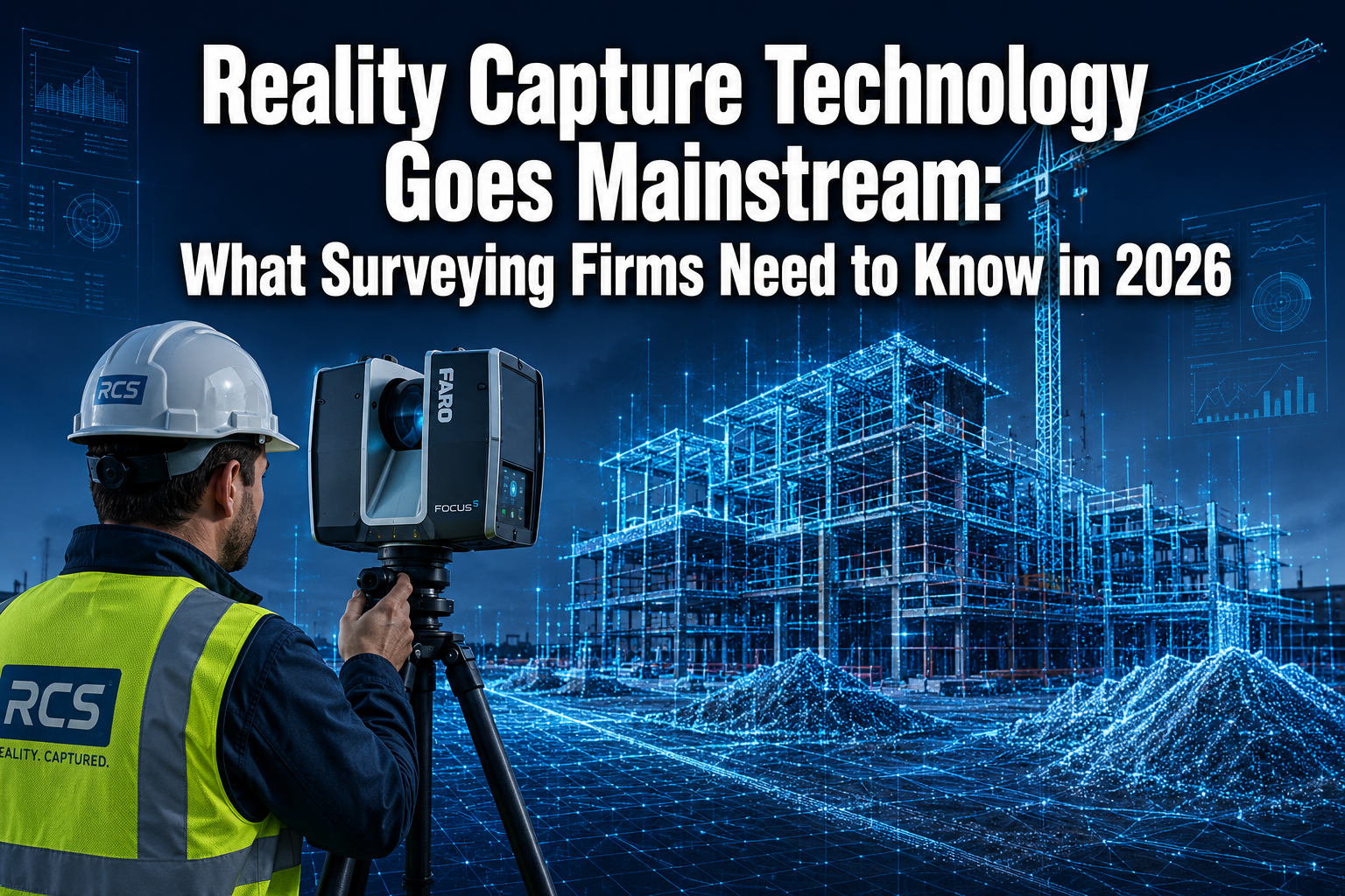
The global market for 3D scanning and reality capture is projected to surpass $10 billion by 2027, yet just a decade ago, LiDAR scanners were considered exotic tools reserved for aerospace contractors and government mapping agencies. That gap between "specialist luxury" and "everyday toolkit" has closed faster than most surveying professionals anticipated. Reality Capture Technology Goes Mainstream: What Surveying Firms Need to Know in 2026 is not a distant forecast — it is the operational reality firms are navigating right now, as hardware costs fall, software platforms mature, and client expectations rise sharply.
Key Takeaways
- Reality capture tools — including LiDAR, photogrammetry, and UAV-based scanning — have moved from specialist services to accessible, everyday surveying workflows in 2026.
- Integration with digital twins, GIS platforms, and cloud collaboration tools multiplies the value of captured data well beyond a single project phase.
- Wearable scanners, mobile LiDAR systems, and AI-assisted processing are reducing both the cost and the skill barrier for adoption.
- Firms that build internal capability now will hold a measurable competitive advantage as client demand for as-built accuracy and 3D deliverables accelerates.
- Practical implementation requires a phased approach: assess current workflows, invest in training, and select platforms that integrate with existing tools.
From Niche Specialist Tool to Everyday Surveying Workflow
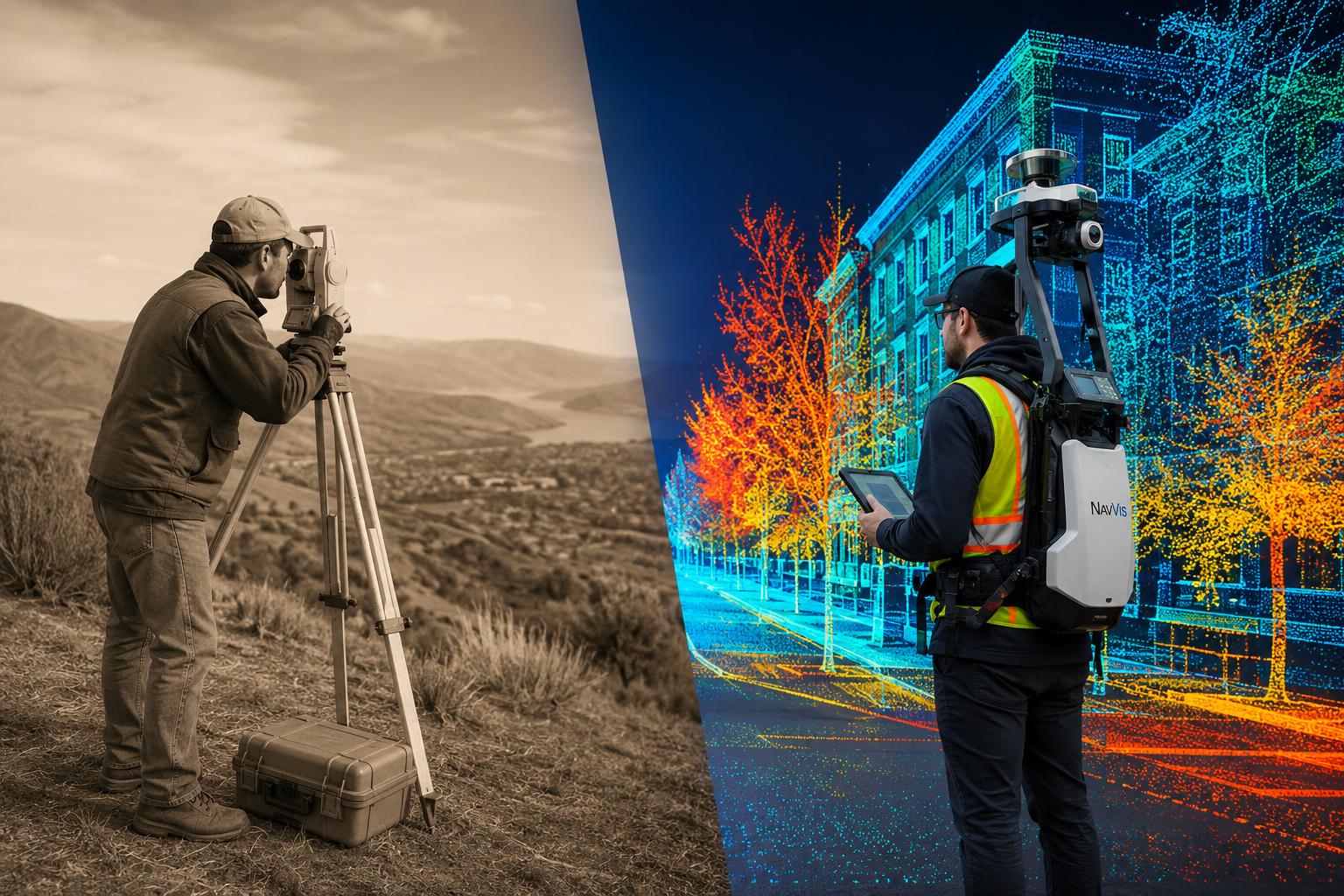
For most of surveying's modern history, capturing the precise geometry of a site meant days of manual measurements, total stations, and painstaking drafting. Reality capture — the process of digitising the physical world into accurate, data-rich 3D models — existed on the fringes. Early terrestrial laser scanners cost upwards of £100,000 per unit, required specialist operators, and produced datasets so large that standard office computers could barely process them.
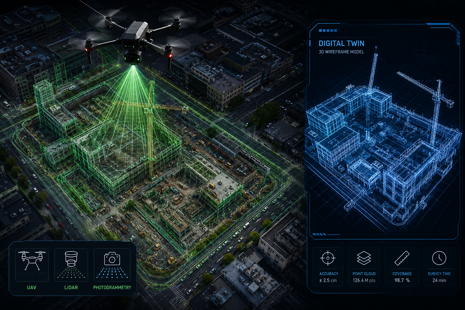
That picture has changed dramatically. Mobile LiDAR systems can now be mounted on vehicles, worn as backpacks, or attached to drones, capturing millions of measurement points per second at a fraction of the former cost. Firms such as James Verra & Associates have integrated mobile LiDAR reality capture into standard project workflows, enabling rapid and precise documentation of existing conditions that would previously have taken field crews several days to complete manually [1]. The result is a detailed 3D digital representation of complex sites delivered in hours rather than weeks.
What drove this shift?
Several forces converged simultaneously:
- Hardware miniaturisation brought scanner weight and cost down to commercially viable levels.
- Cloud computing made storing and processing enormous point cloud datasets practical for firms of any size.
- Software maturity meant platforms like RealityCapture (developed by Capturing Reality) could generate accurate 3D models from photographs and laser scans without requiring a PhD in geomatics.
- Drone regulations in the UK and internationally settled into workable frameworks, opening up aerial data collection as a routine service.
- Client demand from construction, infrastructure, and property sectors pushed firms to offer 3D deliverables as a baseline expectation rather than a premium add-on.
The combination of these factors means that in 2026, a surveying firm without some form of reality capture capability is increasingly at a competitive disadvantage. Understanding the full toolkit — and choosing the right entry points — is now a strategic priority.
The Core Technologies Driving Adoption
Reality capture is not a single technology. It is a family of complementary methods, each suited to different project types and accuracy requirements.
| Technology | Best Use Case | Typical Accuracy |
|---|---|---|
| Terrestrial LiDAR | Buildings, interiors, heritage sites | 2-5 mm |
| Mobile LiDAR (vehicle/wearable) | Corridors, roads, large interiors | 5-20 mm |
| UAV Photogrammetry | Large sites, topographic surveys | 20-50 mm |
| UAV LiDAR | Vegetation, complex terrain | 5-15 mm |
| Structured Light Scanning | Small objects, intricate details | 0.1-1 mm |
IMEG Corp. uses drones and 3D laser scanning together to collect vast amounts of site data efficiently, providing accurate and current information that directly informs cost estimation and project planning [4]. This combined approach — using UAV photogrammetry for broad site coverage and terrestrial scanning for critical detail areas — has become a recognised best practice for complex projects.
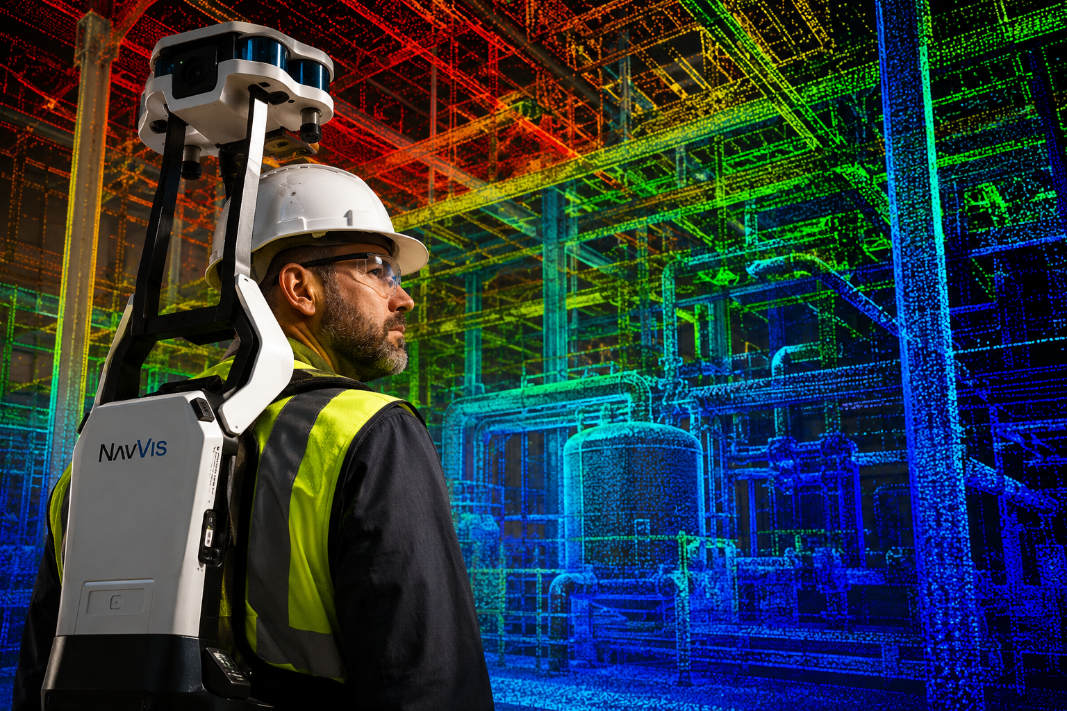
Wearable scanners represent another significant development. Tools such as the NavVis VLX allow a single operator to walk through a building and capture both exterior and interior assets in a single session, producing accurate point clouds of spaces regardless of size or complexity [10]. For property surveyors working across large commercial buildings or multi-storey residential blocks, this capability is transformative.
How Reality Capture Integrates with Modern Surveying Workflows
The raw data produced by reality capture tools only delivers its full value when it connects to the broader project ecosystem. Standalone point clouds sitting on a hard drive serve little purpose. The real competitive advantage comes from integration — linking captured data to digital twins, GIS platforms, BIM models, and cloud collaboration environments.
Digital Twins and Long-Term Asset Management
McLaren Engineering Group uses reality capture alongside digital twin technology to improve coordination and design evaluation across all project phases [7]. A digital twin is a continuously updated virtual replica of a physical asset. When reality capture feeds accurate, current geometry into a digital twin, project teams can work in virtual environments, test design decisions, and detect clashes before they become expensive on-site problems.
For surveying firms, this creates a compelling service proposition: rather than delivering a one-time survey report, firms can position themselves as long-term data partners, maintaining and updating digital twins as assets change over time. This recurring-service model is increasingly attractive to infrastructure owners, facilities managers, and large property portfolios.
Cloud Platforms and Collaborative Data Management
In September 2024, Trimble launched a reality capture platform service integrated with Trimble Connect, designed to facilitate efficient management, visualisation, and collaboration on large reality capture datasets [2]. This kind of platform removes one of the historic barriers to adoption — the difficulty of sharing and working with enormous point cloud files across distributed project teams.
Cloud-based reality capture management means that a structural engineer in London, a contractor on-site in Manchester, and a client reviewing progress from abroad can all access the same accurate, up-to-date 3D dataset simultaneously. For surveying firms, offering this kind of collaborative data environment is a differentiator that goes well beyond traditional deliverable formats.
VHB's approach of integrating reality capture with GIS and 3D modelling applications demonstrates how comprehensive datasets can inform every stage of a project, enhancing accuracy, efficiency, and long-term value for clients. When survey data flows directly into GIS layers and 3D models, the manual re-entry of measurements — and the errors that come with it — is eliminated.
Augmented and Extended Reality Applications
Allen & Company has expanded its services to include augmented reality (AR) and virtual reality (VR) applications, allowing surveyors to overlay digital information onto real-world environments [3]. This enhances situational awareness during complex surveys and supports richer client presentations.
A systematic review published in 2026 in the journal Photogrammetric Record highlights the growing integration of 3D as-built environments into extended reality (XR) applications, noting the importance of accurate 3D data acquisition through photogrammetry, RGB-D cameras, and LiDAR [5]. While challenges remain around real-time data transmission and semantic alignment, the direction of travel is clear: reality capture data will increasingly be consumed through AR and VR interfaces, not just on flat screens.
For property surveyors, this has practical implications. A building survey that once delivered a PDF report could, in the near future, deliver an interactive 3D walkthrough that a buyer or lender can explore directly. Understanding how to produce and package data for these formats is a capability worth developing now.
Safety Improvements Through Remote Data Collection
One of the most underappreciated benefits of reality capture going mainstream is the safety improvement it delivers. High-definition laser scanning, as used by firms such as Messer Construction, allows precise 3D documentation of physical objects without requiring personnel to enter hazardous areas [9]. A non-contact method that captures exact sizes and shapes from a safe distance reduces risk on sites involving confined spaces, unstable structures, or live traffic.
For firms conducting damp surveys or structural assessments in older properties, the ability to scan deteriorating fabric from a distance before committing to close-up inspection adds a meaningful layer of risk management. Similarly, airborne mapping using systems like the Leica TerrainMapper-3 LiDAR — adopted by NV5 to reinforce high-precision geospatial intelligence across complex environments [8] — removes the need for survey crews to work in difficult terrain or near active infrastructure.
Practical Implementation: What Surveying Firms Should Do in 2026
Knowing that reality capture technology has gone mainstream is one thing. Building a practical implementation roadmap is another. The firms that will benefit most are those that take a structured, phased approach rather than making large, undirected capital investments.
Step 1: Audit Current Workflows and Identify Pain Points
Before purchasing any hardware or software, map out where current survey workflows are slowest, least accurate, or most labour-intensive. Common pain points include:
- Manual measurement of large or complex sites
- Difficulty producing accurate as-built documentation
- Time spent on re-surveys when design information is outdated
- Client requests for 3D deliverables that current tools cannot produce
This audit will clarify which reality capture technologies address genuine business problems rather than simply adding technical capability for its own sake.
Step 2: Choose Entry-Level Technologies That Integrate
For most small to mid-sized surveying firms, the most practical entry point in 2026 is UAV photogrammetry combined with a cloud-based processing platform. Drone hardware is now widely available at accessible price points, and photogrammetry software has become sufficiently automated that a skilled operator can produce accurate 3D models without deep technical expertise.
The next step up — mobile LiDAR or wearable scanners — makes sense for firms regularly working on large interiors, infrastructure corridors, or complex multi-storey buildings. The key selection criterion should be integration: does the chosen hardware and software connect to the platforms your clients and project partners already use?
Firms working on projects that involve party wall agreements or boundary assessments will find that high-accuracy point cloud data provides a defensible, objective record of existing conditions — a significant advantage in any dispute resolution scenario. Similarly, a schedule of condition backed by reality capture data is far more robust than one relying solely on photographs and written descriptions.
Step 3: Invest in Training and Workflow Integration
Technology without training delivers poor returns. Surveying firms should budget for:
- Operator certification for UAV pilots (CAA PfCO or equivalent)
- Software training for point cloud processing and 3D modelling
- Workflow redesign to ensure captured data flows into existing project management and reporting systems
The VRISE platform, highlighted in recent research, demonstrates the growing availability of virtual reality laboratories that replicate surveying tasks and provide real-time feedback, improving measurement accuracy and task efficiency [6]. While primarily aimed at education, such platforms also offer experienced professionals a low-risk environment to develop new skills.
Step 4: Position Reality Capture as a Client-Facing Value Proposition
Clients increasingly understand what 3D data can do for them. Construction firms want clash detection. Property owners want accurate as-built records. Infrastructure managers want digital twins they can update over time. Surveying firms that can articulate the specific value of reality capture — in terms of reduced rework costs, faster project delivery, and more accurate documentation — will win more work.
"The firms that frame reality capture as a client benefit rather than an internal efficiency gain are the ones converting the technology into revenue."
For firms covering London and the South East, the demand for advanced survey services is particularly strong across commercial and residential development sectors. Whether providing building evaluation services or supporting complex Level 3 structural surveys, the ability to deliver richer, more accurate data is a clear market differentiator.
Common Pitfalls to Avoid
- Over-investing in hardware before validating demand: Start with a service offering and test client appetite before committing to expensive equipment purchases.
- Ignoring data management: Point clouds are large. Without a clear data storage, processing, and delivery workflow, datasets become a liability rather than an asset.
- Treating reality capture as a standalone service: The greatest value comes from integration with downstream uses — BIM, GIS, digital twins, and client-facing visualisation.
- Underestimating processing time: Capturing data in the field is only part of the workflow. Registration, cleaning, and modelling take time and skilled operators.
Conclusion: Building Competitive Advantage Through Reality Capture in 2026
Reality Capture Technology Goes Mainstream: What Surveying Firms Need to Know in 2026 can be summarised in a single principle: the window for early-mover advantage is still open, but it is closing. The technology has matured, the costs have fallen, and client expectations are rising. Firms that act now — methodically, with clear business cases and phased investment — will be positioned to lead as the market continues to evolve.
Actionable next steps for surveying firms in 2026:
- Conduct a workflow audit to identify where reality capture delivers the highest immediate value.
- Pilot UAV photogrammetry or mobile scanning on a live project to build internal capability and demonstrate client value.
- Evaluate cloud-based data management platforms that integrate with existing project tools.
- Develop a training plan that covers both technical operation and data processing workflows.
- Update service offerings and client-facing materials to reflect new 3D deliverable capabilities.
- Explore how reality capture data can support existing services — from homebuyer reports to complex structural assessments — by providing richer, more defensible evidence.
The surveying profession has always been defined by the accuracy and reliability of the data it produces. Reality capture does not change that mission — it dramatically expands the tools available to fulfil it.
References
[1] Lidar Reality Capture – https://jvasurveyors.com/lidar-reality-capture/?utm_source=openai
[3] Beyond Geospatial How Allen Companys Reality Capture Services Extend The Capabilities Of Traditional Surveying And Mapping Methods – https://www.allen-company.com/2023/08/21/beyond-geospatial-how-allen-companys-reality-capture-services-extend-the-capabilities-of-traditional-surveying-and-mapping-methods/?utm_source=openai
[4] Reality Capture Services – https://imegcorp.com/services/reality-capture-services/?utm_source=openai
[5] Phor – https://onlinelibrary.wiley.com/doi/full/10.1111/phor.70046?utm_source=openai
[6] arxiv – https://arxiv.org/abs/2507.22810?utm_source=openai
[7] Reality Capture And Digital Twins – https://www.mgmclaren.com/keyservices/survey-and-mapping/reality-capture-and-digital-twins/?utm_source=openai
[8] Reality Capture – https://leica-geosystems.com/case-studies/reality-capture?utm_source=openai
[9] Reality Capture – https://www.messer.com/innovation/reality-capture/?utm_source=openai
[10] Reality Capture Virtual Walk Through – https://www.allen-company.com/home/reality-capture-virtual-walk-through/?utm_source=openai