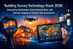
nn

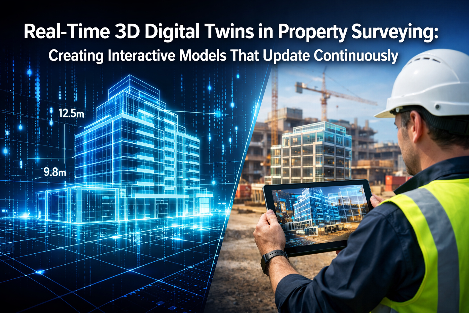
Imagine standing in front of a holographic representation of a property development site where you can simulate a decade's worth of erosion patterns in seconds, test how proposed drainage systems will handle extreme weather events, or visualize how vegetation growth will impact sight lines—all before breaking ground. This isn't science fiction. In 2026, Real-Time 3D Digital Twins in Property Surveying: Creating Interactive Models That Update Continuously have transformed static survey deliverables into dynamic, collaborative assets that respond to changing conditions and stakeholder needs.
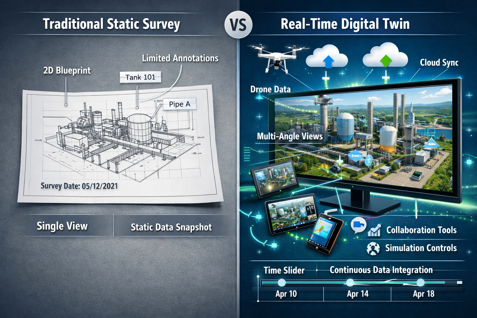
The property surveying industry has undergone a fundamental shift. Traditional surveys delivered fixed snapshots—printed plans, PDF reports, and static measurements that became outdated the moment conditions changed. Today's real-time digital twins create living, breathing representations of properties that evolve alongside the physical assets they represent, enabling developers, planners, and property managers to visualize land behavior under various conditions and make informed decisions with unprecedented confidence.
Key Takeaways
- 🚁 Autonomous drone technology now captures multi-sensor data automatically, eliminating the need for multiple site visits and delivering unprecedented detail for large-scale properties
- 💰 Digital twins reduce maintenance costs by 30% and improve decision-making speed by 10x, with measurable improvements to Net Operating Income of 8%[5]
- ⚡ Processing times have decreased by 90%, allowing surveyors to deliver interactive 3D models in hours rather than days or weeks[2]
- 🔄 Cloud-based collaboration platforms enable real-time revision syncing, instant file sharing, and integrated communication tools that transform how stakeholders interact with survey data[1]
- 📊 Simulation capabilities within digital twins allow testing of slope erosion, water flow patterns, vegetation changes, and infrastructure stress before physical construction begins[1]
Understanding Real-Time 3D Digital Twins in Property Surveying
What Makes Digital Twins "Real-Time"?
The distinction between traditional 3D models and real-time digital twins lies in their dynamic nature. While conventional survey deliverables capture a single moment in time, real-time digital twins continuously integrate new data streams from multiple sources—sensors, drones, satellite imagery, and manual updates—to maintain an accurate, current representation of physical properties.
Real-time digital twins consist of several interconnected components:
- Physical asset layer: The actual property, land, or development site
- Digital representation: High-fidelity 3D model created through reality capture technologies
- Data integration layer: Continuous feeds from IoT sensors, monitoring equipment, and periodic surveys
- Analytics engine: AI-powered processing that identifies changes, patterns, and potential issues
- Visualization interface: Interactive platform where stakeholders access and manipulate the model
This architecture enables what was impossible with traditional building surveys—the ability to track changes over time, simulate future scenarios, and collaborate across distributed teams using a single source of truth.
The Technology Stack Behind Continuous Updates
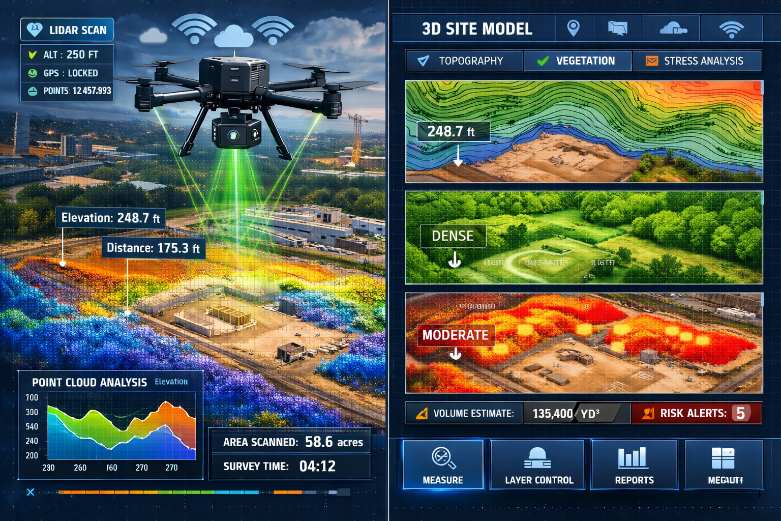
Creating Real-Time 3D Digital Twins in Property Surveying: Creating Interactive Models That Update Continuously requires sophisticated technology integration. In 2026, autonomous drone capabilities have become operational, with flight paths planned using predictive modeling. These drones automatically adjust altitude, angle, and sensor selection to achieve optimal readings, eliminating the need for multiple site visits that previously required complex coordination[1].
Multi-sensor drone technology delivers unprecedented scale and detail, particularly valuable for clients with large agricultural, commercial, or development-scale properties. Industry experts note these systems provide clarity and detail that "simply didn't exist a decade ago"[1].
| Technology Component | Function | 2026 Capability |
|---|---|---|
| LiDAR Scanning | Precise distance measurement | Sub-centimeter accuracy at 100m+ range |
| Photogrammetry | Visual texture and detail capture | 4K+ resolution with automated stitching |
| Thermal Imaging | Heat signature detection | Real-time moisture and insulation analysis |
| IoT Sensors | Continuous environmental monitoring | Automated data transmission every 15 minutes |
| AI Processing | Pattern recognition and analysis | 90% reduction in processing time[2] |
| Cloud Platforms | Data storage and collaboration | Real-time syncing across unlimited users |
The integration of these technologies creates what surveying professionals now describe as a "common visual language" across stakeholder groups, fundamentally changing how reality capture integrates into project management workflows[7].
The Evolution from Static Deliverables to Dynamic Digital Assets
Traditional Survey Limitations
Traditional property surveying methods, while accurate, suffered from inherent limitations that became increasingly problematic as projects grew in complexity. Topographic surveys delivered valuable elevation data, but only for the specific moment of capture. By the time stakeholders reviewed the data, ground conditions might have already changed due to weather events, construction activities, or natural processes.
Common challenges with static survey deliverables included:
- 📄 Obsolescence: Data became outdated quickly, especially on active development sites
- 🔍 Limited perspective: Single viewpoint made it difficult to visualize complex spatial relationships
- 💬 Communication barriers: Technical drawings required specialized knowledge to interpret
- 🔄 Revision difficulties: Updates required entirely new surveys and document versions
- 🤝 Collaboration friction: Sharing physical documents or large files created workflow bottlenecks
These limitations became particularly apparent when dealing with commercial property inspections or large development projects where multiple stakeholders needed simultaneous access to current information.
How Real-Time Updates Transform Decision-Making
The shift to Real-Time 3D Digital Twins in Property Surveying: Creating Interactive Models That Update Continuously addresses these limitations by fundamentally changing the relationship between data collection and decision-making. Rather than waiting weeks for survey reports, stakeholders can access current conditions instantly and run simulations to test hypotheses.
"Design conversations increasingly occur directly within 3D models rather than on traditional 2D plans, enabling quicker iterations and faster workflows with stronger alignment throughout design and construction phases."[7]
This transformation delivers measurable business impact. Organizations implementing digital twins report:
- 30% reduction in maintenance costs through predictive identification of issues[5]
- 10x improvement in decision-making speed by eliminating data gathering delays[5]
- 8% improvement to Net Operating Income (NOI) through optimized operations[5]
- 100% reduction in client travel time for remote inspections and reviews[2]
For property developers and planners, these capabilities translate into the ability to visualize land behavior under various conditions before committing resources. Slope erosion projections, water flow simulations, vegetation pattern changes, and infrastructure stress testing can all occur within a single interactive model[1].
Key Applications of Real-Time 3D Digital Twins in Property Surveying
Development Site Planning and Analysis
For property developers, real-time digital twins provide unprecedented insight into site conditions and development potential. Before purchasing land or committing to design approaches, developers can simulate how proposed structures will interact with existing topography, drainage patterns, and environmental factors.
When evaluating a potential development site, traditional approaches required multiple specialist surveys—topographic, environmental, geotechnical—each delivered as separate documents requiring manual correlation. Digital twins integrate all these data sources into a unified model where relationships become immediately apparent.
Practical applications include:
- Grading optimization: Simulating cut-and-fill scenarios to minimize earthwork costs
- Drainage design: Modeling water flow patterns under various rainfall intensities
- View corridor analysis: Testing sight lines from proposed building locations
- Sun exposure studies: Analyzing seasonal shadow patterns for residential developments
- Access route planning: Optimizing construction vehicle paths to minimize site disturbance
These capabilities prove particularly valuable when working with challenging sites. For instance, property surveyors in Croydon or Bromley dealing with sloped terrain can use digital twins to test multiple retaining wall configurations and drainage solutions before finalizing designs.
Construction Progress Monitoring
During active construction, real-time digital twins serve as powerful project management tools. By capturing regular drone surveys and comparing them against design models, project managers can identify deviations early and track progress with precision that manual inspections cannot match.
Construction case studies document significant benefits, including eliminating four weeks of potential project delays and saving clients thousands of dollars by preventing costly errors and rework through virtual collaboration before physical construction[2].
Construction monitoring capabilities include:
- ✅ As-built verification: Comparing completed work against design specifications
- 📊 Progress quantification: Calculating exact volumes of materials placed or excavated
- 🚨 Deviation detection: Automatically identifying construction that doesn't match plans
- 📸 Visual documentation: Creating timestamped records of site conditions
- 🤝 Stakeholder communication: Providing remote access for owners, architects, and inspectors
The time savings prove substantial. Using Matterport technology, time to produce 360-degree photographs was reduced by 90%, and a 20,000-square-foot space can now be captured in "a few hours" rather than days[2]. For building surveyor services, this efficiency enables more frequent monitoring without proportional cost increases.
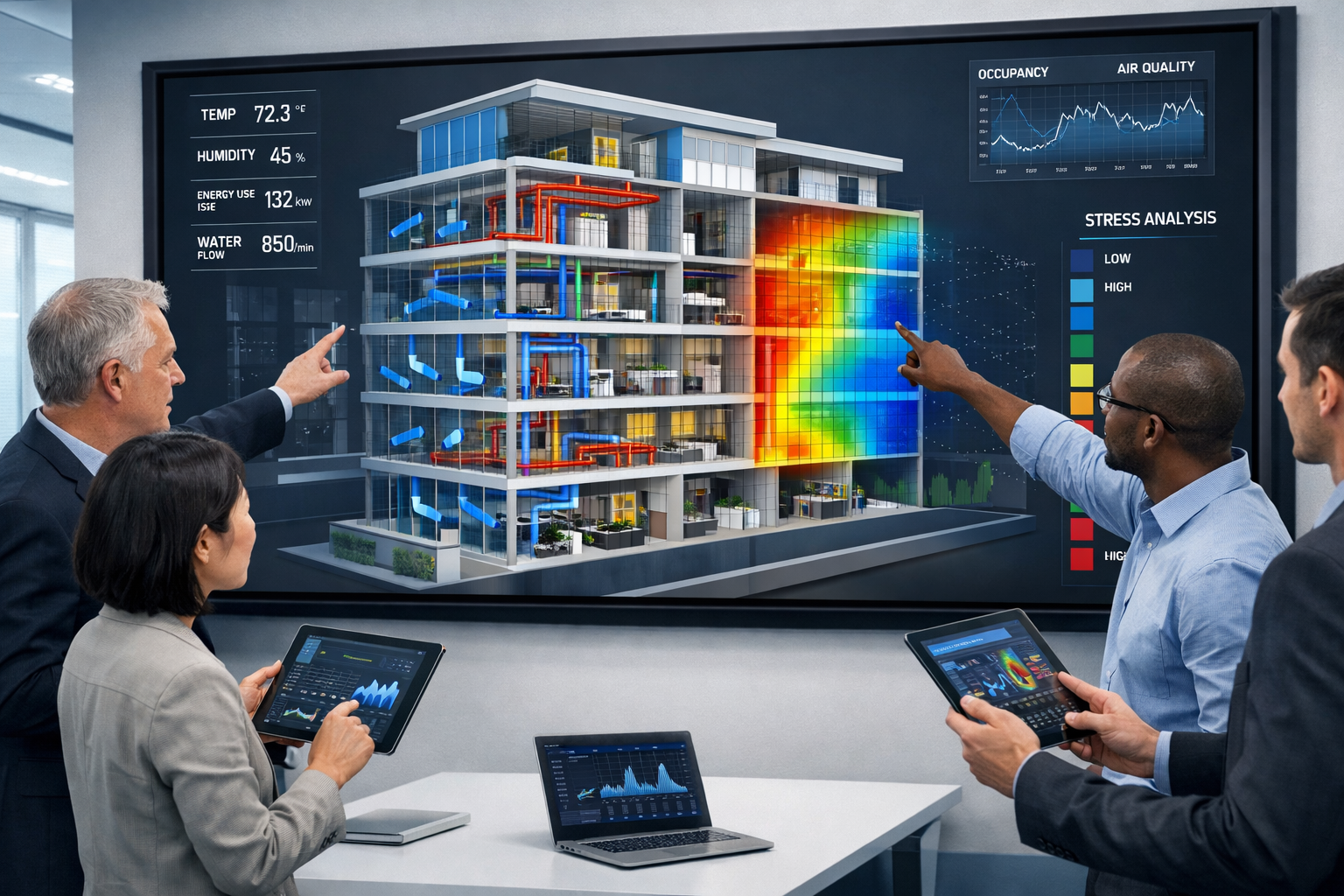
Property Condition Assessment and Maintenance
For existing properties, real-time digital twins transform maintenance from reactive to predictive. Continuous monitoring through integrated sensors detects subtle changes—settlement, moisture infiltration, structural movement—before they become visible problems requiring expensive repairs.
This capability proves especially valuable for property damp assessment and structural monitoring. Thermal imaging sensors integrated into digital twins can track moisture patterns over time, identifying problematic areas that might not be apparent during periodic inspections.
Property management applications include:
| Use Case | Traditional Approach | Digital Twin Approach |
|---|---|---|
| Roof Inspection | Annual physical inspection | Continuous thermal monitoring with alerts |
| Foundation Settlement | Periodic level surveys | Real-time sensor tracking with trend analysis |
| HVAC Performance | Reactive repair when systems fail | Predictive maintenance based on performance data |
| Envelope Integrity | Visual inspection during surveys | Automated thermal anomaly detection |
| Space Utilization | Manual occupancy counts | Continuous sensor-based utilization tracking |
Multiple enterprise platforms now support these capabilities, including Autodesk Tandem, Azure Digital Twins, Bentley iTwin, and vendor-specific solutions like Trimble X12 and NavVis VLX3[5].
Infrastructure and Utilities Management
For properties with complex infrastructure—large estates, commercial campuses, industrial facilities—real-time digital twins provide comprehensive asset management capabilities that extend far beyond traditional survey deliverables.
Underground utilities present particular challenges for conventional surveys. While level 2 surveys and level 3 surveys can identify visible infrastructure, subsurface systems often remain poorly documented. Digital twins integrate ground-penetrating radar data, as-built records, and sensor networks to create comprehensive utility maps that update as infrastructure changes.
Infrastructure management capabilities:
- 🔧 Asset inventory: Complete catalog of all building systems and components
- 📍 Spatial relationships: Understanding how systems interact and depend on each other
- ⏱️ Lifecycle tracking: Monitoring equipment age and predicting replacement needs
- 🔄 Change management: Documenting modifications and maintaining accurate records
- 🛡️ Risk assessment: Identifying single points of failure and vulnerability
Implementing Real-Time 3D Digital Twins in Property Surveying Workflows
Planning Your Digital Twin Strategy
Successful implementation of Real-Time 3D Digital Twins in Property Surveying: Creating Interactive Models That Update Continuously requires strategic planning aligned with specific business objectives. Organizations should begin by identifying high-value use cases where dynamic models deliver clear advantages over traditional approaches.
Strategic planning considerations:
- Define objectives: What decisions will the digital twin support?
- Identify stakeholders: Who needs access and what capabilities do they require?
- Assess data requirements: What sensors, surveys, and updates are necessary?
- Evaluate platforms: Which technology stack best supports your needs?
- Plan integration: How will the digital twin connect with existing systems?
- Establish governance: Who maintains the model and ensures data quality?
For surveying firms, industry experts note that those "weaving reality capture into their core service offerings can differentiate themselves," as clients increasingly expect rich digital deliverables rather than traditional survey products alone[7].
Data Capture and Processing Workflows
Creating the initial digital twin requires comprehensive reality capture that establishes the baseline model. In 2026, this process has become dramatically more efficient through autonomous drone technology and AI-powered processing.
Typical data capture workflow:
Phase 1: Initial Capture
- Autonomous drone survey with multi-sensor payload (LiDAR, photogrammetry, thermal)
- Ground-level detail capture for areas requiring high precision
- Integration of existing as-built documentation and historical records
- Sensor installation for continuous monitoring (if applicable)
Phase 2: Processing and Model Creation
- Automated point cloud processing and mesh generation
- AI-powered feature extraction and classification
- Texture mapping and visual enhancement
- Quality control and accuracy verification
Phase 3: Platform Integration
- Upload to cloud-based collaboration platform
- Configuration of viewing permissions and access controls
- Integration with IoT sensors and data feeds
- Setup of automated update schedules
Phase 4: Continuous Updates
- Scheduled drone surveys (weekly, monthly, or as needed)
- Continuous sensor data integration
- Change detection and notification systems
- Version control and historical record maintenance
The dramatic reduction in processing time—90% faster than previous methods[2]—means surveyors can deliver interactive models within hours of data capture, fundamentally changing client expectations around turnaround times.
Platform Selection and Integration
Choosing the right platform for real-time digital twins depends on project scale, technical requirements, and integration needs. In 2026, several enterprise-grade solutions offer robust capabilities, each with distinct advantages for different use cases.
Leading platforms for property surveying digital twins:
- Autodesk Tandem: Strong integration with BIM workflows and Autodesk ecosystem
- Azure Digital Twins: Excellent for IoT integration and custom development
- Bentley iTwin: Optimized for infrastructure and large-scale projects
- Trimble Solutions: Seamless integration with Trimble surveying hardware
- Matterport: User-friendly interface ideal for property marketing and documentation
When selecting platforms, consider factors beyond initial capabilities. Cloud-based platforms have fundamentally changed client expectations, with features including instant file sharing, 3D visualization in browser, real-time revision syncing, and integrated communication tools now considered standard rather than premium features[1].
For firms serving diverse markets—from residential surveys in Wandsworth to commercial projects in Kensington—platform flexibility to support different project types proves essential.
Overcoming Challenges in Real-Time Digital Twin Implementation
Technical Challenges and Solutions
While Real-Time 3D Digital Twins in Property Surveying: Creating Interactive Models That Update Continuously offer tremendous benefits, implementation presents technical challenges that require careful planning and expertise.
Common technical challenges:
Data Volume Management
Reality capture generates massive datasets—a single drone survey can produce hundreds of gigabytes of raw data. Processing, storing, and transmitting these files requires robust infrastructure and efficient compression algorithms.
Solution: Cloud-based processing with intelligent data reduction techniques that preserve accuracy while minimizing file sizes. Progressive loading allows users to access models quickly while full-resolution data loads in background.
Accuracy Maintenance
As models update continuously, ensuring each iteration maintains survey-grade accuracy becomes critical. Automated processes must match the precision of manual surveying techniques.
Solution: Automated quality control algorithms that compare new data against control points and flag anomalies for human review. Regular validation surveys maintain accuracy standards.
Integration Complexity
Combining data from multiple sources—drones, sensors, manual surveys, existing records—requires sophisticated data fusion capabilities.
Solution: Standardized data formats and robust transformation algorithms that align disparate datasets into unified coordinate systems with documented accuracy metrics.
Network Dependency
Real-time updates require reliable connectivity, which may not exist at remote sites or during initial development phases.
Solution: Hybrid synchronization models that cache data locally and sync when connectivity allows, with conflict resolution protocols for simultaneous edits.
Cost Considerations and ROI
Investment in real-time digital twin capabilities requires upfront costs for equipment, software, and training. However, organizations consistently report strong return on investment through efficiency gains and improved decision-making.
Cost components:
- Hardware: Drones with multi-sensor payloads ($15,000-$50,000)
- Software: Platform licenses and processing tools ($3,000-$15,000 annually)
- Training: Staff development for new workflows ($5,000-$10,000)
- Infrastructure: Cloud storage and computing resources ($500-$5,000 monthly)
ROI drivers:
Organizations using digital twins report eliminating expensive laser scanner costs (saving thousands of dollars per scan), reducing travel and labor costs through remote surveying, and cutting client travel time by up to 100%[2]. The 30% reduction in maintenance costs and 8% improvement to NOI[5] typically justify implementation costs within the first year for commercial properties.
For surveying firms, the ability to differentiate services and command premium pricing for digital deliverables often provides immediate revenue benefits. Clients increasingly view traditional survey products as commodities, while interactive digital twins justify higher fees through enhanced value delivery.
Training and Change Management
Successfully implementing real-time digital twins requires more than technical infrastructure—it demands organizational change management and staff development.
Key training areas:
- 🎓 Technology operation: Drone piloting, sensor deployment, software proficiency
- 📊 Data interpretation: Understanding point clouds, thermal imagery, and sensor data
- 💻 Platform navigation: Efficiently using collaboration tools and visualization interfaces
- 🤝 Client communication: Articulating value and guiding stakeholders through models
- 🔧 Troubleshooting: Resolving common technical issues and data quality problems
Visualization-driven workflows transform design collaboration, with conversations increasingly occurring directly within 3D models rather than on traditional 2D plans[7]. This shift requires professionals accustomed to paper plans and PDF reports to develop new communication approaches centered on interactive exploration.
For firms offering services across diverse locations—from Fulham to Chelmsford—standardized training ensures consistent service quality regardless of project location.
Future Developments in Real-Time Digital Twin Technology
AI and Machine Learning Integration
Artificial intelligence is rapidly enhancing real-time digital twins beyond passive visualization tools into active decision support systems. In 2026, AI-driven precision in property surveying is revolutionizing workflows through automated analysis and predictive capabilities[3].
Emerging AI applications:
- Automated defect detection: AI algorithms identify cracks, moisture damage, and structural issues without human review
- Predictive maintenance: Machine learning models forecast when building systems will require service based on performance trends
- Change detection: Automated comparison of sequential surveys highlights modifications without manual analysis
- Optimization recommendations: AI suggests design improvements based on simulation results and historical performance data
- Natural language queries: Stakeholders can ask questions in plain English and receive visual responses within the model
These capabilities transform digital twins from sophisticated visualization tools into intelligent advisors that augment human expertise with computational analysis at scales impossible through manual review.
Extended Reality (XR) Interfaces
The convergence of digital twins with augmented reality (AR) and virtual reality (VR) technologies creates immersive experiences that further enhance spatial understanding and collaboration.
XR applications in property surveying:
- On-site AR overlays: Field teams view design intent overlaid on physical sites through mobile devices or smart glasses
- VR walkthroughs: Stakeholders experience properties at full scale before construction
- Remote collaboration: Distributed teams meet virtually within digital twin environments
- Training simulations: New staff practice surveying techniques in virtual environments
- Client presentations: Immersive demonstrations that communicate complex concepts intuitively
As XR hardware becomes more affordable and user-friendly, these interfaces will transition from specialized applications to standard features expected by clients and used routinely by surveying professionals.
Integration with Smart Building Systems
The future of Real-Time 3D Digital Twins in Property Surveying: Creating Interactive Models That Update Continuously lies in seamless integration with building automation systems, creating closed-loop feedback between digital models and physical assets.
Smart building integration:
- Automated environmental control: Digital twins optimize HVAC, lighting, and security based on occupancy patterns
- Energy management: Real-time monitoring identifies efficiency opportunities and validates conservation measures
- Space optimization: Utilization tracking informs layout decisions and lease negotiations
- Security coordination: Integration with access control and surveillance systems
- Emergency response: Digital twins guide first responders with real-time building information during incidents
This integration transforms digital twins from documentation tools into operational platforms that actively manage building performance, creating continuous value throughout the property lifecycle.
Best Practices for Maximizing Digital Twin Value
Establishing Data Governance Standards
Maintaining digital twin accuracy and utility over time requires disciplined data governance that ensures quality, security, and accessibility.
Essential governance practices:
- Define data standards: Establish accuracy requirements, update frequencies, and quality metrics
- Assign ownership: Designate responsible parties for model maintenance and updates
- Control access: Implement role-based permissions that balance collaboration with security
- Document processes: Create clear procedures for data collection, processing, and integration
- Audit regularly: Verify model accuracy through periodic validation surveys
- Manage versions: Maintain historical records while clearly identifying current conditions
For organizations managing multiple properties or serving diverse clients—similar to firms offering property valuations across varied property types—standardized governance ensures consistent quality across all digital twin implementations.
Optimizing Stakeholder Collaboration
The collaborative potential of real-time digital twins only materializes when stakeholders actively engage with the models. Successful implementations prioritize user experience and provide appropriate training.
Collaboration optimization strategies:
- Simplify interfaces: Provide intuitive navigation that doesn't require technical expertise
- Customize views: Create role-specific perspectives that highlight relevant information
- Enable annotations: Allow stakeholders to mark up models with comments and questions
- Facilitate meetings: Use digital twins as central focus for design reviews and planning sessions
- Provide support: Offer training and technical assistance to ensure all stakeholders can participate effectively
The shift from static documents to interactive models fundamentally changes collaboration dynamics. Rather than reviewing fixed plans and providing written comments, stakeholders explore models together, testing alternatives in real-time and reaching consensus through visual experimentation.
Measuring and Communicating ROI
Demonstrating the value of digital twin investments requires tracking relevant metrics and communicating benefits in business terms that resonate with decision-makers.
Key performance indicators:
| Metric | Measurement Method | Typical Improvement |
|---|---|---|
| Survey Turnaround Time | Hours from capture to deliverable | 90% reduction[2] |
| Decision Speed | Days from question to resolution | 10x faster[5] |
| Maintenance Costs | Annual spending on reactive repairs | 30% reduction[5] |
| Project Delays | Days lost to coordination issues | Eliminate weeks of delays[2] |
| Travel Expenses | Cost of site visits and inspections | Up to 100% reduction[2] |
| NOI Performance | Net operating income improvement | 8% increase[5] |
When presenting ROI to clients or internal stakeholders, translate these metrics into concrete examples relevant to their specific situations. For a property developer, emphasize how faster decisions accelerate project timelines and reduce carrying costs. For facility managers, highlight maintenance savings and operational efficiency.
Selecting the Right Digital Twin Partner
Evaluating Surveying Firm Capabilities
For property owners and developers seeking to implement Real-Time 3D Digital Twins in Property Surveying: Creating Interactive Models That Update Continuously, selecting the right surveying partner proves critical to success.
Essential capabilities to evaluate:
✅ Technology infrastructure: Modern drone fleets, multi-sensor capabilities, and enterprise-grade platforms
✅ Technical expertise: Staff trained in reality capture, data processing, and digital twin management
✅ Industry experience: Track record with projects similar in scale and complexity
✅ Integration capabilities: Ability to work with existing systems and stakeholder requirements
✅ Support services: Ongoing maintenance, training, and technical assistance
✅ Quality standards: Documented accuracy verification and quality control processes
Leading surveying firms are weaving reality capture into their core service offerings to differentiate themselves, recognizing that clients increasingly expect rich digital deliverables rather than traditional survey products alone[7].
When evaluating potential partners, request case studies demonstrating successful digital twin implementations, ask about their technology roadmap to ensure continued innovation, and verify their capacity to support your project throughout its lifecycle.
Questions to Ask Potential Providers
Technical capabilities:
- What drone and sensor systems do you use, and how do they ensure survey-grade accuracy?
- Which digital twin platforms do you support, and can you integrate with our existing systems?
- How do you handle data security and privacy for sensitive property information?
- What is your typical turnaround time from data capture to deliverable model?
Service approach:
- How will you train our team to use and maintain the digital twin?
- What ongoing support and update services do you provide?
- Can you provide references from similar projects?
- How do you handle changes in project scope or requirements?
Value delivery:
- What specific benefits have your clients realized from digital twin implementations?
- How do you measure and report on ROI?
- What differentiates your digital twin services from competitors?
- Can you provide a detailed cost breakdown including all ongoing fees?
For projects requiring specialized knowledge—such as first-time buyer surveys or complex commercial property inspections—ensure providers demonstrate relevant expertise beyond general digital twin capabilities.
Conclusion: Embracing the Digital Twin Revolution in Property Surveying
Real-Time 3D Digital Twins in Property Surveying: Creating Interactive Models That Update Continuously represent more than technological advancement—they signal a fundamental transformation in how professionals understand, communicate, and manage spatial information. The shift from static snapshots to dynamic, collaborative models addresses longstanding limitations of traditional surveying while enabling entirely new capabilities that were impossible just years ago.
The evidence for this transformation is compelling. Organizations implementing digital twins report 30% reductions in maintenance costs, 10x improvements in decision-making speed, and measurable enhancements to property performance[5]. Processing times have decreased by 90%, enabling delivery of complex 3D models in hours rather than days[2]. Autonomous drone technology and AI-powered analysis continue advancing, making sophisticated capabilities accessible to projects of all scales[1].
For property developers and planners, the ability to visualize land behavior under various conditions—testing drainage patterns, simulating erosion, modeling infrastructure stress—transforms risk management and design optimization. For facility managers, continuous monitoring and predictive maintenance prevent costly failures and extend asset lifecycles. For surveying professionals, digital twins differentiate services and create new value propositions that command premium positioning in competitive markets.
Next Steps: Getting Started with Digital Twins
For property owners and developers:
- Identify high-value applications where dynamic models would improve decision-making or reduce costs
- Research qualified providers with demonstrated expertise in digital twin implementation
- Start with a pilot project to validate benefits before scaling across your portfolio
- Invest in stakeholder training to ensure your team can fully utilize digital twin capabilities
- Establish governance standards for maintaining model accuracy and maximizing long-term value
For surveying professionals:
- Assess your current capabilities and identify gaps in technology, training, or processes
- Develop an investment roadmap for acquiring necessary hardware, software, and expertise
- Create service offerings that clearly articulate digital twin value to target clients
- Build case studies documenting measurable benefits from early implementations
- Stay current with emerging technologies including AI integration and XR interfaces
The transition to real-time digital twins requires investment and organizational change, but the competitive advantages and operational benefits justify the effort. As client expectations continue evolving toward interactive, continuously updated deliverables, firms that master these capabilities will lead the industry while those relying solely on traditional methods face increasing pressure.
The future of property surveying is already here in 2026—dynamic, collaborative, and powered by digital twins that transform static data into living assets. The question is no longer whether to adopt these technologies, but how quickly you can implement them to capture the substantial benefits they deliver.
Ready to explore how digital twins can transform your property projects? Get a quote to discuss your specific needs and discover the possibilities that real-time 3D models can unlock.
References
[1] Future Land Surveying 2026 – https://haller-blanchard.com/future-land-surveying-2026/
[2] Construction – https://matterport.com/learn/digital-twin/construction
[3] Ai Driven Precision In Property Surveying How Artificial Intelligence Is Revolutionizing Workflows In 2026 – https://nottinghillsurveyors.com/blog/ai-driven-precision-in-property-surveying-how-artificial-intelligence-is-revolutionizing-workflows-in-2026
[4] Digital Twin Technology – https://construction.trimble.com/en/solutions/design/digital-twin-technology
[5] Digital Twins – https://www.thefuture3d.com/industries/property-management/digital-twins/
[6] Real Time 3d Digital Twins For Property Development Interactive Models That Update Live – https://nottinghillsurveyors.com/blog/real-time-3d-digital-twins-for-property-development-interactive-models-that-update-live
[7] Doubling Down On Digital – https://amerisurv.com/2026/02/01/doubling-down-on-digital/