
The construction industry stands at a pivotal moment in 2026. Property surveyors who once relied solely on traditional measurement tools now find themselves at the heart of a digital revolution. BIM Integration for Property Surveyors: Seamless Collaboration in Modern Construction Projects has transformed from an optional upgrade to an essential requirement for professionals who want to remain competitive and deliver exceptional value to clients.
Picture this: A surveyor arrives at a complex construction site, captures detailed measurements using advanced laser scanning technology, and within hours, that geospatial data seamlessly flows into a Building Information Modeling (BIM) platform where architects, engineers, and project managers can immediately access it. This isn't science fiction—it's the reality of modern surveying practice.
The integration of BIM technology into property surveying workflows represents more than just adopting new software. It fundamentally changes how surveyors collaborate with construction teams, how they capture and share data, and how they contribute to reducing costly errors before they happen. As infrastructure demands intensify in 2026, surveyors who master BIM integration position themselves as indispensable partners in the construction process rather than isolated data collectors.
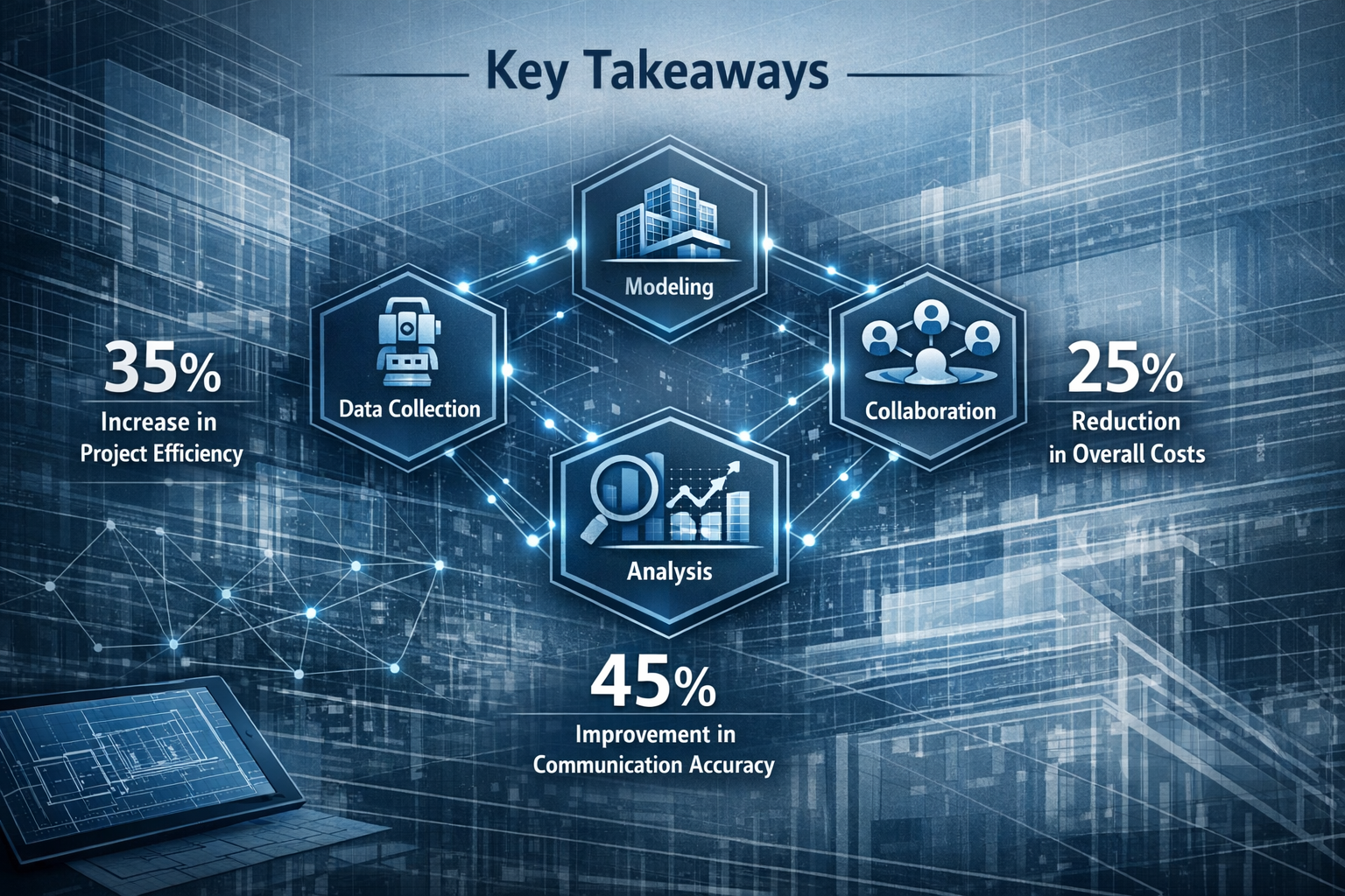
Key Takeaways
✅ BIM integration enables real-time collaboration between property surveyors and construction teams, reducing communication gaps and project delays by consolidating geospatial data into shared digital models
✅ Modern surveying tools including GNSS receivers, 3D laser scanners, and drone technology now feed data directly into BIM platforms like Revit and Navisworks, eliminating manual data transfer errors
✅ Clash detection capabilities allow surveyors to identify conflicts between structural, mechanical, and electrical systems during the design stage, preventing expensive rework and construction delays
✅ Standardized workflows and data protocols (IFC, COBie) are essential for successful BIM adoption, requiring surveyors to implement structured transition roadmaps with clear performance metrics
✅ AI and machine learning integration is enhancing BIM's analytical capabilities in 2026, making surveying data analysis more efficient and providing deeper insights for construction planning
Understanding BIM Integration for Property Surveyors
Building Information Modeling has evolved far beyond simple 3D visualization. For property surveyors, BIM represents a comprehensive digital ecosystem where geospatial data becomes the foundation for every construction decision. Understanding this integration requires examining both the technological components and the collaborative workflows that make it effective.
What Is BIM and Why Does It Matter for Surveyors?
Building Information Modeling (BIM) is a digital representation of physical and functional characteristics of a building or infrastructure project. Unlike traditional CAD drawings, BIM models contain rich data about every component—from structural elements to mechanical systems—creating an intelligent, interconnected digital twin of the actual construction.
For property surveyors, BIM integration means their measurements, topographical data, and site analysis become living components of this digital ecosystem. When a surveyor captures point cloud data from a 3D laser scanner, that information doesn't sit in isolation. Instead, it flows directly into the BIM model where architects can overlay their designs, engineers can verify measurements, and project managers can track progress[2].
The significance extends beyond convenience. Land surveyors are increasingly collaborating with architects, engineers, and construction professionals to integrate geospatial data into BIM models, representing a major industry shift toward integrated workflows[1]. This collaboration transforms surveyors from external consultants into core team members whose data directly influences design decisions.
The Evolution of Surveying in the BIM Era
Traditional surveying workflows involved collecting data through multiple means—total stations, GPS receivers, manual measurements—then transferring that information through various file formats before it reached design teams. Each transfer point introduced potential errors and delays.
BIM is streamlining this process by consolidating data into a single unified digital model using Scan to BIM Services, which minimizes errors and reduces redundancy[2]. Modern BIM platforms now enable surveyors to visualize topographical data, building footprints, and other site elements in real-time during data collection, allowing immediate decision-making and plan adjustments[2].
This evolution has created new expectations for surveying professionals. Clients no longer want static reports—they want dynamic data that integrates seamlessly with their project management systems. Chartered surveyors who embrace BIM integration can offer this enhanced service delivery, distinguishing themselves in a competitive marketplace.
Core Components of BIM-Integrated Surveying
Several technological components work together to enable effective BIM integration:
Point Cloud Data: 3D laser scanners capture millions of measurement points, creating detailed representations of existing conditions. These point clouds import directly into BIM platforms, providing the as-built foundation for design work.
Geospatial Coordinates: GNSS (Global Navigation Satellite System) receivers establish precise positioning that ties BIM models to real-world locations, ensuring accurate site placement and coordination with geographic information systems.
Data Exchange Protocols: Industry Foundation Classes (IFC) and Construction Operations Building Information Exchange (COBie) standards enable different software platforms to share information without data loss or corruption.
Collaborative Platforms: Cloud-based BIM environments allow multiple stakeholders to access and modify the same model simultaneously, with version control preventing conflicts and maintaining data integrity.
Implementing BIM Integration: Practical Steps for Property Surveyors
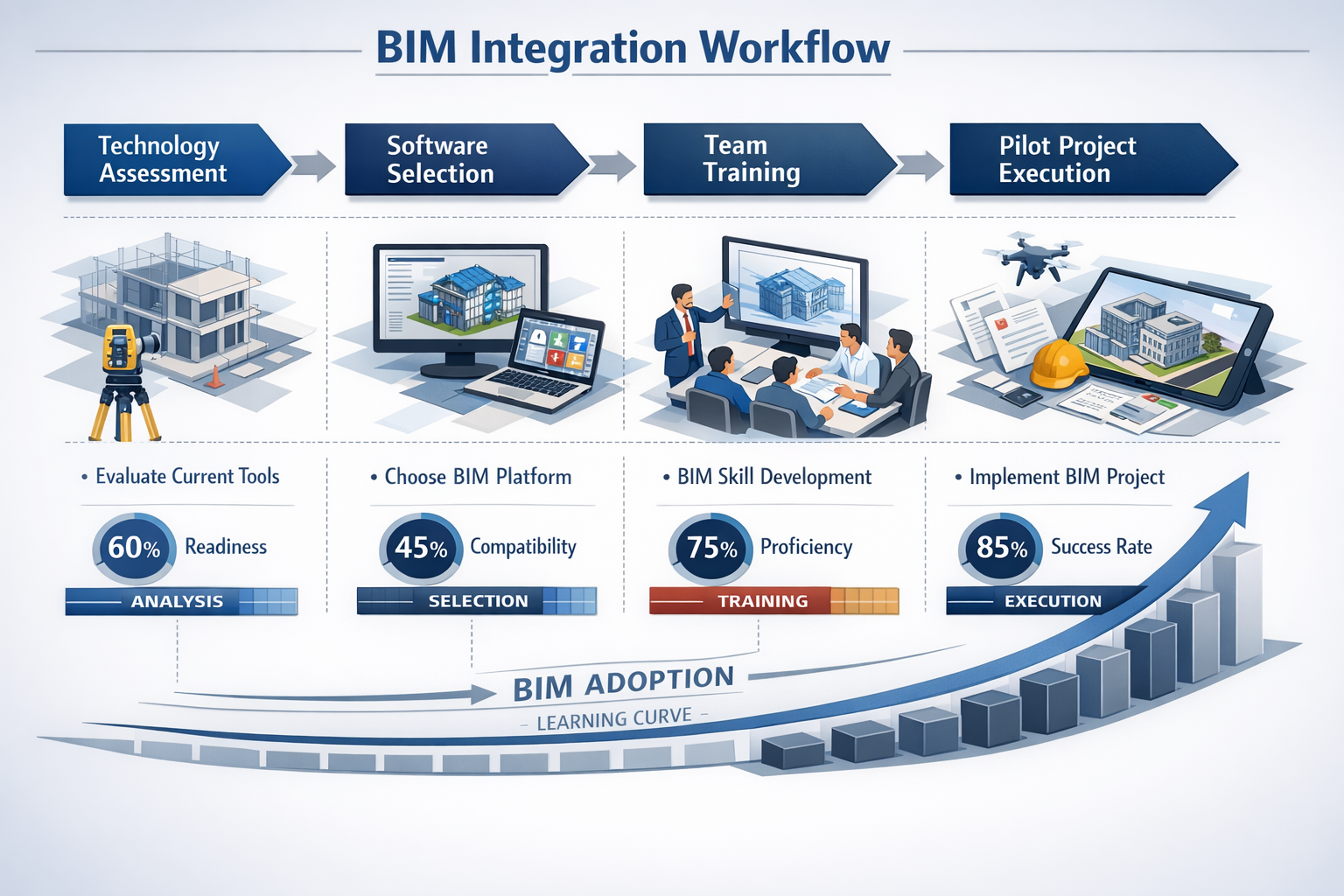
Transitioning to BIM-integrated workflows requires more than purchasing new equipment. Successful implementation demands strategic planning, skill development, and systematic process changes. Property surveyors who approach this transition methodically achieve better outcomes and faster return on investment.
Assessing Your Current Workflow and Identifying Gaps
Before investing in new technology, surveyors must thoroughly audit their existing processes. This assessment reveals where BIM integration will provide the greatest value and which legacy systems need upgrading.
Start by documenting your current workflow from initial site visit through final deliverable. Identify each point where data transfers between systems or formats. These transfer points typically represent opportunities for error reduction through BIM integration. Consider questions like:
- How many times does survey data get manually re-entered or reformatted?
- What percentage of project time involves preparing data for other stakeholders?
- How often do design teams request clarification on survey deliverables?
- What delays occur due to incompatible file formats or data structures?
Organizations implementing structured approaches in 2026 are auditing current workflows, identifying tool gaps, upgrading to interoperable software (Revit, Navisworks, Civil 3D), and establishing standard naming conventions and IFC/COBie data standards[6]. This systematic approach prevents costly false starts and ensures technology investments align with actual business needs.
Similar to how building surveyors evaluate property conditions, assessing your workflow requires honest evaluation of strengths and weaknesses. Document everything, even processes that seem to work well—they may benefit from BIM enhancement in ways you haven't considered.
Selecting the Right BIM Tools and Technologies
The BIM ecosystem includes numerous software platforms and hardware devices. Choosing the right combination depends on your specific surveying applications, client requirements, and budget constraints.
Essential Software Platforms
Autodesk Revit serves as the industry-standard BIM authoring platform for building projects. While primarily used by architects and engineers, surveyors benefit from understanding Revit's data structure and import capabilities. Point cloud data from laser scanners imports directly into Revit, where it can be referenced during design development.
Autodesk Civil 3D specializes in infrastructure projects including roads, bridges, and utility corridors. For surveyors working on civil engineering projects, Civil 3D provides powerful tools for surface modeling, corridor design, and earthwork calculations—all within a BIM environment.
Navisworks excels at model coordination and clash detection. Surveyors can use Navisworks to combine their survey data with architectural, structural, and MEP (mechanical, electrical, plumbing) models, identifying conflicts before construction begins.
Hardware Integration
BIM-ready GNSS receivers from manufacturers like Trimble, Leica, and Carlson now feed coordinates directly into Revit or AutoCAD workflows, enabling seamless field-to-BIM integration for large-scale projects including utility corridors and road/bridge work[3].
3D laser scanners such as the Trimble X7, Leica RTC360, and Carlson Scan capture point clouds that import directly into BIM platforms, allowing architects and engineers to overlay design models on real-world scans and identify conflicts early[3]. These scanners have become increasingly affordable and user-friendly in 2026, making them accessible to smaller surveying firms.
Drone technology extends surveying capabilities to large sites and difficult-to-access areas. Modern drones equipped with photogrammetry cameras or LiDAR sensors create detailed topographic models that integrate seamlessly with BIM platforms[2].
Establishing Data Standards and Protocols
Successful BIM integration requires consistent data organization and naming conventions. Without standards, collaborative workflows break down as team members struggle to locate information or understand data structure.
Develop a comprehensive data management protocol that includes:
File Naming Conventions: Establish clear, descriptive naming systems that identify project, discipline, zone, level, and element type. For example: "ProjectName_Survey_PointCloud_BuildingA_Level1_20260315.rcp"
Coordinate Systems: Define the coordinate reference system for all projects and ensure every team member understands how to work within it. Mixing coordinate systems causes alignment errors that undermine BIM accuracy.
Level of Detail (LOD): Specify the appropriate level of detail for survey data at different project stages. Early design phases may require less detailed topographic information than construction documentation.
Data Exchange Formats: Standardize on IFC for model exchange and establish clear protocols for point cloud formats (E57, RCP, RCS). These industry standards ensure compatibility across different software platforms.
Organizations implementing these standards report measurable improvements. 2026 projects are being measured against KPIs including reduced rework, faster design approvals, improved site coordination, and 4D/5D integration combining models with scheduling and cost control tools[6].
Training and Skill Development
Technology alone doesn't create successful BIM integration—skilled professionals do. Investing in comprehensive training ensures your team can leverage BIM tools effectively and contribute meaningfully to collaborative workflows.
Software Training: Beyond basic software operation, surveyors need to understand BIM concepts, data structures, and collaborative workflows. Many software vendors offer certification programs that validate competency and build credibility with clients.
Interdisciplinary Communication: BIM integration requires surveyors to communicate effectively with architects, engineers, and construction managers. Understanding their terminology, priorities, and workflows facilitates smoother collaboration.
Continuous Learning: BIM technology evolves rapidly. Establish ongoing learning opportunities through webinars, industry conferences, and professional development courses. Encourage team members to share knowledge and develop internal expertise.
Consider partnering with experienced BIM consultants during initial implementation. Their guidance can accelerate learning curves and help avoid common pitfalls that delay successful adoption.
Real-World Applications: BIM Integration in Modern Construction Projects
Theory becomes meaningful when applied to actual construction challenges. Property surveyors implementing BIM integration across various project types demonstrate the practical value of these workflows through measurable improvements in efficiency, accuracy, and collaboration.
Infrastructure Projects: Roads, Bridges, and Utilities
Large-scale infrastructure projects exemplify BIM integration's transformative potential. These complex undertakings involve multiple disciplines, extensive coordination requirements, and tight tolerances where surveying accuracy directly impacts construction success.
Highway Corridor Development: A 2026 highway expansion project demonstrates how BIM-integrated surveying streamlines infrastructure delivery. Surveyors equipped with BIM-ready GNSS receivers captured precise centerline data, cross-sections, and existing utility locations. This data fed directly into Civil 3D, where engineers developed corridor models incorporating alignment, profile, and typical sections.
The integration eliminated traditional workflow bottlenecks. Previously, surveyors would collect field data, process it separately, then deliver CAD files to engineers who manually incorporated measurements into design software. With BIM integration, field data appeared in the design model within hours, allowing engineers to make immediate decisions about alignment adjustments and grading strategies.
Geographic Information Systems data integrated with BIM models provided comprehensive details on terrain, zoning, utilities, and environmental factors, enabling data-driven site layout planning before construction[3][4]. This GIS-BIM integration revealed potential conflicts with underground utilities that would have caused costly delays if discovered during construction.
Bridge Reconstruction: Point clouds from 3D laser scanning documented existing bridge conditions with millimeter accuracy. Engineers overlaid new design models on these scans, immediately identifying clearance issues and structural conflicts. This early clash detection prevented expensive field modifications and change orders.
Commercial Building Development
Commercial construction projects benefit significantly from BIM-integrated surveying, particularly during site analysis and as-built documentation phases.
Site Analysis and Planning: Before design begins, surveyors create detailed topographic models incorporating existing structures, vegetation, utilities, and site features. Modern BIM platforms enable surveyors to visualize this data in real-time during collection, allowing immediate decision-making and plan adjustments[2].
Developers use these comprehensive site models to evaluate multiple building placement scenarios, optimizing for solar orientation, drainage patterns, access routes, and utility connections. The ability to test alternatives digitally before committing to a design saves time and reduces costly design revisions.
As-Built Documentation: During construction, surveyors verify that built conditions match design intent. Point cloud scans captured at key construction milestones create permanent records of as-built conditions. These scans integrate into the BIM model, creating an accurate digital twin that facilities managers use throughout the building's operational life.
One commercial office development in 2026 used weekly laser scans to track construction progress. Comparing scans against the design model revealed deviations early enough for correction without delaying the schedule. This proactive approach prevented the accumulation of small errors that often compound into major problems.
Residential Property Assessment and Renovation
While large infrastructure and commercial projects dominate BIM discussions, residential applications offer significant value for property surveyors serving homeowners and small developers.
Pre-Purchase Surveys: Property buyers increasingly request detailed condition assessments before purchase. Surveyors using 3D scanning technology create comprehensive digital records of property conditions. These detailed surveys go beyond traditional homebuyers reports, providing buyers with accurate measurements and visual documentation.
When buyers proceed with renovations, the existing point cloud data becomes the foundation for renovation planning. Architects and contractors work from accurate as-built information rather than approximate measurements, reducing design errors and construction surprises.
Historic Building Renovation: Older buildings present unique challenges due to irregular geometry, settlement, and undocumented modifications. Laser scanning captures these complexities with precision that manual measurement cannot match. The resulting point cloud provides renovation teams with accurate baseline data for planning structural modifications, MEP upgrades, and architectural enhancements.
A 2026 renovation of a Victorian-era property demonstrated this value. Laser scanning revealed that walls varied from plumb by several inches and floor levels changed throughout the structure. Armed with this accurate data, the design team developed renovation plans that accommodated existing conditions rather than assuming ideal geometry—preventing numerous field conflicts and change orders.
Clash Detection and Conflict Resolution
Perhaps the most compelling BIM integration benefit is identifying conflicts before construction begins. BIM-integrated surveying enables clash detection between structural, mechanical, and electrical systems at the design stage, minimizing costly errors and rework[2].
Mechanical, Electrical, and Plumbing Coordination: Modern buildings contain increasingly complex MEP systems. Without BIM coordination, these systems frequently conflict with structural elements or each other. Surveyors contribute to clash detection by providing accurate as-built data for existing structures and precise site conditions for new construction.
A mixed-use development project used BIM coordination to identify over 200 potential clashes between ductwork, structural beams, and electrical conduits before construction. Resolving these conflicts digitally cost a fraction of what field modifications would have required. The surveyor's accurate point cloud data of existing adjacent structures proved essential for identifying clearance issues that would have otherwise gone unnoticed until construction.
Utility Coordination: Underground utilities present particular challenges. Integrating utility location data into BIM models prevents excavation conflicts and service disruptions. Surveyors using ground-penetrating radar and electromagnetic locators map existing utilities, then incorporate this data into the BIM model where it informs excavation planning and new utility routing.
Overcoming Challenges in BIM Integration

Despite clear benefits, property surveyors face legitimate challenges when implementing BIM integration. Understanding these obstacles and developing strategies to address them increases the likelihood of successful adoption and long-term value realization.
Technical Challenges and Solutions
Data Volume Management: Point cloud files from laser scanning can exceed several gigabytes, creating storage, transfer, and processing challenges. A single building scan might generate 50-100 GB of data, and infrastructure projects can produce terabytes.
Solution: Implement strategic data decimation and segmentation. Not every application requires full-resolution point clouds. Create multiple versions at different resolutions—high-resolution for detailed analysis, medium-resolution for general reference, and low-resolution for quick visualization. Cloud-based storage and processing platforms help manage large datasets without overwhelming local computer resources.
Software Interoperability: Despite industry standards like IFC, data exchange between different software platforms sometimes loses information or introduces errors. Point clouds may not align properly, or metadata might not transfer correctly.
Solution: Establish rigorous quality control procedures for data exchange. Always verify that imported data aligns correctly with coordinate systems and maintains expected accuracy. Develop relationships with software vendors' technical support teams who can assist with complex interoperability issues. When possible, standardize on software ecosystems (like Autodesk or Bentley platforms) that share common data structures.
Processing Speed and Computer Requirements: BIM software and point cloud processing demand significant computing power. Older workstations struggle with large models, creating frustrating delays that reduce productivity.
Solution: Invest in appropriate hardware including high-performance processors, substantial RAM (32GB minimum, 64GB preferred), and professional-grade graphics cards. Consider cloud-based processing for particularly demanding tasks. The productivity gains from adequate computing power quickly justify the investment.
Organizational and Cultural Barriers
Resistance to Change: Experienced surveyors who have worked successfully with traditional methods may resist BIM adoption. This resistance often stems from comfort with familiar workflows and concern about learning curves.
Solution: Demonstrate clear value through pilot projects that show tangible benefits. Involve skeptical team members in implementation planning, giving them ownership of the transition. Provide comprehensive training that builds confidence with new tools. Celebrate early successes and share positive feedback from clients who appreciate BIM deliverables.
Client Education: Many clients don't understand BIM capabilities or why it might cost more than traditional surveying services. They may resist paying for BIM-integrated deliverables when they're accustomed to conventional reports.
Solution: Develop clear communication materials that explain BIM benefits in client-focused terms. Show how BIM integration reduces their overall project costs through clash detection, improved coordination, and reduced change orders. Provide case studies demonstrating return on investment. Consider offering BIM services as optional upgrades initially, allowing clients to experience the value before making it standard.
Collaboration Coordination: BIM's collaborative nature requires coordination with other project stakeholders. Surveyors accustomed to working independently may find this coordination challenging, particularly when other team members have varying levels of BIM competency.
Solution: Establish clear communication protocols and regular coordination meetings. Use common data environments (CDEs) that provide centralized access to BIM models and related documentation. Define roles and responsibilities explicitly, so everyone understands who contributes what information and when. Be patient with team members who are also learning BIM workflows—collaborative success requires mutual support.
Cost Considerations and ROI
Initial Investment: BIM integration requires significant upfront investment in software licenses, hardware upgrades, training, and potentially consulting services. Small surveying firms may struggle to justify these costs.
Solution: Develop a phased implementation plan that spreads costs over time. Start with essential software and hardware, then expand capabilities as revenue from BIM-integrated projects grows. Consider software subscription models that reduce upfront costs compared to perpetual licenses. Calculate return on investment based on realistic projections of efficiency gains, reduced errors, and ability to command premium fees for BIM deliverables.
Ongoing Costs: BIM integration involves continuing expenses for software subscriptions, hardware upgrades, and training. These recurring costs must be factored into project pricing and business planning.
Solution: Build BIM-related costs into project pricing structures. Clients who understand the value of BIM integration typically accept appropriate fee adjustments. Track time savings and error reductions to demonstrate that BIM integration reduces overall project costs despite higher surveying fees. Consider the competitive advantage BIM capabilities provide—firms that can't offer BIM-integrated services may lose projects to competitors who can.
Quality Control and Accuracy Verification
Maintaining Survey Accuracy: BIM models contain data from multiple sources with varying accuracy levels. Ensuring that survey data maintains its precision when integrated into BIM models requires vigilant quality control.
Solution: Establish clear accuracy standards for different project types and BIM uses. Document the accuracy of survey data and communicate limitations to other stakeholders. Implement systematic verification procedures including independent checks of critical measurements and regular calibration of surveying instruments. Use BIM platforms' built-in quality control tools to identify potential errors.
Data Validation: When multiple team members contribute to BIM models, inadvertent changes to survey data can occur. An architect might accidentally move a survey point, or an engineer might modify site topography.
Solution: Use layer management and access controls to protect survey data from unintentional modification. Establish clear protocols requiring coordination before anyone modifies survey elements. Implement version control systems that track changes and allow rollback if errors occur. Regular model audits help identify unauthorized changes before they cause problems.
Future Trends: The Evolution of BIM Integration for Surveyors
The BIM landscape continues evolving rapidly. Property surveyors who understand emerging trends can position themselves advantageously, adopting new capabilities that differentiate their services and increase value delivery.
Artificial Intelligence and Machine Learning
Artificial intelligence and machine learning are expected to enhance BIM's analytical capabilities, making data analysis more efficient and insightful for surveying applications[2]. These technologies are moving beyond experimental applications into practical tools that surveyors can use daily.
Automated Feature Extraction: AI algorithms can analyze point cloud data to automatically identify and classify building elements, topographic features, and site conditions. What previously required hours of manual modeling can now happen in minutes. Surveyors review and refine AI-generated models rather than creating everything from scratch.
Predictive Analysis: Machine learning algorithms identify patterns in construction data, predicting potential issues before they occur. For surveyors, this might mean algorithms that flag unusual measurement patterns suggesting equipment calibration issues or site conditions that historically correlate with construction challenges.
Quality Control Automation: AI systems can compare point cloud data against design models, automatically identifying deviations that exceed tolerance thresholds. This automated clash detection extends beyond simple geometric conflicts to include more subtle issues like drainage patterns or sight line obstructions.
Digital Twins and Lifecycle Management
BIM models are evolving from construction tools into permanent digital twins that support facility management throughout a building's operational life. Surveyors play a crucial role in creating accurate baseline data for these digital twins.
As-Built to Operations Transition: The survey data captured during construction becomes the foundation for operational digital twins. Facility managers use these models to plan maintenance, manage space, track assets, and optimize building performance. Surveyors who understand operational requirements can structure their deliverables to support long-term facility management needs.
Continuous Monitoring Integration: Sensors embedded in buildings feed real-time data into digital twin models, tracking structural movement, environmental conditions, and system performance. Surveyors may increasingly provide ongoing monitoring services, comparing sensor data against baseline conditions to identify changes requiring investigation.
Enhanced Mobile and Field Technologies
Field surveying technology continues advancing, making BIM integration more seamless and accessible.
Augmented Reality Applications: Surveyors using AR-enabled devices can overlay BIM models on real-world views, immediately comparing design intent against existing conditions. This technology facilitates real-time decision-making and improves communication with stakeholders who may not read traditional construction drawings.
Real-Time Cloud Processing: Modern field equipment connects directly to cloud-based processing platforms, enabling immediate data processing and model updates. Surveyors can capture measurements in the field and see them appear in the BIM model within minutes, allowing same-day verification and quality control.
Autonomous Surveying Systems: Robotic total stations and autonomous drones are reducing the manual effort required for data collection. These systems can execute pre-programmed survey routines, capturing data while surveyors focus on analysis and quality control rather than instrument operation.
Expanded GIS-BIM Integration
The convergence of Geographic Information Systems and BIM continues deepening, creating comprehensive models that span from regional planning scales to individual building components[4].
Smart City Integration: Urban planning initiatives increasingly rely on integrated GIS-BIM models that combine regional infrastructure data with detailed building information. Surveyors who can work across these scales position themselves for smart city projects that represent significant growth opportunities.
Environmental Analysis: Combining GIS environmental data with BIM models enables sophisticated analysis of solar exposure, wind patterns, flood risks, and ecological impacts. Surveyors contribute essential site-specific data that grounds these analyses in real-world conditions.
Regulatory Compliance: Automated compliance checking against zoning regulations, building codes, and environmental restrictions increasingly relies on integrated GIS-BIM data. Surveyors who provide properly structured data enable these automated checks, accelerating approval processes.
Sustainability and Green Building
BIM integration supports sustainability initiatives by enabling detailed analysis of environmental impacts and energy performance.
Carbon Footprint Analysis: Detailed BIM models allow calculation of embodied carbon in construction materials and operational carbon from building systems. Accurate survey data ensures these calculations reflect actual site conditions and construction quantities.
Energy Modeling: Building energy performance depends significantly on accurate geometry, orientation, and site conditions—all areas where surveying contributes essential data. BIM-integrated survey information improves energy model accuracy, supporting more effective sustainability strategies.
Material Optimization: Precise surveying reduces material waste by ensuring accurate quantity calculations and minimizing construction errors that require rework. This optimization directly supports sustainability goals while reducing project costs.
Developing Your BIM Integration Roadmap for 2026 and Beyond
Successfully implementing BIM integration requires a structured approach that aligns technology adoption with business objectives. Property surveyors who develop clear roadmaps achieve better outcomes than those who adopt tools opportunistically without strategic planning.
Phase 1: Assessment and Planning (Months 1-2)
Begin with comprehensive assessment of current capabilities and future requirements. This foundation ensures subsequent investments align with actual needs rather than perceived trends.
Workflow Documentation: Map every step of current surveying processes from initial client contact through final deliverable. Identify pain points, inefficiencies, and client feedback themes. Understanding what works well and what needs improvement guides technology selection.
Stakeholder Consultation: Interview clients, project partners, and team members about their BIM expectations and experiences. What deliverables do they value most? What frustrations do they encounter with current workflows? This input ensures your BIM integration addresses real needs.
Competitive Analysis: Research how competitors are implementing BIM integration. What services do they offer? How do they market BIM capabilities? Understanding the competitive landscape helps identify differentiation opportunities.
Goal Setting: Establish specific, measurable objectives for BIM integration. Rather than vague aspirations like "improve efficiency," set concrete targets: "Reduce survey-to-deliverable time by 30%," or "Achieve 90% client satisfaction with BIM deliverables within 12 months."
Phase 2: Tool Selection and Acquisition (Months 2-4)
Armed with clear requirements, select specific technologies that support your objectives while fitting within budget constraints.
Software Evaluation: Test multiple BIM platforms through trial versions or demonstrations. Evaluate based on your specific workflows, not generic feature lists. Can the software import your survey data formats? Does it integrate with tools your clients use? Is technical support adequate?
Hardware Assessment: Determine whether existing computer workstations can handle BIM software requirements or if upgrades are necessary. Consider field equipment needs—do you need new laser scanners, GNSS receivers, or drones to capture BIM-compatible data?
Vendor Relationships: Establish relationships with equipment and software vendors who can provide ongoing support. Ask about training resources, technical support response times, and user communities where you can seek advice.
Budget Finalization: Develop detailed budgets including not just purchase costs but also training, consulting services, and contingencies for unexpected expenses. Secure necessary financing or allocate funds from operating budgets.
Phase 3: Implementation and Training (Months 4-8)
With tools acquired, focus on developing competency and establishing workflows that leverage new capabilities.
Pilot Project Selection: Choose an appropriate pilot project—complex enough to test BIM capabilities but not so critical that problems cause major business disruption. Ideally, select a client who understands you're implementing new workflows and will provide constructive feedback.
Intensive Training: Invest in comprehensive training for all team members who will use BIM tools. Beyond basic software operation, ensure understanding of BIM concepts, data standards, and collaborative workflows. Consider both vendor-provided training and third-party courses that offer broader industry perspectives.
Process Documentation: As you develop BIM workflows, document procedures in detail. Create step-by-step guides for common tasks, data standards, quality control procedures, and client deliverable specifications. This documentation becomes essential for maintaining consistency as more team members adopt BIM workflows.
Feedback Loops: Establish regular team meetings to discuss BIM implementation challenges and successes. Create safe environments where team members can admit struggles without fear of criticism. Early identification of problems allows quick course corrections.
Phase 4: Expansion and Optimization (Months 8-12)
After successful pilot projects, systematically expand BIM integration across more projects while continuously refining workflows.
Service Offerings: Develop clear descriptions of BIM-integrated services for marketing materials and client proposals. Explain what clients receive, how it benefits their projects, and how pricing reflects the enhanced value.
Client Education: Create presentations, case studies, and demonstrations that help clients understand BIM capabilities. Many clients need education before they can appreciate and request BIM deliverables. Proactive education positions you as a trusted advisor rather than just a service provider.
Performance Measurement: Track key performance indicators established during planning. Are you achieving targeted efficiency improvements? How do clients rate BIM deliverables compared to traditional services? What financial returns are you seeing from BIM investments?
Continuous Improvement: BIM technology evolves rapidly. Establish processes for staying current with new capabilities, software updates, and industry best practices. Attend conferences, participate in professional organizations, and maintain vendor relationships that provide access to emerging technologies.
Long-Term Sustainability (Year 2 and Beyond)
BIM integration isn't a one-time project but an ongoing commitment to technological advancement and service improvement.
Advanced Capabilities: As basic BIM workflows become routine, explore advanced applications like 4D scheduling integration, 5D cost modeling, or facility management support. These advanced services command premium fees and differentiate your offerings.
Industry Leadership: Share your BIM experiences through conference presentations, articles, or professional organization involvement. Establishing thought leadership attracts clients seeking cutting-edge expertise and positions your firm as an industry innovator.
Team Development: Invest continuously in team member development. Support professional certifications, encourage specialization in particular BIM applications, and create career paths that reward BIM expertise. Retaining skilled team members protects your BIM investment and maintains service quality.
Technology Refresh: Plan for regular technology updates. Software subscriptions provide automatic access to new features, but hardware requires periodic replacement. Budget for these refresh cycles to maintain optimal performance and capability.
Conclusion: Embracing the Future of Property Surveying
BIM Integration for Property Surveyors: Seamless Collaboration in Modern Construction Projects represents far more than a technological upgrade—it's a fundamental transformation of how surveyors contribute value to construction projects. As 2026 infrastructure demands intensify and construction complexity increases, surveyors who master BIM integration position themselves as indispensable collaborative partners rather than isolated data collectors.
The journey from traditional surveying workflows to fully integrated BIM processes requires significant investment in technology, training, and process development. Yet the benefits—reduced errors, improved collaboration, enhanced client satisfaction, and competitive differentiation—justify this investment for firms committed to long-term success.
Property surveyors implementing BIM integration discover that their role expands beyond measurement and documentation. They become early problem solvers, identifying conflicts before construction begins. They facilitate collaboration by providing the accurate baseline data that enables effective coordination among architects, engineers, and contractors. They contribute to sustainability by enabling precise material calculations and supporting energy modeling. And they create lasting value through digital twins that support facility management long after construction completion.
The technical challenges are real but manageable through systematic planning, appropriate tool selection, and comprehensive training. The organizational challenges require leadership commitment and cultural change, but firms that successfully navigate this transition emerge stronger and more capable. The financial investment demands careful justification, but the return on investment becomes clear through efficiency gains, error reduction, and ability to command premium fees for enhanced services.
Actionable Next Steps
For property surveyors ready to advance their BIM integration journey:
🎯 Conduct a comprehensive workflow audit this month to identify specific pain points where BIM integration would provide the greatest value. Document current processes in detail and gather input from team members and clients about improvement opportunities.
🎯 Select and execute a pilot project within the next quarter that tests BIM workflows in a controlled environment. Choose a project with appropriate complexity and a client willing to provide constructive feedback on new deliverable formats.
🎯 Invest in targeted training for key team members who will champion BIM adoption. Look beyond basic software training to comprehensive programs that develop understanding of BIM concepts, collaborative workflows, and industry standards.
🎯 Establish relationships with BIM-focused project teams in your market. Attend industry events, join BIM user groups, and connect with architects and engineers who can provide insights into their BIM requirements and expectations for surveying deliverables.
🎯 Develop clear service descriptions and pricing structures for BIM-integrated surveying services. Create marketing materials that educate potential clients about BIM benefits and position your firm as a knowledgeable partner in modern construction delivery.
🎯 Monitor emerging technologies including AI-enhanced analysis tools, advanced scanning systems, and augmented reality applications. While you don't need to adopt every innovation immediately, understanding the technology landscape helps you make informed decisions about future investments.
The construction industry's digital transformation continues accelerating. Property surveyors who embrace BIM integration now will lead their profession into a future where seamless collaboration, data-driven decision-making, and comprehensive digital documentation become standard expectations. Those who delay risk finding themselves increasingly marginalized as clients demand capabilities that only BIM-integrated workflows can deliver.
The tools exist. The standards are established. The market demand is clear. The question isn't whether to integrate BIM into surveying practice, but how quickly and effectively your firm will make this essential transition. Start your journey today, and position yourself at the forefront of modern construction collaboration.
For surveyors seeking additional guidance on modern property assessment practices, explore resources on choosing the right property assessment approach and understanding common property survey myths to complement your BIM integration knowledge.
References
[1] Future Land Surveying 2026 – https://haller-blanchard.com/future-land-surveying-2026/
[2] How Bim Is Transforming The Future Of Surveying – https://www.qecad.com/cadblog/how-bim-is-transforming-the-future-of-surveying/
[3] Top Surveying Tools That Integrate With Bim – https://www.baselineequipment.com/top-surveying-tools-that-integrate-with-bim
[4] Gis And Bim – https://www.datumate.com/blog/gis-and-bim/
[5] Bim Integration For Surveyors Bridging Geospatial Data And Construction Planning – https://nottinghillsurveyors.com/blog/bim-integration-for-surveyors-bridging-geospatial-data-and-construction-planning
[6] How To Build A Bim Transition Roadmap For Your 2026 Projects Step By Step – https://www.thecadroom.com/blog/how-to-build-a-bim-transition-roadmap-for-your-2026-projects-step-by-step/
[7] Jtm Technology – https://jtmconstruction.com/jtm-technology/