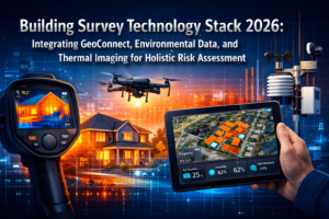
The surveying industry stands at a transformative crossroads in 2026. Imagine a drone that not only flies itself but also thinks ahead—predicting the optimal flight path, automatically adjusting its altitude over changing terrain, and intelligently switching between sensors to capture the exact data needed, all without human intervention. This isn't science fiction; it's the reality of Autonomous Drone Surveying: Predictive Flight Paths and Intelligent Sensor Adjustment in 2026. These advanced systems are fundamentally changing how professionals conduct land surveys, infrastructure inspections, and property assessments by reducing on-site visits and delivering survey-grade accuracy that rivals traditional ground-based methods.
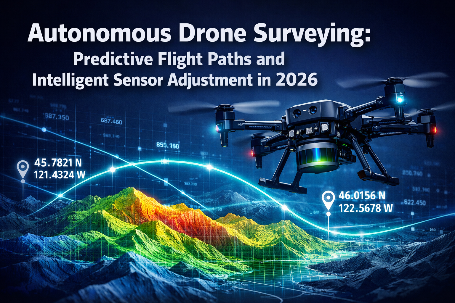
The convergence of artificial intelligence, real-time kinematic positioning, and multi-sensor platforms has created a new paradigm where drones operate as autonomous data collection systems rather than remotely piloted aircraft. With platforms like ZenaTech's IQ Quad launching in January 2026, the industry has witnessed purpose-built solutions that combine 45-minute flight endurance, 5 km operational range, and the ability to carry interchangeable survey equipment ranging from 4K cameras to LiDAR scanners[1]. These capabilities enable surveyors to capture comprehensive datasets in a single flight that previously required multiple site visits with different equipment configurations.
Key Takeaways
✅ Predictive flight planning uses autonomous software and onboard AI to generate optimal flight paths automatically, eliminating manual waypoint programming and adapting to environmental conditions in real-time[2].
✅ Intelligent sensor adjustment allows drones to automatically switch between 4K cameras, LiDAR, thermal, and multispectral sensors during flight, adjusting altitude and angle to achieve optimal readings without human intervention[3].
✅ RTK/PPK GNSS systems now deliver centimeter-level positioning accuracy, meeting professional survey-grade standards while reducing reliance on ground control points[2][4].
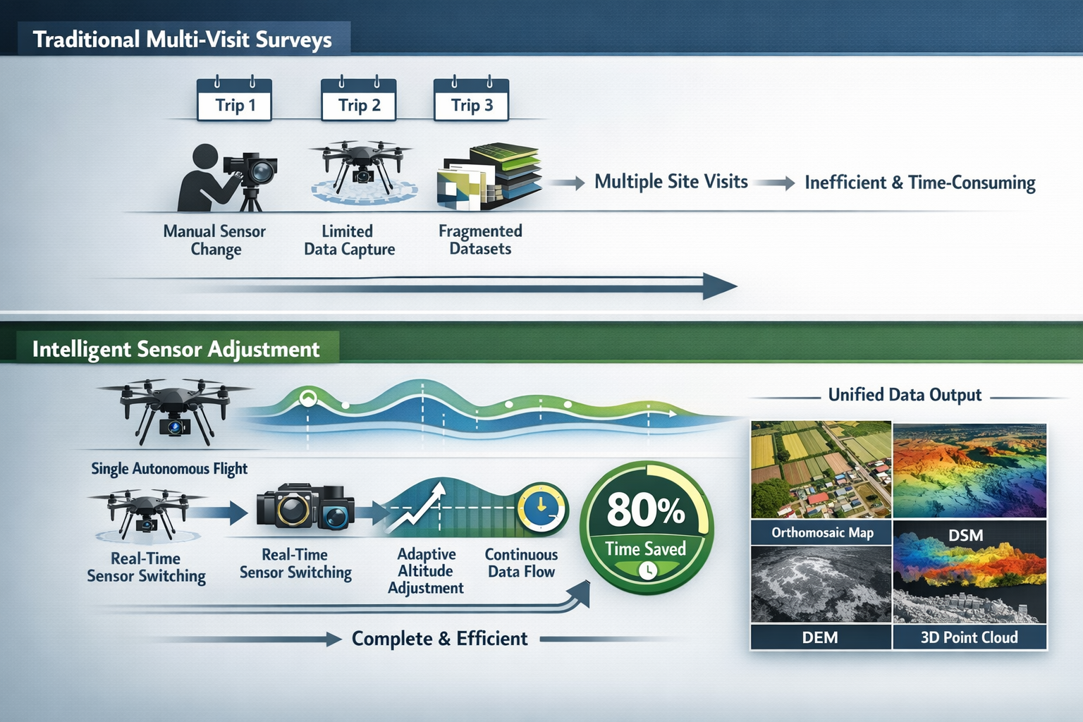
✅ Single-flight data collection has replaced multi-visit workflows, with autonomous drones capturing orthomosaic maps, 3D terrain models, and Digital Elevation Models in one operation[4][5].
✅ Reduced operational costs and faster project completion times make autonomous surveying economically viable for projects ranging from small residential properties to large infrastructure corridors[3].
Understanding Autonomous Drone Surveying: Predictive Flight Paths and Intelligent Sensor Adjustment in 2026
The Evolution from Manual to Autonomous Operations
Traditional drone surveying required skilled pilots to manually plan flight paths, set waypoints, and make real-time decisions about altitude, speed, and sensor configurations. This approach demanded significant expertise and often necessitated multiple site visits to capture different data types. The shift to autonomous operations represents a fundamental change in methodology.
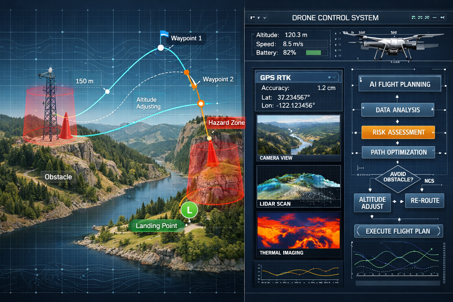
Autonomous Drone Surveying: Predictive Flight Paths and Intelligent Sensor Adjustment in 2026 leverages sophisticated algorithms that analyze terrain data, weather conditions, and survey objectives to generate optimal flight plans without human input[2]. These systems incorporate:
- GPS RTK (Real-Time Kinematic) systems for centimeter-level positioning accuracy
- Onboard AI processors that make split-second decisions during flight
- Advanced obstacle detection sensors that enable real-time path adjustments
- Terrain-following capabilities that maintain optimal sensor distance regardless of elevation changes
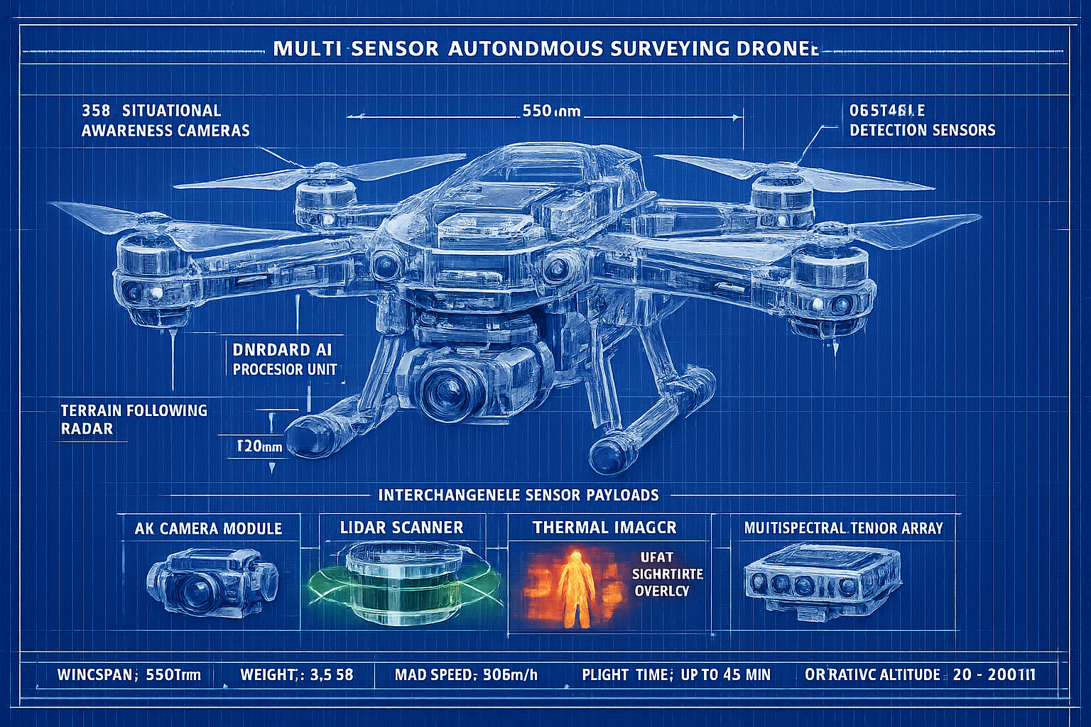
The ZenaTech IQ Quad exemplifies this evolution with its 360-degree situational awareness cameras and advanced obstacle detection systems that allow operation in complex environments without constant human oversight[1]. This level of autonomy transforms drones from tools requiring constant operator attention into independent data collection platforms.
How Predictive Flight Path Technology Works
Predictive flight path technology represents one of the most significant advances in autonomous surveying. Rather than following pre-programmed routes blindly, modern systems anticipate optimal trajectories based on multiple variables.
The process begins with mission planning software that analyzes:
- Survey area boundaries and topography from existing GIS data
- Required data resolution and overlap percentages based on project specifications
- Sensor capabilities and optimal operating parameters for each payload type
- Environmental factors including wind patterns, lighting conditions, and restricted airspace
- Battery consumption predictions to ensure safe completion or identify recharge points
Once airborne, the autonomous system continuously refines the flight path using real-time data. If the drone encounters unexpected obstacles, changing wind conditions, or terrain variations not reflected in preliminary data, the onboard AI processor recalculates the optimal route instantly[2]. This adaptive capability ensures data quality remains consistent even when conditions deviate from initial planning assumptions.
For professionals conducting building surveys or structural inspections, this predictive capability means comprehensive coverage without gaps or redundant passes that waste battery life and extend project timelines.
The Technology Behind Intelligent Sensor Adjustment
Multi-Sensor Platforms and Automatic Switching
The true power of Autonomous Drone Surveying: Predictive Flight Paths and Intelligent Sensor Adjustment in 2026 emerges from the integration of multiple sensor types on a single platform. Modern autonomous drones support interchangeable survey equipment including:
| Sensor Type | Primary Applications | Key Advantages |
|---|---|---|
| 4K/High-Resolution Cameras | Orthomosaic mapping, visual documentation, facade inspection | High detail for visual analysis, color accuracy |
| LiDAR Scanners | Topographic surveys, vegetation penetration, volumetric calculations | Operates in low light, penetrates tree canopy, precise elevation data |
| Thermal Imaging | Building envelope analysis, moisture detection, electrical inspections | Identifies temperature differentials, non-contact measurement |
| Multispectral Sensors | Agricultural assessment, vegetation health, environmental monitoring | Captures beyond visible spectrum, quantifies plant stress |
The IQ Quad's 2-3 kg payload capacity allows it to carry these sensors either individually or in combination, with the autonomous system selecting the appropriate sensor for each portion of the flight path[1]. This capability eliminates the need for multiple flights with equipment changes between missions.
Real-Time Altitude and Angle Optimization
Intelligent sensor adjustment extends beyond simply switching between different instruments. The system continuously optimizes altitude, flight angle, and sensor orientation to achieve the best possible data quality for each specific target.
For example, when surveying a property with varying elevation—such as a hillside development—the autonomous system:
- Maintains consistent ground sampling distance (GSD) by adjusting altitude as terrain elevation changes
- Modifies camera angle when approaching vertical structures to reduce distortion
- Switches to LiDAR when passing over heavily vegetated areas where photogrammetry would produce gaps
- Adjusts flight speed based on lighting conditions to prevent motion blur
This level of intelligent adaptation means a single autonomous flight can capture data that previously required multiple site visits with different equipment configurations[3]. For professionals conducting property condition assessments, this translates to comprehensive datasets delivered faster and at lower cost than traditional methods.
The Role of AI in Decision-Making
Artificial intelligence serves as the decision-making engine that enables true autonomy. The onboard AI processor continuously analyzes sensor feeds and makes real-time adjustments based on:
🔹 Image quality metrics that detect blur, exposure issues, or insufficient overlap
🔹 LiDAR point density calculations ensuring adequate coverage for terrain modeling
🔹 Thermal signature analysis identifying areas requiring additional passes for detailed investigation
🔹 Battery consumption rates balancing data quality goals against safe return-to-base requirements
When the AI detects suboptimal conditions—such as shadows obscuring important features or wind-induced camera shake—it automatically implements corrective actions. This might include adjusting flight speed, changing altitude, switching to a different sensor, or marking the area for a secondary pass[2].
Survey-Grade Accuracy: RTK/PPK GNSS Systems
Achieving Centimeter-Level Positioning
One of the most critical requirements for professional surveying is positional accuracy. Traditional drone operations relied heavily on ground control points (GCPs)—precisely surveyed markers placed throughout the survey area that serve as reference points for data processing. While effective, GCP placement is time-consuming and impractical for large or inaccessible areas.
RTK (Real-Time Kinematic) and PPK (Post-Processed Kinematic) GNSS systems have revolutionized positioning accuracy in autonomous drone surveying. These technologies deliver centimeter-level positioning accuracy—typically 1-3 cm horizontal and 2-5 cm vertical—that meets or exceeds professional survey-grade standards[2][4].
RTK systems work by:
- Receiving signals from multiple GNSS satellite constellations (GPS, GLONASS, Galileo, BeiDou)
- Comparing these signals with data from a nearby base station with known coordinates
- Calculating correction factors that eliminate atmospheric interference and satellite orbit errors
- Applying these corrections in real-time during flight
PPK systems follow a similar principle but process the corrections after flight, offering flexibility when real-time communication with a base station isn't feasible.
Reduced Dependency on Ground Control Points
The integration of RTK/PPK technology with autonomous flight systems has dramatically reduced reliance on ground control points without sacrificing accuracy[4]. While traditional photogrammetry might require 10-15 GCPs for a 50-acre survey, modern autonomous systems with RTK can achieve comparable accuracy with just 2-3 checkpoints used for quality verification rather than data correction.
This reduction offers substantial benefits:
✅ Faster mobilization with minimal ground preparation
✅ Improved safety by eliminating the need to access dangerous or difficult terrain
✅ Cost savings from reduced field crew time
✅ Scalability for linear infrastructure projects like pipelines or transmission corridors
For professionals conducting monitoring surveys that require repeated measurements over time, the consistency of RTK-enabled autonomous systems ensures that positional accuracy remains constant across multiple survey dates, enabling reliable change detection.
Data Output and Professional Applications
Comprehensive Dataset Generation
Autonomous Drone Surveying: Predictive Flight Paths and Intelligent Sensor Adjustment in 2026 produces a diverse range of professional-grade deliverables from a single flight operation. The intelligent sensor adjustment capabilities enable simultaneous or sequential capture of data types that serve different analytical purposes.
Standard outputs include:
📊 High-Resolution Orthomosaic Maps – Geometrically corrected aerial images that maintain consistent scale throughout, suitable for distance and area measurements
📊 3D Point Clouds – Dense collections of georeferenced points (often millions per acre) that represent surface geometry with millimeter-level detail
📊 Digital Surface Models (DSM) – Raster datasets representing the elevation of all surfaces including buildings, vegetation, and infrastructure
📊 Digital Elevation Models (DEM) – Ground elevation data with vegetation and structures removed, essential for drainage analysis and earthwork calculations
📊 Thermal Imagery Maps – Temperature distribution visualizations useful for building envelope analysis and moisture detection
📊 3D Textured Meshes – Photorealistic 3D models suitable for visualization, volume calculations, and virtual inspections
These deliverables rival the precision of traditional surveying methods while being produced in a fraction of the time[2][4]. For professionals preparing building survey reports, the comprehensive nature of autonomous drone data provides supporting documentation that enhances report credibility and detail.
Industry-Specific Applications
The versatility of autonomous multi-sensor platforms has made them the standard method for several surveying disciplines in 2026:
🏗️ Construction and Development
Autonomous drones conduct pre-construction site surveys, monitor earthwork progress, verify as-built conditions, and generate volumetric calculations for material quantities. The ability to capture both visual and elevation data in a single flight provides project managers with comprehensive progress documentation.
🌲 Forestry and Environmental
LiDAR-enabled autonomous systems penetrate tree canopy to map ground elevation beneath dense vegetation, while multispectral sensors assess forest health and identify stressed vegetation. These capabilities support sustainable forestry management and environmental impact assessments.
⚡ Utility and Infrastructure
Powerline corridor mapping, pipeline route surveys, and transmission tower inspections benefit from autonomous systems that can cover linear features spanning hundreds of kilometers. Thermal sensors identify electrical hotspots while LiDAR maps vegetation encroachment risks.
⛏️ Mining and Aggregates
Volumetric calculations for stockpiles, pit progression monitoring, and reclamation verification rely on the precision elevation data that autonomous drones deliver. Monthly or weekly surveys track material movement and support operational planning.
🏘️ Property and Real Estate
Large property surveys, boundary verification, and comprehensive property documentation benefit from the efficiency of autonomous systems. A single flight can capture detailed imagery, elevation data, and thermal information for properties spanning hundreds of acres[5].
Real-World Implementation: The ZenaTech IQ Quad Case Study
Platform Specifications and Capabilities
The January 2026 launch of the ZenaTech IQ Quad provides a concrete example of how autonomous surveying technology has matured into production-ready platforms. This purpose-built VTOL (Vertical Take-Off and Landing) AI drone represents the convergence of predictive flight planning and intelligent sensor management in a commercial product[1].
Key specifications include:
- Flight Endurance: 45 minutes per battery cycle
- Operational Range: 5 km radius from launch point
- Payload Capacity: 2-3 kg for survey equipment
- Positioning Accuracy: RTK-enabled centimeter-level precision
- Autonomous Features: Self-planning flight paths, obstacle avoidance, terrain following
- Safety Systems: 360-degree situational awareness, redundant sensors, automatic return-to-base
The platform's autonomous recharging capabilities via dedicated landing stations enable extended operations without human intervention. For large-area surveys, the drone can complete a survey segment, return to a charging station, recharge, and resume operations automatically—a capability that extends effective survey coverage beyond the limitations of single-battery endurance[1].
Deployment Through Drone-as-a-Service Networks
ZenaTech's implementation strategy leverages a Drone-as-a-Service (DaaS) network currently supporting 19 US locations and 3 international sites. This distributed approach allows organizations to access autonomous surveying capabilities without the capital investment of purchasing and maintaining their own fleet[1].
The DaaS model offers several advantages:
✅ Lower barriers to entry for firms wanting to incorporate drone surveying
✅ Access to latest technology without depreciation concerns
✅ Scalability to match project demand fluctuations
✅ Professional data processing and quality assurance included
✅ Regulatory compliance managed by the service provider
For surveying firms conducting occasional aerial surveys or those wanting to evaluate autonomous technology before committing to equipment purchases, the DaaS model provides a practical entry point.
Operational Benefits and Cost Considerations
Reducing On-Site Visit Requirements
Perhaps the most significant operational benefit of Autonomous Drone Surveying: Predictive Flight Paths and Intelligent Sensor Adjustment in 2026 is the dramatic reduction in required site visits. Traditional surveying workflows often demanded multiple trips:
- Visit 1: Site reconnaissance and GCP placement
- Visit 2: Initial data collection flight
- Visit 3: Supplementary data collection with different sensors
- Visit 4: GCP recovery and verification measurements
Autonomous systems with intelligent sensor adjustment compress this timeline into a single site visit. The drone autonomously captures all required data types during one flight operation, with RTK positioning eliminating most GCP requirements[3][5].
This consolidation delivers:
🎯 Reduced travel costs and field crew time
🎯 Faster project completion from data collection to deliverable
🎯 Minimized site disruption for occupied properties or active construction sites
🎯 Improved safety by reducing personnel exposure to hazardous environments
For professionals managing multiple projects across a service area, the efficiency gains translate directly to increased capacity and improved profitability.
Economic Analysis and ROI
While autonomous drone systems represent a significant initial investment—with platforms like the IQ Quad and associated sensors potentially costing $30,000-$75,000 depending on configuration—the return on investment can be compelling for firms conducting regular surveying work.
Cost comparison for a typical 50-acre topographic survey:
| Method | Equipment Cost | Field Time | Processing Time | Total Cost |
|---|---|---|---|---|
| Traditional Ground Survey | $50,000+ (total station, GPS) | 3-5 days (3-person crew) | 2-3 days | $8,000-$12,000 |
| Manual Drone Survey | $15,000-$25,000 | 1-2 days (2-person crew) | 2-4 days | $4,000-$6,000 |
| Autonomous Drone Survey | $40,000-$75,000 | 4-6 hours (1-person crew) | 1-2 days | $2,000-$3,500 |
The autonomous approach delivers the fastest turnaround at the lowest per-project cost, though it requires higher initial capital investment. Firms completing 10-15 surveys annually can typically achieve ROI within 18-24 months.
For occasional users, the DaaS model mentioned earlier provides access to autonomous capabilities at per-project rates typically ranging from $1,500-$4,000 depending on area and deliverable requirements—competitive with manual drone services while offering superior efficiency.
Challenges and Limitations in 2026
Regulatory and Airspace Constraints
Despite technological advances, regulatory frameworks continue to present challenges for autonomous drone operations. In most jurisdictions, fully autonomous flights beyond visual line of sight (BVLOS) require special waivers or authorizations that involve extensive documentation and safety case development.
Current regulatory limitations include:
⚠️ Visual observer requirements that negate some autonomy benefits
⚠️ Restricted airspace near airports, military installations, and urban centers
⚠️ Maximum altitude limitations (typically 400 feet AGL in many jurisdictions)
⚠️ Privacy concerns regarding aerial data collection over private property
Progressive regulatory authorities have begun implementing performance-based standards that focus on demonstrated safety capabilities rather than prescriptive operational rules, but widespread adoption of these frameworks remains incomplete in 2026.
Surveyors must navigate these regulations carefully, often requiring coordination with aviation authorities, property owners, and local jurisdictions before conducting autonomous surveys. This administrative overhead can offset some of the efficiency gains, particularly for smaller projects.
Technical Limitations and Environmental Factors
While autonomous systems have advanced significantly, certain technical limitations and environmental factors still constrain operations:
Weather Sensitivity: High winds, precipitation, and extreme temperatures can ground autonomous drones or degrade data quality. Most platforms operate safely in winds up to 15-20 mph, but stronger conditions require postponement.
Battery Limitations: Despite the IQ Quad's impressive 45-minute endurance[1], battery technology remains a limiting factor for very large survey areas. While autonomous recharging stations help, they require infrastructure deployment and extend total mission time.
Sensor Trade-offs: No single sensor excels at all tasks. LiDAR provides excellent elevation data but lacks the visual detail of photography. Thermal imaging identifies temperature differentials but doesn't produce geometric measurements. Intelligent sensor switching helps, but payload weight limits sometimes force choices between sensor types.
Processing Requirements: The massive datasets generated by autonomous multi-sensor platforms demand substantial computing resources for processing. A single 100-acre survey might generate 50-100 GB of raw data requiring hours or days of processing time on high-performance workstations.
Accuracy Verification: While RTK systems deliver impressive positional accuracy, professional standards still require independent verification through checkpoints or comparison with known control. Fully autonomous operations must include quality assurance protocols to maintain professional credibility.
Integration with Traditional Surveying Workflows
Complementary Rather Than Replacement
Autonomous Drone Surveying: Predictive Flight Paths and Intelligent Sensor Adjustment in 2026 functions best as a complement to traditional surveying methods rather than a complete replacement. Certain applications still require ground-based measurements:
- Boundary surveys requiring precise monumentation and legal description
- Underground utility location where aerial sensors cannot detect subsurface features
- Dense urban environments where airspace restrictions prevent drone operations
- Interior building surveys requiring access to enclosed spaces
Forward-thinking surveying firms integrate autonomous drones into a comprehensive service offering that matches the appropriate methodology to each project's specific requirements. For example, a property survey might use autonomous drones for topographic mapping and aerial documentation while employing traditional methods for boundary verification and monumentation.
Data Integration and Quality Assurance
Professional surveying standards demand rigorous quality assurance regardless of data collection method. Autonomous drone data must be validated and integrated with other survey information to produce reliable deliverables.
Best practices for data integration include:
- Independent checkpoint verification using traditional survey methods to confirm autonomous drone accuracy
- Cross-validation between different sensor types (comparing photogrammetry-derived elevations with LiDAR data)
- Metadata documentation recording flight parameters, sensor specifications, and processing methods
- Professional review by licensed surveyors who take responsibility for deliverable accuracy
- Archival standards ensuring long-term data accessibility and traceability
This integration ensures that autonomous drone data meets the same professional standards as traditional survey deliverables, maintaining the credibility essential for regulatory submissions, legal proceedings, and engineering design.
Future Developments and Emerging Trends
Advancing AI Capabilities
The artificial intelligence systems powering autonomous drones in 2026 represent just the beginning of what's possible. Emerging developments in machine learning and computer vision promise even more sophisticated capabilities:
Predictive Maintenance: AI systems that monitor component performance and predict maintenance needs before failures occur, improving reliability and reducing downtime.
Automated Feature Extraction: Advanced computer vision that automatically identifies and classifies features in survey data—distinguishing buildings from vegetation, identifying utility infrastructure, or detecting changes between survey dates without manual interpretation.
Swarm Coordination: Multiple autonomous drones working cooperatively to survey large areas simultaneously, with AI coordinating their flight paths to maximize efficiency while avoiding conflicts.
Adaptive Mission Planning: Systems that learn from previous surveys to optimize future missions, recognizing patterns in terrain, vegetation, or infrastructure that inform more efficient data collection strategies.
Sensor Technology Evolution
Sensor development continues to advance, with several trends likely to impact autonomous surveying:
🔬 Miniaturization: Smaller, lighter sensors that allow multiple sensor types to be carried simultaneously without exceeding payload limits
🔬 Improved Resolution: Higher-resolution cameras and denser LiDAR point clouds that capture finer detail from higher altitudes, improving safety and efficiency
🔬 Hyperspectral Imaging: Sensors capturing dozens or hundreds of spectral bands for advanced material identification and analysis beyond current multispectral capabilities
🔬 Integrated Sensor Fusion: Hardware-level integration of multiple sensor types that share processing resources and produce pre-fused datasets
These advances will further enhance the intelligent sensor adjustment capabilities that define modern autonomous surveying, enabling even more comprehensive data collection from single flight operations.
Regulatory Evolution
Regulatory frameworks are gradually evolving to accommodate autonomous operations while maintaining safety standards. Anticipated developments include:
- Performance-based certification focusing on demonstrated safety capabilities rather than prescriptive operational rules
- Automated airspace authorization systems that provide real-time approval for low-risk operations
- Remote identification standards enabling authorities to track and manage drone operations without restricting legitimate uses
- BVLOS operation normalization as safety records demonstrate the reliability of autonomous systems
These regulatory changes will reduce administrative overhead and unlock the full potential of autonomous surveying technology, particularly for large-area and linear infrastructure projects where visual line of sight requirements currently impose significant constraints.
Selecting the Right Autonomous Surveying Solution
Evaluating Platform Capabilities
Organizations considering autonomous drone surveying must carefully evaluate platforms against their specific requirements. Key considerations include:
Mission Requirements:
- Typical survey area sizes and required flight endurance
- Sensor types needed for primary applications
- Accuracy requirements and RTK/PPK capabilities
- Environmental conditions in operating regions
Operational Factors:
- Ease of deployment and setup time
- Autonomous capabilities and required operator skill level
- Maintenance requirements and support availability
- Regulatory compliance and certification status
Economic Considerations:
- Initial capital investment versus DaaS subscription models
- Per-project operating costs including processing time
- Expected project volume and ROI timeline
- Upgrade path and technology obsolescence risk
For firms with established surveying practices, integration with existing workflows and software platforms represents another critical consideration. The autonomous drone system should complement rather than disrupt proven processes.
Training and Skill Development
While autonomous systems reduce the technical piloting skills required, they demand new competencies:
✏️ Mission planning and autonomous system configuration
✏️ Data quality assessment and validation techniques
✏️ Processing software operation and parameter optimization
✏️ Regulatory compliance and airspace coordination
✏️ Professional standards application to drone-derived data
Successful implementation requires investment in training for personnel who will operate autonomous systems and interpret the resulting data. Many platform manufacturers offer certification programs, while professional organizations provide continuing education focused on drone surveying best practices.
For traditional surveying firms, this may involve cross-training existing staff or hiring personnel with drone experience. The investment in human capital is as important as the equipment purchase for realizing the full benefits of autonomous surveying technology.
Conclusion: The Path Forward for Autonomous Surveying
Autonomous Drone Surveying: Predictive Flight Paths and Intelligent Sensor Adjustment in 2026 represents a mature technology that delivers tangible benefits for surveying professionals across multiple disciplines. The convergence of predictive flight planning, intelligent sensor management, and survey-grade positioning accuracy has created systems that genuinely reduce on-site visit requirements while maintaining or exceeding the quality standards of traditional methods.
The technology's value proposition is clear: comprehensive datasets captured in single flights, centimeter-level accuracy without extensive ground control, and operational efficiency that reduces both costs and project timelines. Platforms like the ZenaTech IQ Quad demonstrate that these capabilities are available in production-ready systems rather than experimental prototypes[1].
However, successful implementation requires more than equipment acquisition. Organizations must develop appropriate workflows, invest in personnel training, navigate regulatory requirements, and integrate autonomous capabilities with traditional surveying methods. The technology complements rather than replaces professional surveying expertise—the autonomous system captures data efficiently, but professional judgment remains essential for quality assurance, interpretation, and deliverable preparation.
Actionable Next Steps
For surveying professionals considering autonomous drone technology:
1. Assess Your Requirements: Evaluate your typical project portfolio to identify applications where autonomous surveying offers the greatest value. Projects involving large areas, difficult terrain, or requirements for multiple data types benefit most.
2. Explore DaaS Options: Before committing to equipment purchases, consider engaging a Drone-as-a-Service provider for initial projects. This provides hands-on experience with autonomous capabilities and data outputs without capital investment.
3. Develop Internal Expertise: Invest in training for key personnel, whether through manufacturer certification programs, professional organization courses, or partnerships with experienced drone surveying firms.
4. Start Small and Scale: Begin with lower-risk projects that allow process refinement and confidence building before deploying autonomous systems on critical or high-profile work.
5. Maintain Professional Standards: Ensure that autonomous drone data undergoes the same quality assurance and professional review as traditional survey deliverables. Professional credibility depends on consistent accuracy and reliability.
6. Stay Informed: The technology continues to evolve rapidly. Engage with industry publications, attend conferences, and participate in professional organizations to track developments in autonomous surveying capabilities and regulatory frameworks.
The autonomous surveying revolution is not coming—it has arrived. The question for surveying professionals in 2026 is not whether to engage with this technology, but how to integrate it effectively into practice to deliver superior value to clients while maintaining the professional standards that define the surveying profession. Those who successfully navigate this integration will find themselves well-positioned to thrive in an increasingly competitive and technology-driven marketplace.
Whether you're conducting structural surveys, property inspections, or large-area topographic mapping, autonomous drone technology offers capabilities that can enhance your service offering and operational efficiency. The future of surveying is autonomous, intelligent, and remarkably capable—and that future is now.
References
[1] Autonomous Vtol Ai Drone Launched For Surveying Mapping Applications – https://www.unmannedsystemstechnology.com/2026/01/autonomous-vtol-ai-drone-launched-for-surveying-mapping-applications/
[2] Self Flying Uavs For Survey Mapping Are Redefining Aerial Intelligence – https://www.dronitech.com/self-flying-uavs-for-survey-mapping-are-redefining-aerial-intelligence/
[3] Future Land Surveying 2026 – https://haller-blanchard.com/future-land-surveying-2026/
[4] How Drones Are Transforming Surveying Mapping And Inspection In 2026 – https://www.uavsphere.com/post/how-drones-are-transforming-surveying-mapping-and-inspection-in-2026
[5] Autonomous Drones In Land Surveying Capturing Large Properties With Single Flights In 2026 – https://nottinghillsurveyors.com/blog/autonomous-drones-in-land-surveying-capturing-large-properties-with-single-flights-in-2026
[6] Drone Mapping Trends 2026 Simactive – https://dronelife.com/2025/12/03/drone-mapping-trends-2026-simactive/