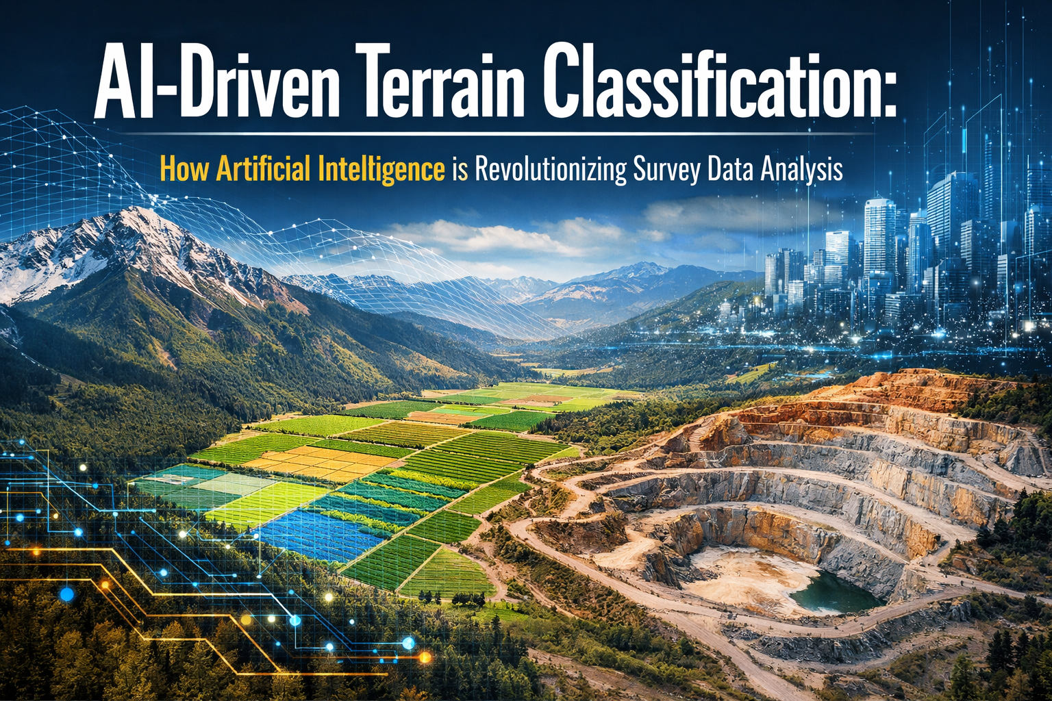
The surveying industry stands at a transformative crossroads in 2026. What once required weeks of manual data processing and classification now happens in minutes—sometimes seconds. AI-Driven Terrain Classification: How Artificial Intelligence is Revolutionizing Survey Data Analysis represents more than technological advancement; it marks a fundamental shift in how professionals understand, analyze, and interpret the physical world around us. Surveyors who previously spent countless hours sorting through raw field data now dedicate their expertise to strategic analysis and client consultation, while AI systems handle the heavy lifting of preliminary classification work.[2]
This revolution extends far beyond simple automation. Modern AI systems instantly classify terrain types, identify survey markers, detect anomalies, and flag potential issues from raw field data—all without human intervention.[2] The implications ripple through every sector that depends on accurate terrain analysis, from construction and urban planning to agriculture, environmental conservation, and infrastructure development.
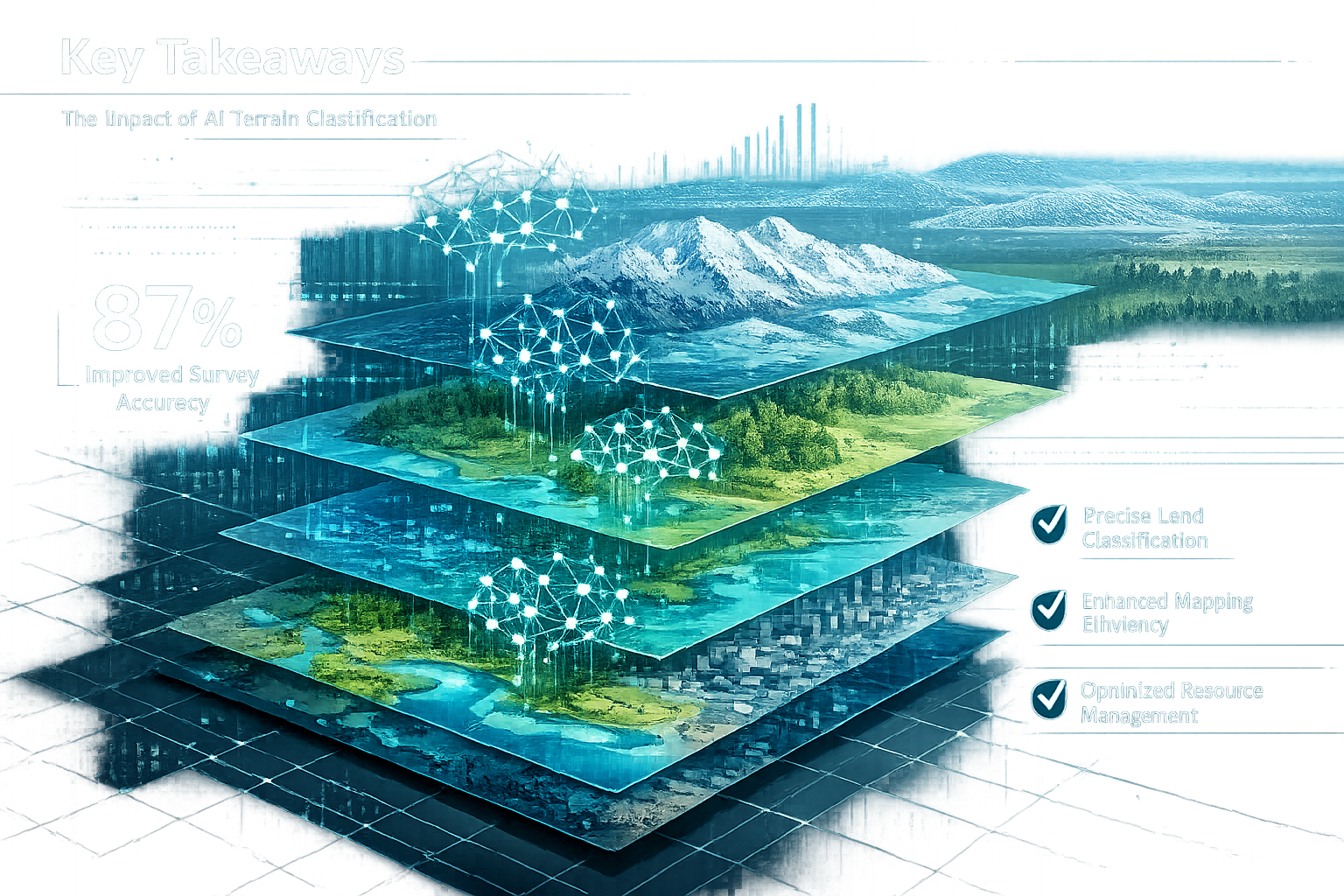
Key Takeaways
✅ Real-time terrain classification has become standard practice in 2026, with AI systems processing and categorizing survey data instantly, eliminating weeks of manual analysis that previously dominated workflows.[2]
✅ Multi-sensor data fusion combines satellite imagery, LiDAR, radar, hyperspectral data, and drone imagery to create comprehensive terrain classifications with unprecedented accuracy and detail.[4]
✅ Predictive error detection powered by machine learning identifies GPS inconsistencies and data anomalies before they compromise survey accuracy, reducing costly post-survey adjustments.[3]
✅ Autonomous survey operations leverage reinforcement learning to optimize drone flight paths, sensor selection, and data collection strategies without human intervention.[3]
✅ Professional skill requirements have shifted dramatically, with surveyors now needing proficiency in AI frameworks like TensorFlow and PyTorch alongside traditional surveying expertise.[4]
Understanding AI-Driven Terrain Classification in Modern Surveying
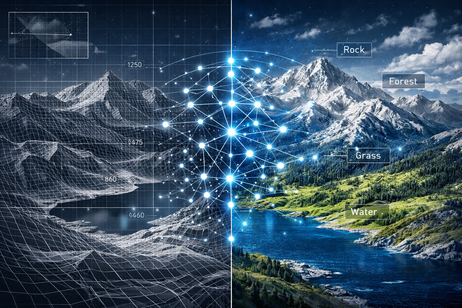
Terrain classification represents the process of categorizing land areas based on physical characteristics, vegetation cover, geological features, and human-made structures. Traditionally, this process demanded extensive manual review, expert judgment, and time-intensive analysis. Today's AI-driven approaches fundamentally transform this workflow.
What Makes AI Classification Different?
Modern AI systems employ deep learning algorithms—specifically convolutional neural networks (CNNs)—to analyze terrain data with precision that often surpasses human classification accuracy.[4] These networks process vast quantities of visual and sensor data, identifying patterns invisible to the human eye and maintaining consistency across massive datasets.
The technology operates through several sophisticated mechanisms:
Supervised Learning Models 🎯
These systems train on labeled datasets where terrain types have been pre-identified by experts. The AI learns to recognize distinguishing features of forests, urban areas, water bodies, agricultural land, and geological formations. Once trained, the model applies this knowledge to new, unlabeled terrain data, automatically categorizing zones for construction suitability, conservation priority, or agricultural potential.[3]
Unsupervised Learning Approaches 🔍
Without pre-labeled data, these algorithms identify natural groupings and patterns within terrain datasets. They discover relationships and classifications that human analysts might overlook, revealing subtle terrain variations with significant practical implications.
Reinforcement Learning for Optimization 🚁
Particularly relevant for autonomous drone operations, reinforcement learning systems receive feedback on their performance and continuously improve their data collection strategies. Drones learn efficient flight routes, optimal sensor configurations, and accurate data capture techniques while avoiding inefficient or high-risk paths.[3]
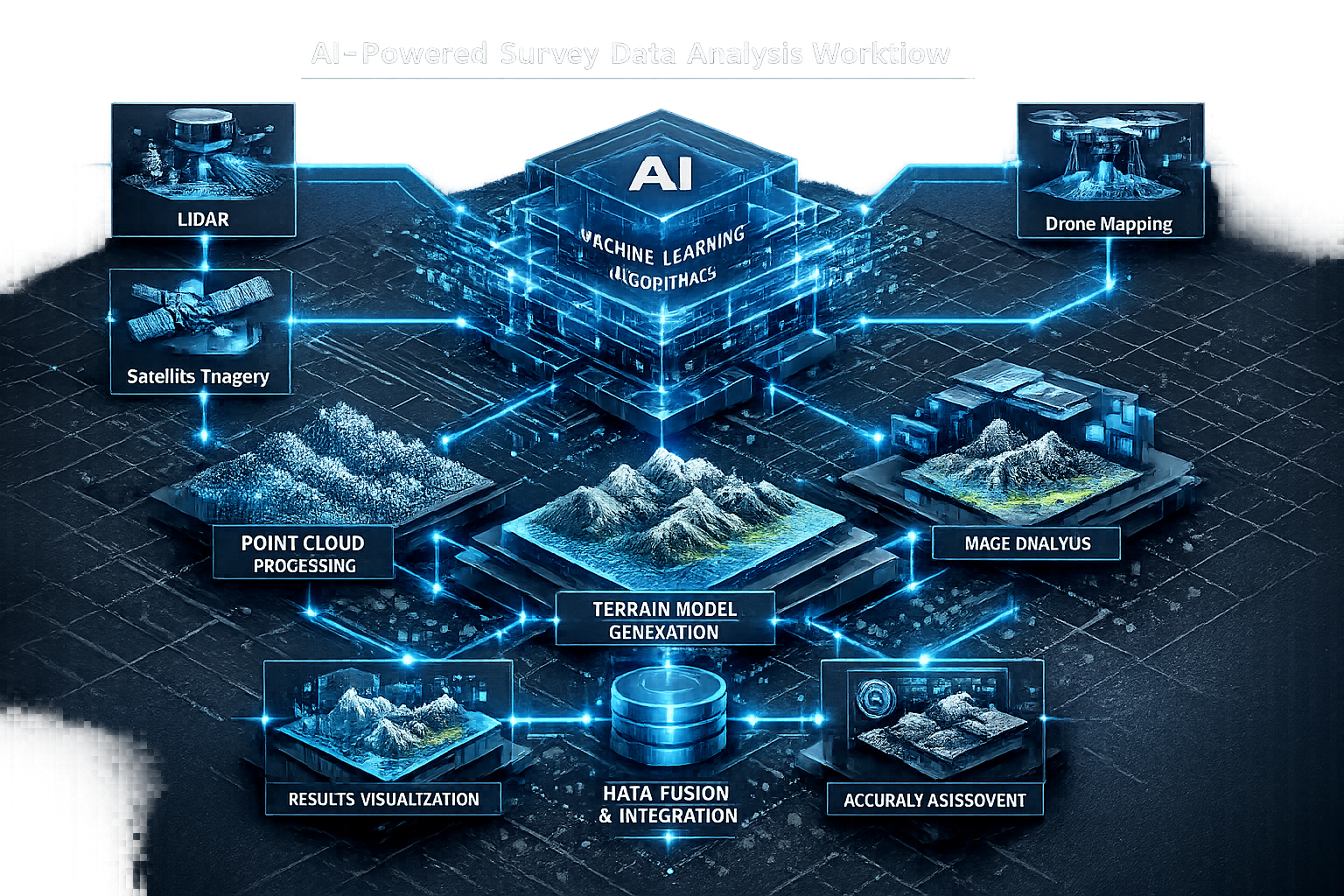
The Technology Stack Behind Modern Terrain Classification
The AI revolution in surveying relies on several interconnected technologies working in concert:
| Technology Component | Function | Impact on Classification |
|---|---|---|
| Convolutional Neural Networks (CNNs) | Image pattern recognition | Identifies terrain features from visual data with 95%+ accuracy[4] |
| LiDAR Point Clouds | 3D terrain mapping | Provides elevation data with centimeter-level precision |
| Hyperspectral Imaging | Material composition analysis | Distinguishes vegetation types, soil conditions, moisture levels |
| Synthetic Aperture Radar (SAR) | All-weather terrain sensing | Penetrates cloud cover and vegetation for year-round data collection |
| TensorFlow/PyTorch Frameworks | AI model development | Enables custom classification models for specific terrain types[4] |
These technologies don't operate in isolation. The most powerful applications involve data fusion—combining multiple sensor types to create richer, more accurate terrain classifications than any single data source could provide.[4]
How AI is Revolutionizing Survey Data Analysis Workflows
The practical implementation of AI-Driven Terrain Classification: How Artificial Intelligence is Revolutionizing Survey Data Analysis extends across every phase of the surveying workflow, from initial data collection through final deliverable production.
Real-Time Classification During Field Operations
Perhaps the most dramatic change in 2026 surveying practice is the shift to real-time terrain classification. As drones and ground-based sensors collect data, AI systems simultaneously process and categorize the information, providing immediate feedback to field operators.[2]
This capability transforms field operations in several ways:
Immediate Quality Assurance ✓
Surveyors receive instant alerts when data quality falls below acceptable thresholds or when unexpected terrain features appear. This allows for immediate re-surveying while equipment and personnel are still on-site, rather than discovering issues weeks later during office processing.
Adaptive Data Collection ✓
AI systems analyze incoming data and automatically adjust collection parameters. If initial scans reveal complex terrain requiring higher resolution, the system increases sensor density or adjusts drone altitude without human intervention.[2]
Anomaly Detection ✓
Machine learning algorithms compare current survey data against historical patterns and expected terrain characteristics. Unusual features—whether natural formations, undocumented structures, or potential hazards—are flagged immediately for expert review.
Automated Post-Processing and Classification
Once field data collection completes, AI systems handle the bulk of post-processing work that previously consumed weeks of professional time. Modern data analysis workflows incorporate multiple AI-driven stages:
Point Cloud Classification 🌲
LiDAR scans generate millions of individual data points. AI algorithms automatically classify each point as ground, vegetation, building, water, or other categories. This process, which once required days of manual work, now completes in hours with greater consistency.[2]
Feature Extraction and Mapping 🗺️
AI systems identify and extract specific features from raw data—property boundaries, elevation contours, vegetation boundaries, drainage patterns, and infrastructure elements. These features populate digital maps automatically, requiring only expert verification rather than complete manual creation.
Predictive Error Detection ⚠️
Machine learning models identify inconsistencies by comparing incoming data against historical trends and established patterns. GPS signal anomalies, sensor drift, and environmental interference are detected and corrected before they compromise final deliverables.[3]
Integration with Traditional Surveying Expertise
AI doesn't replace professional surveyors—it amplifies their capabilities. The technology handles repetitive, time-consuming classification tasks, freeing professionals to focus on areas requiring expert judgment, client consultation, and strategic decision-making.
Modern surveying firms have restructured their workflows accordingly. AI systems perform initial classification and analysis, generating preliminary reports that professional surveyors review, validate, and refine based on their expertise and local knowledge. This hybrid approach combines AI efficiency with human insight, delivering faster results without sacrificing accuracy or professional judgment.
For property surveyors conducting building surveys or property condition assessments, AI-driven terrain classification provides crucial context about site conditions, drainage patterns, and environmental factors that influence property value and structural integrity.
The Role of Multi-Sensor Data Fusion in AI-Driven Terrain Classification
One of the most significant advances in AI-Driven Terrain Classification: How Artificial Intelligence is Revolutionizing Survey Data Analysis involves the sophisticated integration of multiple data sources. Data fusion represents a key trend in 2026, combining satellite imagery, radar (SAR), LiDAR point clouds, hyperspectral imagery, thermal infrared data, and drone imagery to create comprehensive terrain understanding.[4]
Why Multiple Sensors Matter
Each sensor type captures different aspects of terrain characteristics:
Optical Satellite Imagery 🛰️
Provides broad-area coverage with regular updates, excellent for tracking land use changes over time. However, optical sensors cannot penetrate cloud cover or vegetation canopy, limiting their utility in certain conditions and environments.
Synthetic Aperture Radar (SAR) 📡
Penetrates clouds and vegetation, operates day or night, and reveals surface texture and moisture content. SAR data proves invaluable for monitoring terrain in regions with persistent cloud cover or dense vegetation.
LiDAR Point Clouds 📊
Delivers precise elevation data and 3D terrain models with centimeter-level accuracy. LiDAR excels at revealing ground surface beneath vegetation and detecting subtle elevation changes critical for drainage analysis and construction planning.
Hyperspectral Imaging 🌈
Captures data across dozens or hundreds of spectral bands, revealing material composition, vegetation health, soil moisture, and mineral content invisible to standard cameras. This technology identifies terrain characteristics that other sensors miss entirely.
Thermal Infrared 🌡️
Detects temperature variations that indicate moisture levels, vegetation stress, underground features, and recent disturbances. Thermal data adds another dimension to terrain classification, particularly valuable for environmental and agricultural applications.
How AI Synthesizes Multiple Data Streams
The challenge with multi-sensor data isn't collection—it's integration. Different sensors operate at different resolutions, capture data in different formats, and measure fundamentally different physical properties. AI systems excel at synthesizing these disparate data streams into coherent terrain classifications.
Deep learning models trained on multi-sensor datasets learn which sensor provides the most reliable information for each terrain type and environmental condition. The AI automatically weights different data sources based on quality, relevance, and reliability for specific classification tasks.[4]
For example, when classifying forested areas:
- Optical imagery identifies vegetation presence and general forest extent
- LiDAR penetrates canopy to reveal ground elevation and tree height
- Hyperspectral data distinguishes tree species and health status
- SAR reveals moisture content and structural characteristics
- Thermal imaging detects stress patterns and recent disturbances
The AI synthesizes all five data sources, creating a forest classification far more detailed and accurate than any single sensor could provide.
Practical Applications of Data Fusion
The power of multi-sensor AI classification becomes evident in real-world applications:
Urban Development Planning 🏗️
Combining LiDAR elevation data with hyperspectral soil analysis and thermal moisture mapping identifies optimal construction sites while flagging areas with poor drainage, unstable soils, or environmental constraints. This comprehensive analysis reduces development risks and supports informed decision-making.
Agricultural Land Assessment 🌾
Multi-sensor classification reveals soil composition, moisture distribution, drainage patterns, and vegetation health across large agricultural properties. Farmers and land managers receive detailed terrain classifications that guide irrigation planning, crop selection, and land management strategies.
Environmental Conservation 🌳
Fused sensor data tracks habitat changes, identifies invasive species, monitors wetland health, and detects illegal land use changes. Conservation organizations leverage AI-driven classification to prioritize protection efforts and monitor ecological changes over time.
Infrastructure Planning 🛣️
Transportation agencies use multi-sensor terrain classification to optimize route selection, identify geotechnical hazards, and predict maintenance requirements. The comprehensive terrain understanding supports cost-effective infrastructure development and long-term planning.
Autonomous Survey Operations and Predictive Modeling
The evolution toward fully autonomous survey operations represents one of the most exciting frontiers in AI-Driven Terrain Classification: How Artificial Intelligence is Revolutionizing Survey Data Analysis. In 2026, autonomous drone capabilities have emerged with sophisticated predictive modeling that transforms how surveys are planned and executed.[2]
AI-Planned Flight Paths and Sensor Selection
Modern AI systems don't just process survey data—they actively plan and optimize data collection strategies. Autonomous drones equipped with AI planning algorithms analyze terrain characteristics from preliminary data or existing maps, then automatically design optimal flight paths.[2]
The AI considers multiple variables:
Terrain Complexity 🏔️
Complex terrain with significant elevation changes requires different flight patterns than flat agricultural land. AI systems adjust altitude, flight speed, and overlap percentages to ensure complete coverage and adequate data density for accurate classification.
Sensor Requirements 📷
Different terrain types and survey objectives require different sensor configurations. The AI selects appropriate cameras, LiDAR settings, hyperspectral sensors, or thermal imaging based on classification goals and environmental conditions.
Environmental Conditions ☀️
Weather, lighting, and seasonal factors influence optimal survey timing and sensor selection. AI systems incorporate weather forecasts and environmental data to schedule flights when conditions support the highest quality data collection.
Efficiency Optimization ⚡
The AI balances thoroughness against operational costs, designing flight paths that capture all necessary data in minimal flight time while maintaining battery reserves and safety margins.
This level of automation delivers surveys with unprecedented detail in a single, highly optimized flight—eliminating the multiple survey passes and manual planning that characterized traditional approaches.[2]
Reinforcement Learning for Continuous Improvement
Reinforcement learning algorithms enable autonomous survey systems to improve performance over time through experience.[3] Each survey provides feedback that refines the AI's decision-making:
- Flight paths that produced complete, high-quality data are reinforced
- Routes that missed coverage areas or generated poor data are avoided
- Sensor configurations that delivered optimal results for specific terrain types are prioritized
- Inefficient or high-risk approaches are eliminated from future planning
This continuous learning process means autonomous survey systems become more efficient and effective with each mission, adapting to local conditions and specific terrain characteristics without explicit programming.
Predictive Modeling for Survey Planning
Beyond optimizing individual surveys, AI systems now employ predictive modeling to anticipate survey requirements and potential challenges before fieldwork begins.[2]
Terrain Complexity Prediction 🎯
Analyzing preliminary data or existing maps, AI models predict where surveys will encounter complex terrain requiring specialized approaches. This foresight supports better resource allocation and equipment selection.
Data Quality Forecasting 📈
Machine learning models predict expected data quality based on terrain type, vegetation cover, weather patterns, and sensor capabilities. Surveyors receive realistic expectations about achievable accuracy and potential limitations before committing resources.
Risk Assessment ⚠️
AI systems identify potential survey hazards—difficult terrain, restricted airspace, environmental sensitivities, or access challenges—enabling proactive risk mitigation and safety planning.
For firms providing surveying technology services across diverse locations, from London property surveyors to regional operations, predictive modeling ensures appropriate resource allocation and realistic project timelines.
Quality Assurance and Error Detection Through AI
Quality assurance represents a critical application of AI-Driven Terrain Classification: How Artificial Intelligence is Revolutionizing Survey Data Analysis. Modern surveying firms have integrated AI-assisted quality checks into their review pipelines, with leading companies actively implementing AI into their core operations.[2]
Automated Quality Control Processes
Traditional quality control required experienced professionals to manually review survey data, checking for inconsistencies, errors, and anomalies—a time-consuming process prone to human oversight. AI systems now perform continuous quality monitoring throughout data collection and processing:
Real-Time Data Validation ✓
As survey data streams in from field equipment, AI algorithms validate each data point against expected parameters. Outliers, sensor errors, and data gaps trigger immediate alerts, enabling on-site correction rather than discovering problems during office processing.
Consistency Checking ✓
Machine learning models verify that terrain classifications remain consistent across dataset boundaries and between different sensor types. Inconsistencies that might indicate processing errors or equipment problems are flagged for expert review.
Completeness Verification ✓
AI systems analyze survey coverage to ensure no gaps exist in data collection. Missing data areas are identified and prioritized for additional survey passes before field crews demobilize.
Accuracy Assessment ✓
By comparing survey results against known control points and reference datasets, AI calculates accuracy metrics automatically. Results falling below specified thresholds trigger review and potential re-survey.
Predictive Error Detection in GPS and Positioning Data
GPS and positioning errors can compromise entire surveys if not detected and corrected promptly. Machine learning algorithms now identify GPS inconsistencies by comparing incoming data against historical trends and predicting where signal outages or interference might occur.[3]
The AI analyzes patterns in GPS data quality:
- Signal strength variations across the survey area
- Multipath interference from terrain features or structures
- Atmospheric conditions affecting signal propagation
- Satellite geometry and dilution of precision factors
This predictive capability allows surveyors to implement correction strategies proactively, using alternative positioning methods or additional control points in areas where GPS reliability is predicted to be compromised.
Integration with Professional Review Workflows
AI quality assurance doesn't replace professional review—it makes expert review more efficient and effective. Instead of examining every data point, professionals focus their expertise on:
- Anomalies and exceptions flagged by AI systems
- Complex terrain features requiring expert interpretation
- Classification decisions where AI confidence falls below thresholds
- Final validation and professional certification
This approach combines AI thoroughness with human expertise, delivering higher quality results in less time than either approach could achieve independently.
For property professionals conducting homebuyers reports or building condition assessments, AI-enhanced quality assurance provides confidence that terrain analysis supporting property evaluations meets the highest accuracy standards.
Industry Applications and Real-World Impact
The practical applications of AI-Driven Terrain Classification: How Artificial Intelligence is Revolutionizing Survey Data Analysis extend across numerous industries, each benefiting from faster, more accurate terrain understanding.
Construction and Development
Construction projects depend on accurate terrain classification for site selection, grading design, drainage planning, and foundation engineering. AI-driven classification accelerates project timelines while reducing risks:
Site Suitability Analysis 🏗️
Multi-sensor AI classification identifies optimal building locations by analyzing soil composition, drainage patterns, slope stability, and environmental constraints. Developers receive comprehensive site assessments in days rather than weeks, supporting faster decision-making.
Earthwork Planning ⛏️
Precise terrain classification enables accurate cut-and-fill calculations, optimizing earthwork operations and reducing construction costs. AI systems identify areas requiring special handling due to soil conditions or environmental sensitivities.
Infrastructure Design 🛣️
Transportation and utility infrastructure requires detailed terrain understanding along extended corridors. AI classification processes linear survey data efficiently, identifying geological hazards, unstable slopes, and optimal routing options.
Agriculture and Land Management
Agricultural operations leverage AI terrain classification for precision farming, irrigation planning, and land productivity assessment:
Precision Agriculture 🌾
Hyperspectral imaging combined with AI classification creates detailed maps of soil fertility, moisture distribution, and vegetation health. Farmers apply inputs precisely where needed, reducing waste and environmental impact while maximizing yields.
Drainage and Irrigation 💧
LiDAR-derived elevation models processed through AI algorithms identify drainage patterns, low-lying areas prone to waterlogging, and optimal locations for irrigation infrastructure. This analysis supports water management strategies that improve crop performance and resource efficiency.
Land Valuation 💰
Comprehensive terrain classification provides objective data supporting agricultural land valuation. Soil quality, drainage characteristics, slope, and access are quantified through AI analysis, supporting informed investment and management decisions.
Environmental Conservation and Monitoring
Conservation organizations employ AI terrain classification to track ecosystem changes, identify conservation priorities, and monitor protected areas:
Habitat Mapping 🌳
Multi-sensor classification distinguishes vegetation communities, wetland types, and habitat structures with precision supporting conservation planning and species protection efforts.
Change Detection 📊
AI systems automatically detect land use changes, deforestation, wetland degradation, and habitat fragmentation by comparing terrain classifications across time periods. Early detection enables rapid response to environmental threats.
Restoration Planning 🌱
Detailed terrain classification guides ecosystem restoration by identifying suitable planting sites, drainage restoration opportunities, and areas requiring intervention to support natural recovery.
Urban Planning and Smart Cities
Municipal governments and urban planners use AI terrain classification to support sustainable development and infrastructure planning:
Green Space Planning 🌲
AI classification identifies suitable locations for parks, urban forests, and green infrastructure based on soil conditions, drainage, and connectivity to existing green spaces.
Flood Risk Assessment 🌊
Combining elevation data with drainage pattern analysis, AI systems model flood risks and identify areas requiring mitigation measures. This analysis supports resilient urban development and emergency planning.
Infrastructure Optimization 🚇
Comprehensive terrain understanding guides placement of utilities, transportation networks, and public facilities, minimizing construction costs while maximizing service delivery.
For chartered surveyors working across these diverse applications, AI-driven terrain classification provides the detailed, accurate data required for professional analysis and client consultation.
Skills and Training for the AI-Driven Surveying Era
The integration of AI into surveying workflows has fundamentally transformed professional skill requirements. Remote sensing specialists and surveyors must now master AI frameworks like TensorFlow and PyTorch to work effectively with geospatial data, representing a significant shift in required professional competencies.[4]
Essential Technical Skills for 2026
Modern surveying professionals need a hybrid skill set combining traditional surveying expertise with data science and AI capabilities:
Programming and Scripting 💻
Proficiency in Python has become essential for surveyors working with AI systems. Python provides the foundation for AI frameworks and geospatial data processing libraries, enabling professionals to customize classification algorithms and automate workflows.
Machine Learning Fundamentals 🧠
Understanding how machine learning models train, validate, and predict allows surveyors to select appropriate algorithms, interpret results critically, and troubleshoot classification issues. This knowledge doesn't require deep mathematical expertise but does demand conceptual understanding of AI principles.
Geospatial Data Science 🗺️
Working with multiple data formats—raster imagery, vector datasets, point clouds, and attribute tables—requires specialized skills in geospatial data manipulation, coordinate systems, and spatial analysis techniques.
AI Framework Operation ⚙️
Practical experience with TensorFlow, PyTorch, or similar frameworks enables surveyors to implement pre-trained models, fine-tune algorithms for specific terrain types, and develop custom classification solutions.[4]
Professional Development Pathways
Surveying professionals can develop AI competencies through several approaches:
Formal Education Programs 🎓
Universities and technical colleges increasingly offer specialized programs in geospatial AI, remote sensing, and data science tailored to surveying applications. These programs provide structured learning paths from fundamentals through advanced applications.
Professional Certifications 📜
Industry organizations now offer certifications in AI-driven surveying technologies, validating professional competency in modern tools and techniques. These credentials demonstrate commitment to professional development and mastery of current best practices.
Online Learning Platforms 💡
Flexible online courses enable working professionals to develop AI skills at their own pace. Platforms offering hands-on projects with real geospatial datasets provide practical experience complementing theoretical knowledge.
On-the-Job Training 🛠️
Many surveying firms implement internal training programs, pairing experienced professionals with AI specialists to develop hybrid expertise. This approach builds organizational capability while maintaining continuity in client service.
Balancing Traditional and Modern Skills
While AI capabilities are increasingly important, traditional surveying fundamentals remain essential. The most effective professionals combine:
- Field surveying expertise with autonomous system operation
- Professional judgment with AI-generated insights
- Client communication skills with technical data science capabilities
- Regulatory knowledge with innovative technology applications
This balanced skill set positions surveyors to leverage AI tools effectively while maintaining the professional standards and expert judgment that clients depend upon.
For professionals seeking to understand how these technological advances impact traditional services like property inspection guidance or building surveyor services, the integration of AI enhances rather than replaces core professional competencies.
Challenges and Limitations of AI-Driven Terrain Classification
Despite remarkable advances, AI-Driven Terrain Classification: How Artificial Intelligence is Revolutionizing Survey Data Analysis faces several challenges and limitations that professionals must understand and address.
Data Quality and Availability
AI systems are only as good as the data they process. Several data-related challenges persist:
Training Data Requirements 📊
Supervised learning models require extensive labeled datasets for training. Creating these datasets demands significant expert time and effort, particularly for specialized terrain types or regional variations not well-represented in existing databases.
Data Standardization 📏
Different sensors, platforms, and data providers use varying formats, resolutions, and quality standards. Integrating diverse data sources requires careful preprocessing and standardization—processes that can introduce errors or inconsistencies if not properly managed.
Historical Data Limitations 📅
AI models trained on historical data may not perform well when terrain characteristics change due to development, natural disasters, or climate shifts. Models require periodic retraining with current data to maintain accuracy.
Algorithm Limitations and Bias
AI classification algorithms have inherent limitations that professionals must recognize:
Classification Confidence 🎯
AI systems often struggle with ambiguous terrain features that fall between distinct categories. While the algorithm will produce a classification, confidence levels may be low, requiring expert review and validation.
Edge Cases and Unusual Features ⚠️
Terrain features poorly represented in training data may be misclassified. Unusual geological formations, novel land uses, or rare vegetation communities can confound AI systems trained primarily on common terrain types.
Algorithmic Bias ⚖️
If training data over-represents certain terrain types or geographic regions, the resulting AI model may perform poorly in under-represented areas. This bias can lead to systematic classification errors in specific contexts.
Regulatory and Professional Standards
The integration of AI into professional surveying raises regulatory and standards questions:
Professional Liability ⚠️
When AI systems contribute to survey deliverables, questions arise about professional responsibility for AI-generated errors. Clear protocols for AI validation and professional oversight are essential for managing liability.
Regulatory Acceptance 📋
Some regulatory frameworks and professional standards were developed before AI surveying technologies emerged. Updating these frameworks to accommodate AI-driven methods while maintaining quality standards requires ongoing dialogue between regulators, professional organizations, and technology providers.
Client Understanding 💬
Clients may not understand how AI contributes to survey results or what limitations apply. Clear communication about AI capabilities and limitations supports realistic expectations and informed decision-making.
Cost and Implementation Barriers
Adopting AI-driven terrain classification involves significant investments:
Technology Costs 💰
AI-capable hardware, software licenses, multi-sensor equipment, and cloud computing resources require substantial capital investment. Smaller firms may struggle to justify these costs without sufficient project volume.
Training and Expertise 🎓
Developing staff competencies in AI technologies demands time and resources. The learning curve can be steep, particularly for professionals whose previous experience centered on traditional surveying methods.
Workflow Integration 🔄
Incorporating AI systems into established workflows requires careful planning and change management. Disruption during implementation can temporarily reduce productivity even as long-term efficiency improves.
Despite these challenges, the benefits of AI-driven terrain classification generally outweigh the limitations for firms committed to staying current with technological advances and client expectations.
Future Trends and Emerging Developments
Looking beyond 2026, several emerging trends will further advance AI-Driven Terrain Classification: How Artificial Intelligence is Revolutionizing Survey Data Analysis:
Edge Computing and On-Device AI
Edge computing brings AI processing directly to survey equipment rather than relying on cloud-based systems. Drones and ground sensors with integrated AI processors will perform sophisticated terrain classification in real-time during data collection, even in areas without network connectivity.[7]
Benefits include:
- Immediate classification feedback during field operations
- Reduced data transmission requirements
- Enhanced privacy and data security
- Continued operation in remote areas without connectivity
Contextual Intelligence and AI Agents
The evolution toward contextual intelligence will enable AI systems to understand not just what terrain features exist but why they matter for specific applications.[7] AI agents will provide context-aware recommendations:
- Suggesting optimal construction techniques based on classified terrain
- Recommending environmental mitigation measures for sensitive areas
- Identifying regulatory requirements triggered by specific terrain classifications
- Proposing alternative survey approaches when initial data reveals unexpected conditions
Integration with Digital Twins
Digital twin technology—creating comprehensive digital replicas of physical environments—will increasingly incorporate AI-driven terrain classification. These digital twins will:
- Update automatically as new survey data becomes available
- Simulate terrain changes under different scenarios
- Support predictive modeling for development impacts
- Enable virtual site visits and remote collaboration
Quantum Computing Applications
While still emerging, quantum computing may eventually revolutionize AI terrain classification by processing vastly larger datasets and more complex algorithms than classical computers allow. Potential applications include:
- Real-time processing of global-scale terrain datasets
- Simultaneous optimization of multiple competing classification objectives
- Detection of subtle patterns invisible to current AI systems
- Integration of additional data dimensions beyond current capabilities
Ethical AI and Explainability
Growing emphasis on AI ethics and explainability will drive development of classification systems that not only produce results but explain their reasoning. This transparency will:
- Build client confidence in AI-generated classifications
- Support professional validation and quality assurance
- Enable identification and correction of algorithmic bias
- Facilitate regulatory compliance and professional standards adherence
These emerging trends promise to further enhance surveying capabilities, making terrain classification faster, more accurate, and more accessible across diverse applications and geographic contexts.
Implementing AI-Driven Terrain Classification in Your Organization
For surveying firms and organizations seeking to adopt AI-Driven Terrain Classification: How Artificial Intelligence is Revolutionizing Survey Data Analysis, a strategic implementation approach maximizes success while managing risks and costs.
Assessment and Planning
Evaluate Current Capabilities 🔍
Begin by assessing existing technology infrastructure, staff competencies, project types, and client requirements. Identify gaps between current capabilities and AI-enabled workflows to guide investment priorities.
Define Clear Objectives 🎯
Establish specific goals for AI implementation:
- Reduce processing time by specific percentages
- Improve classification accuracy for particular terrain types
- Expand service offerings into new markets or applications
- Enhance competitive positioning through technology leadership
Develop Implementation Roadmap 🗺️
Create a phased approach that builds capabilities progressively:
- Pilot phase: Test AI systems on limited projects to validate benefits and identify challenges
- Expansion phase: Scale successful approaches across additional project types
- Integration phase: Fully incorporate AI into standard workflows and quality systems
- Optimization phase: Refine processes and develop advanced capabilities
Technology Selection
Choose Appropriate Tools 🛠️
Select AI platforms and tools matched to organizational needs:
- Commercial platforms: Turnkey solutions with vendor support, ideal for rapid deployment
- Open-source frameworks: Greater customization potential, requiring more technical expertise
- Hybrid approaches: Combining commercial platforms for core functions with custom development for specialized needs
Consider Integration Requirements 🔗
Ensure new AI systems integrate with existing surveying software, data management platforms, and client delivery systems. Seamless integration reduces workflow disruption and accelerates adoption.
Staff Development
Invest in Training 📚
Develop staff competencies through:
- Formal training programs in AI fundamentals and geospatial applications
- Hands-on experience with pilot projects under expert guidance
- Ongoing professional development to stay current with evolving technologies
- Cross-training between traditional surveying and data science disciplines
Build Internal Expertise 💪
Consider hiring specialists with AI and data science backgrounds to complement traditional surveying expertise. These specialists can lead implementation, train colleagues, and develop advanced capabilities.
Quality Assurance and Validation
Establish Validation Protocols ✓
Develop clear procedures for validating AI-generated classifications:
- Define confidence thresholds requiring expert review
- Establish comparison against known reference data
- Document validation results to build confidence in AI accuracy
- Create feedback loops to improve model performance over time
Maintain Professional Standards 📋
Ensure AI-enhanced workflows meet professional and regulatory requirements:
- Professional review and certification of AI-generated deliverables
- Clear documentation of AI contributions to survey results
- Compliance with industry standards and best practices
- Transparent communication with clients about AI capabilities and limitations
Client Communication
Educate Clients 💬
Help clients understand how AI enhances survey services:
- Explain benefits in terms of speed, accuracy, and comprehensiveness
- Address concerns about AI reliability and professional oversight
- Demonstrate value through case studies and pilot results
- Maintain transparency about AI capabilities and appropriate applications
Manage Expectations 🎯
Set realistic expectations about what AI can and cannot deliver. Emphasize that AI augments rather than replaces professional expertise, and that expert judgment remains essential for complex decisions and client consultation.
Organizations following this strategic approach can successfully integrate AI-driven terrain classification into their operations, delivering enhanced value to clients while positioning themselves for continued success in an increasingly technology-driven industry.
Conclusion: Embracing the AI Revolution in Terrain Classification
AI-Driven Terrain Classification: How Artificial Intelligence is Revolutionizing Survey Data Analysis represents far more than incremental technological improvement—it marks a fundamental transformation in how professionals understand and interact with the physical world. The shift from manual data processing to AI-automated classification has already moved beyond experimental status into standard practice, with real-time terrain classification, autonomous survey operations, and predictive modeling becoming baseline expectations rather than cutting-edge innovations.[2]
The benefits are compelling and measurable:
✅ Dramatic time savings: Tasks requiring weeks now complete in hours or minutes
✅ Enhanced accuracy: AI consistency eliminates human errors and oversight
✅ Comprehensive analysis: Multi-sensor data fusion reveals terrain characteristics invisible to traditional methods
✅ Predictive capabilities: AI systems anticipate challenges and optimize approaches proactively
✅ Professional leverage: Surveyors focus expertise on strategic analysis rather than repetitive processing
Yet success requires more than simply adopting new technology. Organizations must invest in staff development, establish robust validation protocols, maintain professional standards, and communicate effectively with clients about AI capabilities and limitations. The most successful firms will be those that thoughtfully integrate AI tools while preserving the professional judgment, local knowledge, and client relationships that define quality surveying practice.
Actionable Next Steps
For surveying professionals and organizations ready to advance their AI capabilities:
1. Assess Your Current Position 📊
Evaluate existing technology infrastructure, staff competencies, and client requirements. Identify specific areas where AI-driven terrain classification could deliver the greatest value for your practice.
2. Start with Focused Pilots 🚀
Rather than attempting comprehensive transformation immediately, begin with targeted pilot projects that test AI systems on specific terrain types or project categories. Learn from these experiences before scaling adoption.
3. Invest in Professional Development 🎓
Provide training opportunities for staff to develop AI competencies alongside traditional surveying expertise. Consider hiring specialists with data science backgrounds to accelerate capability development.
4. Establish Quality Protocols ✓
Develop clear validation procedures ensuring AI-generated classifications meet professional standards. Document these protocols and refine them based on experience.
5. Engage with the Professional Community 🤝
Participate in professional organizations, conferences, and forums focused on AI in surveying. Learn from peers, share experiences, and contribute to evolving best practices.
6. Communicate Value to Clients 💬
Help clients understand how AI enhances your services while maintaining the professional expertise they depend upon. Use concrete examples demonstrating faster delivery, enhanced accuracy, and more comprehensive analysis.
7. Stay Current with Emerging Trends 🔮
The AI landscape evolves rapidly. Commit to ongoing learning about new capabilities, emerging tools, and evolving best practices to maintain competitive advantage.
The revolution in terrain classification driven by artificial intelligence is not a distant future possibility—it's the present reality of surveying practice in 2026. Organizations that embrace this transformation thoughtfully and strategically will thrive in an increasingly competitive, technology-driven industry. Those that resist or delay adoption risk falling behind competitors who deliver faster, more accurate, and more comprehensive terrain analysis to increasingly sophisticated clients.
The choice is clear: adapt and excel, or maintain outdated approaches and gradually lose relevance. For professionals committed to delivering the highest quality surveying services, AI-driven terrain classification represents not a threat to traditional practice but an opportunity to elevate the profession to new levels of capability, efficiency, and value creation.
Whether you're conducting building surveys for property transactions, performing property condition assessments for commercial clients, or supporting major infrastructure development, AI-driven terrain classification provides the detailed, accurate, timely data required for professional excellence in 2026 and beyond.
The future of surveying has arrived. The question is not whether to adopt AI-driven terrain classification, but how quickly and effectively your organization can integrate these transformative capabilities into your professional practice.
References
[1] Ai Powered Surveying The Future Of Data Analysis In Land And Hydrographic Surveys – https://www.arcsurveyors.com/ai-powered-surveying-the-future-of-data-analysis-in-land-and-hydrographic-surveys/
[2] Future Land Surveying 2026 – https://haller-blanchard.com/future-land-surveying-2026/
[3] Ai Machine Learning Impact Gps Data Processsing – https://www.baselineequipment.com/ai-machine-learning-impact-gps-data-processsing
[4] Remote Sensing Scientist Engineer In 2026 Mastering Earth Observation In The Ai Era – https://www.refontelearning.com/blog/remote-sensing-scientist-engineer-in-2026-mastering-earth-observation-in-the-ai-era
[5] Ai Driven Precision In Property Surveying How Artificial Intelligence Is Revolutionizing Workflows In 2026 – https://nottinghillsurveyors.com/blog/ai-driven-precision-in-property-surveying-how-artificial-intelligence-is-revolutionizing-workflows-in-2026
[6] Ai And Machine Learning In Property Surveying Predicting Risks And Automating Analysis – https://nottinghillsurveyors.com/blog/ai-and-machine-learning-in-property-surveying-predicting-risks-and-automating-analysis
[7] 2026 Data Predictions Scaling Ai Agents Via Contextual Intelligence – https://siliconangle.com/2026/01/18/2026-data-predictions-scaling-ai-agents-via-contextual-intelligence/