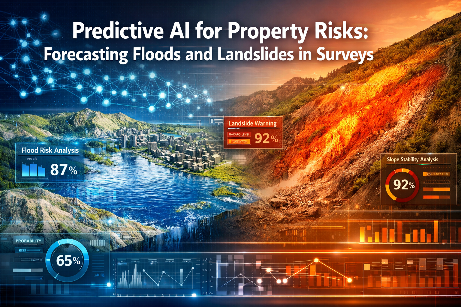
When a property developer in Surrey discovered their planned £12 million residential project sat in a previously undetected flood corridor, it wasn't a traditional surveyor who identified the risk—it was an artificial intelligence system analyzing decades of rainfall patterns, soil composition data, and topographical changes. This scenario represents the transformative power of Predictive AI for Property Risks: Forecasting Floods and Landslides in Surveys, a technological revolution reshaping how the property industry identifies and mitigates environmental hazards before they become catastrophic financial losses.
By 2026, the property surveying landscape has fundamentally shifted from reactive assessments to proactive risk forecasting. Machine learning algorithms now process vast datasets—from satellite imagery and geological surveys to historical weather patterns and soil moisture readings—to predict environmental disasters with unprecedented accuracy. This evolution addresses a critical industry challenge: traditional static flood zone maps and landslide assessments cannot account for changing climate patterns, urban development impacts, or the complex interplay of environmental factors that contribute to property risks[6].
The integration of predictive AI into property surveys represents more than technological advancement; it signals a paradigm shift in how professionals approach due diligence, valuation, and long-term property planning. As commercial real estate companies have witnessed AI pilot programs surge from just 5% to 92% in three years[4], the message is clear: artificial intelligence has moved from experimental technology to essential infrastructure.
Key Takeaways
- 🤖 AI-driven risk forecasting analyzes thousands of environmental scenarios simultaneously, identifying flood and landslide risks that traditional surveys might miss through cross-referencing satellite imagery, geological data, and climate patterns[3]
- 📊 Dynamic modeling has replaced static assessments, enabling scenario-based predictions that account for climate change, urban development, and evolving environmental conditions rather than relying on outdated flood zone maps[6]
- 💰 Predictive analytics has become fundamental to property valuation, with AI systems forecasting how environmental risks will impact future property values by analyzing economic signals, demographic shifts, and hazard probabilities[1]
- ⚡ Rapid industry adoption demonstrates the technology's value, with commercial real estate AI implementations jumping from 5% to 92% in just three years as firms recognize measurable ROI from predictive risk assessment[4]
- 🎯 Probabilistic risk modeling provides property stakeholders with percentage-based likelihood assessments for various environmental scenarios, enabling more informed decision-making for development, insurance, and investment strategies[1]
Understanding Predictive AI for Property Risks: Forecasting Floods and Landslides in Surveys
The Evolution from Static to Dynamic Risk Assessment
Traditional property surveys have long relied on static environmental risk assessments—fixed flood zone designations, historical landslide records, and geological maps that assume conditions remain constant. This approach, while valuable for establishing baseline understanding, fails to account for the dynamic nature of environmental hazards in an era of climate change and rapid urban development.
Predictive AI for Property Risks: Forecasting Floods and Landslides in Surveys represents a fundamental departure from this static methodology. Modern AI systems employ scenario-based risk modeling that simulates thousands of potential environmental conditions[3]. These systems consider:
- Climate trajectory modeling: How changing precipitation patterns will affect flood risks over 10, 25, and 50-year timeframes
- Urban development impact: How new construction, impervious surfaces, and drainage modifications alter water flow and soil stability
- Geological evolution: How soil composition changes, groundwater levels fluctuate, and subsurface conditions shift over time
- Vegetation and land use changes: How deforestation, agricultural practices, and landscaping modifications influence erosion and water retention
This shift from static to dynamic modeling enables property professionals to move beyond asking "Is this property currently in a flood zone?" to answering "What is the probability this property will experience flooding under various climate and development scenarios over the next three decades?"
How Machine Learning Algorithms Process Survey Data
The technical foundation of predictive AI systems lies in their ability to process and synthesize massive datasets that would be impossible for human surveyors to analyze comprehensively. Machine learning models employed in property risk forecasting typically utilize:
Deep Learning Neural Networks that identify complex patterns across multiple data layers, recognizing subtle correlations between topographical features, soil types, vegetation coverage, and historical hazard events. These networks "learn" from thousands of documented floods and landslides, identifying the environmental signatures that precede such events[3].
Computer Vision Algorithms that analyze satellite imagery and aerial photography to detect changes in terrain, identify drainage patterns, spot vegetation stress indicators, and measure slope angles with precision impossible through manual inspection. These systems can process decades of imagery in hours, tracking how landscapes have evolved and predicting future changes.
Natural Language Processing that extracts relevant information from historical survey reports, geological studies, planning documents, and incident records, converting unstructured text into structured data points that feed predictive models.
Time Series Analysis that examines how environmental conditions have changed over time, identifying trends, cyclical patterns, and accelerating risks that indicate future hazards.
When integrated with traditional monitoring surveys, these AI systems create a comprehensive risk assessment framework that combines human expertise with computational power.
Data Sources Powering Environmental Hazard Predictions
The accuracy of Predictive AI for Property Risks: Forecasting Floods and Landslides in Surveys depends heavily on the quality and diversity of input data. Modern systems cross-reference information from multiple sources to build robust risk models[3]:
| Data Source | Information Provided | Risk Assessment Application |
|---|---|---|
| Satellite Imagery | Terrain changes, vegetation health, surface water accumulation | Detecting slope instability, identifying flood-prone depressions |
| LiDAR Surveys | High-resolution topographical data, precise elevation measurements | Modeling water flow paths, calculating slope angles |
| Geological Databases | Soil composition, bedrock depth, fault lines, aquifer locations | Assessing landslide susceptibility, groundwater flood risk |
| Weather Records | Historical precipitation, temperature, extreme events | Establishing baseline conditions, identifying trend changes |
| Municipal Records | Drainage infrastructure, development plans, historical claims | Understanding human-made flood mitigation, predicting development impacts |
| Insurance Claims Data | Past flood and landslide incidents, damage assessments | Validating model predictions, identifying high-risk patterns |
| River Gauging Stations | Water level monitoring, flow rates, flood stage data | Real-time flood risk assessment, model calibration |
| Soil Moisture Sensors | Ground saturation levels, drainage capacity | Landslide trigger prediction, flood absorption modeling |
This multi-source approach ensures that AI systems don't rely on single data points that might be outdated or incomplete. Instead, they triangulate information to build confidence in their predictions and flag inconsistencies that warrant human investigation.
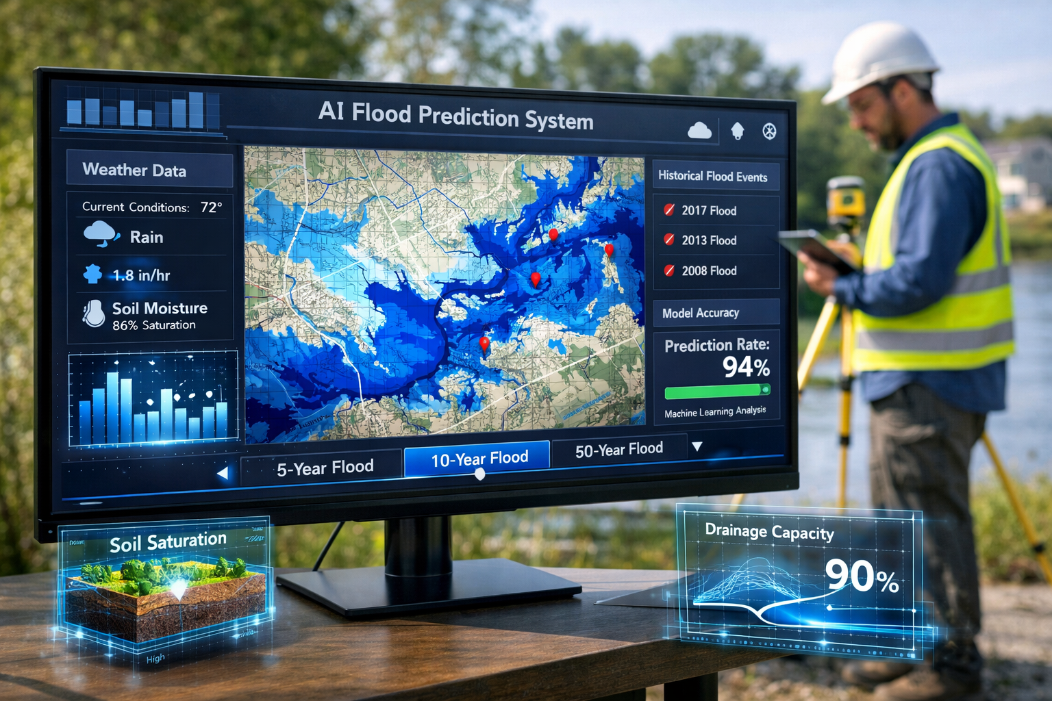
Flood Risk Prediction: How AI Transforms Property Surveys
Advanced Flood Modeling Techniques
Flood prediction has progressed beyond traditional static flood zone maps to embrace dynamic, scenario-based risk modeling that accounts for the complex interplay of environmental factors[6]. Modern AI systems employed in property surveys utilize several sophisticated modeling approaches:
Hydrological Modeling combines rainfall predictions, soil absorption rates, topographical data, and drainage infrastructure capacity to simulate how water will accumulate and flow across landscapes. Machine learning enhances these models by identifying non-obvious factors—such as how specific soil types behave when saturated or how urban heat islands affect local precipitation patterns.
Hydraulic Modeling focuses on water movement through channels, rivers, and drainage systems. AI algorithms can process real-time data from river gauging stations and weather forecasts to predict flood timing, depth, and duration with remarkable precision. These models account for:
- Upstream development that increases runoff velocity
- Infrastructure changes (new bridges, culverts, flood barriers)
- Seasonal vegetation changes affecting water retention
- Tidal influences in coastal and estuarine areas
Coastal Flood Modeling incorporates sea-level rise projections, storm surge patterns, and wave action to assess properties near coastlines. By 2026, these models routinely simulate compound flooding scenarios where multiple factors (high tides, storm surges, heavy rainfall) coincide to create extreme events.
Pluvial (Surface Water) Flood Modeling addresses flooding from intense rainfall overwhelming drainage systems—a growing concern in urban areas. AI systems identify subtle topographical depressions, inadequate drainage points, and impervious surface concentrations that create localized flood risks not captured in traditional river flood maps.
Case Study: AI-Detected Flood Corridor Saves Development Project
A residential development company planning a 150-unit housing estate in the Thames Valley commissioned a comprehensive survey that included AI-powered flood risk assessment. Traditional Environment Agency flood maps classified the site as "low risk," located outside designated flood zones.
However, the predictive AI system flagged several concerning patterns:
- Historical imagery analysis revealed that during the 2007 and 2014 flood events, water had temporarily pooled in a specific area of the site, despite the location not being officially flood-mapped
- Topographical modeling identified a subtle depression (elevation difference of just 1.2 meters) that created a natural water collection point
- Upstream development analysis showed that three new commercial projects completed since the last flood map update had increased impervious surface area by 18%, accelerating runoff toward the site
- Climate projection modeling indicated that the 1-in-100-year flood event for this location would likely become a 1-in-30-year event by 2045 based on precipitation trend analysis
Armed with this AI-generated insight, the development company redesigned the project, relocating the most vulnerable buildings, implementing enhanced drainage infrastructure, and creating a retention pond in the identified depression area. The predictive analysis prevented an estimated £4.8 million in future flood damage costs and ensured the development met emerging insurance and regulatory requirements.
This case exemplifies how Predictive AI for Property Risks: Forecasting Floods and Landslides in Surveys delivers tangible value by identifying risks that traditional methods miss and enabling proactive mitigation rather than reactive damage control.
Integration with Traditional Property Valuations
The flood risk insights generated by AI systems have profound implications for property valuations. Predictive analytics has become a major pillar of property valuation by 2026, with systems forecasting future values by analyzing how environmental risks will impact marketability, insurance costs, and structural integrity[1].
Modern valuation approaches incorporate:
Risk-Adjusted Valuations that apply percentage discounts based on flood probability and potential damage costs. A property with a 15% chance of experiencing a significant flood event within 30 years might see a 5-12% valuation reduction depending on mitigation measures in place.
Insurance Cost Projections that factor AI-predicted risk escalation into long-term ownership cost calculations. Properties in areas where flood risk is increasing may face insurance premium increases of 30-80% over a decade, significantly impacting affordability and resale value.
Mitigation Value Assessment that quantifies how flood defense improvements (raised foundations, flood barriers, enhanced drainage) affect property value. AI systems can model the exact value increase from specific mitigation investments, enabling cost-benefit analysis.
Future Marketability Scoring that predicts how buyer demand will shift as climate awareness increases. Properties with high AI-predicted flood risk may experience reduced buyer interest even before actual flood events occur, as informed buyers incorporate long-term risk into purchasing decisions.
These valuation adjustments ensure that property prices reflect true long-term value rather than current conditions that may not persist. For buyers, this transparency prevents purchasing overvalued properties in high-risk areas; for sellers, it incentivizes proactive risk mitigation that protects asset value.
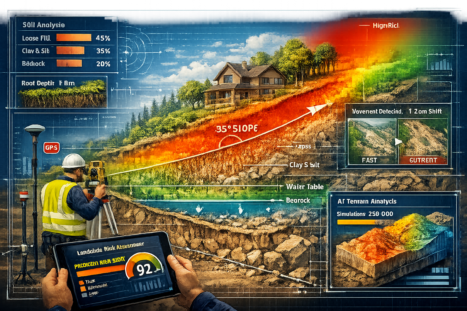
Landslide Risk Assessment Through Machine Learning
Geological and Topographical Data Analysis
Landslide prediction presents unique challenges compared to flood forecasting, as slope failures depend on complex interactions between geology, topography, hydrology, vegetation, and human activity. Predictive AI systems address these challenges through multi-dimensional analysis that considers:
Slope Geometry Analysis utilizing high-resolution LiDAR data to measure slope angles, aspect (direction), curvature, and height. Machine learning algorithms have identified that slopes between 25-45 degrees show the highest landslide susceptibility, but this varies significantly based on other factors. AI systems don't rely on simple angle thresholds; instead, they analyze how slope geometry interacts with other variables.
Geological Composition Mapping that categorizes subsurface materials based on their landslide susceptibility. Certain geological formations—such as clay-rich soils, weathered shale, and volcanic deposits—demonstrate higher failure rates. AI systems cross-reference geological survey data with historical landslide locations to identify which specific formations pose the greatest risk in particular climatic and topographical contexts.
Groundwater and Soil Moisture Modeling that tracks how water infiltration affects slope stability. Landslides often occur when soil becomes saturated, increasing weight while reducing friction between soil particles. Predictive systems monitor:
- Seasonal groundwater fluctuations
- Soil drainage capacity based on composition
- Vegetation root systems that stabilize or destabilize slopes
- Rainfall intensity and duration thresholds that trigger failures
Historical Movement Detection using satellite interferometry (InSAR) and repeat aerial imagery analysis. These techniques can detect millimeter-scale ground movement over time, identifying slopes experiencing gradual creep that may precede catastrophic failure. AI algorithms analyze movement patterns to distinguish between stable seasonal shifts and accelerating instability.
Identifying Subtle Warning Signs Through Computer Vision
One of the most powerful applications of Predictive AI for Property Risks: Forecasting Floods and Landslides in Surveys is the ability to identify subtle environmental changes that human observers might miss[3]. Computer vision algorithms trained on thousands of pre-landslide images can recognize warning signs including:
Vegetation Stress Patterns where trees lean downslope, display curved trunks (indicating gradual movement), or show sudden die-off in specific areas due to root disruption or altered drainage. AI systems can detect these patterns across entire hillsides in minutes, flagging areas for detailed investigation.
Surface Cracking and Fissures that appear in soil, pavement, or structures near slopes. Computer vision algorithms can measure crack width, length, and orientation, tracking how these features evolve over time. Expanding cracks oriented parallel to slope contours often indicate incipient failure.
Drainage Pattern Changes where new gullies form, existing streams divert, or water accumulation points shift—all potential indicators of subsurface movement or altered permeability. AI systems compare current imagery with historical baselines to detect these changes.
Structural Deformation in buildings, retaining walls, and infrastructure near slopes. Algorithms can detect tilting, settling, or cracking that suggests ground movement, even when changes are too gradual for casual observation to notice.
Exposed Soil or Bedrock where vegetative cover has been lost, potentially indicating active erosion or recent movement. AI systems can quantify the rate of exposure expansion, predicting when conditions might reach critical thresholds.
Real-World Application: Preventing Development on Unstable Terrain
A property development firm acquired a hillside parcel in the Cotswolds for luxury home construction, attracted by the panoramic views and premium location. Traditional geological surveys indicated the site was generally stable, with no recorded landslide history.
However, a comprehensive AI-powered risk assessment revealed concerning patterns:
- InSAR analysis detected 3-7mm annual downslope movement in the upper portion of the property over the previous five years—subtle enough to escape notice but indicating active instability
- Computer vision analysis of historical aerial imagery showed progressive vegetation stress patterns and minor drainage changes consistent with gradual slope creep
- Machine learning models trained on regional landslide data identified the site's combination of slope angle (32 degrees), clay-rich soil composition, and aspect (north-facing with limited sun exposure and higher moisture retention) as matching the profile of slopes that had failed during the 2012 and 2020 heavy rainfall events
- Climate projection modeling indicated that increasingly intense rainfall events (predicted to increase in frequency by 40% over 30 years) would likely trigger slope failure within the property's development timeline
The predictive analysis assigned a 68% probability of significant slope movement within 25 years under current climate projections. Armed with this information, the development company commissioned detailed geotechnical investigation that confirmed the AI findings, discovering a weak clay layer at depth that was slowly failing.
Rather than proceeding with the original plan, the firm redesigned the project to concentrate development on the more stable lower slopes, implemented extensive drainage improvements, and installed slope stabilization measures in high-risk areas. The AI-driven assessment prevented potential catastrophic failure that could have resulted in property loss, liability claims, and reputational damage estimated to exceed £15 million.
This case demonstrates how machine learning can detect patterns invisible to traditional assessment methods, providing early warning that enables proactive intervention rather than reactive disaster response.
Automation and On-Site Risk Reduction
Reducing Human Exposure to Hazardous Survey Conditions
One of the most immediate benefits of Predictive AI for Property Risks: Forecasting Floods and Landslides in Surveys is the reduction of surveyor exposure to dangerous conditions. Traditional environmental risk assessment often requires physical site visits to unstable slopes, flood-prone areas, and other hazardous locations.
AI-powered remote sensing technologies minimize these risks through:
Drone-Based Surveying that captures high-resolution imagery, thermal data, and LiDAR measurements without requiring surveyors to access dangerous terrain. Drones can survey steep slopes, eroding riverbanks, and flood-affected areas while operators remain in safe locations. AI algorithms process the collected data to identify risk indicators, often eliminating the need for physical site access entirely.
Satellite-Based Monitoring that provides regular updates on environmental conditions without any site presence. Modern satellite constellations offer imagery resolution sufficient for detecting many landslide and flood risk indicators, with AI systems automatically flagging changes that warrant attention.
Predictive Site Assessment that identifies high-risk areas before surveyors visit, enabling better safety planning. When physical inspection is necessary, AI systems can pinpoint exactly which areas require examination, minimizing time spent in hazardous locations and ensuring surveyors are prepared with appropriate safety equipment.
Continuous Automated Monitoring using fixed sensors and cameras that track conditions in real-time. For properties under ongoing assessment—such as those near active slopes or in flood-prone areas—automated systems can provide 24/7 monitoring without continuous human presence, alerting professionals only when conditions change significantly.
This automation doesn't eliminate the need for skilled surveyors but rather enhances their effectiveness while improving safety. Professionals can focus their expertise on interpreting AI-generated insights, conducting targeted investigations of flagged concerns, and developing mitigation strategies rather than spending time on routine data collection in potentially dangerous locations.
Streamlining Survey Workflows and Reporting
Beyond safety improvements, AI integration significantly enhances survey efficiency and output quality. Modern predictive systems automate numerous time-consuming tasks that previously required manual effort:
Automated Data Aggregation that pulls information from multiple sources—geological databases, weather records, satellite imagery, municipal planning documents—and synthesizes it into coherent risk profiles. Tasks that might require days of manual research are completed in minutes.
Standardized Risk Scoring that applies consistent criteria across all properties, eliminating the variability that can occur when different surveyors assess similar risks. AI systems generate probabilistic risk scores (e.g., "37% probability of 1-in-100-year flood event within 30 years") that provide clear, quantifiable assessments[1].
Automated Report Generation that produces comprehensive documentation of findings, complete with visualizations, supporting data, and risk mitigation recommendations. These reports can be customized for different audiences—technical documents for engineers, executive summaries for property investors, or simplified versions for homebuyers.
Continuous Report Updating where AI systems automatically refresh risk assessments as new data becomes available. A property surveyed six months ago can have its flood risk profile updated based on recent weather patterns, new development approvals, or updated climate projections without requiring a complete resurvey.
For firms offering specific defect surveys, this automation enables more comprehensive environmental risk assessment within standard service timeframes, adding value without proportional cost increases.
Integration with Traditional Survey Methodologies
The most effective implementation of Predictive AI for Property Risks: Forecasting Floods and Landslides in Surveys occurs when AI capabilities complement rather than replace traditional surveying expertise. The optimal approach combines:
AI-Driven Preliminary Assessment that rapidly screens properties for environmental risks, identifying areas requiring detailed investigation. This preliminary phase can eliminate low-risk properties from extensive analysis while flagging high-concern areas for focused attention.
Human Expert Validation where experienced surveyors review AI-generated findings, apply professional judgment, and conduct targeted physical inspections of flagged concerns. Surveyors can contextualize AI predictions with local knowledge, historical understanding, and nuanced interpretation that algorithms may lack.
Collaborative Analysis where AI systems provide data and pattern recognition while human professionals contribute critical thinking, ethical considerations, and stakeholder communication. For example, an AI system might identify flood risk, but a surveyor determines appropriate mitigation recommendations based on property use, budget constraints, and regulatory requirements.
Continuous Feedback Loops where surveyor observations and real-world outcomes feed back into AI training data, continuously improving model accuracy. When surveyors identify risks that AI systems missed—or when AI predictions prove incorrect—this information refines future predictions.
This integrated approach appears throughout comprehensive property assessments, from initial homebuyers reports to detailed structural evaluations, ensuring that technological capabilities enhance rather than diminish professional expertise.
Economic and Insurance Implications of AI Risk Forecasting
Impact on Property Insurance Premiums and Coverage
The insurance industry has rapidly embraced predictive AI, fundamentally altering how flood and landslide coverage is priced and structured. By 2026, most major insurers utilize AI-driven risk models that create highly granular property-specific assessments rather than relying on broad geographic zones.
This shift produces several significant effects:
Precision Pricing where premiums reflect individual property risk profiles rather than neighborhood averages. Two adjacent properties might have substantially different insurance costs if one has superior drainage, elevated foundations, or other risk-reducing features that AI systems quantify. This precision rewards property owners who invest in mitigation while ensuring high-risk properties pay premiums commensurate with their exposure.
Dynamic Premium Adjustment where insurance costs evolve as risk profiles change. Properties in areas experiencing increasing flood frequency or showing early landslide warning signs may see premium increases even without actual damage events. Conversely, properties where owners implement AI-recommended mitigation measures may qualify for premium reductions.
Coverage Restrictions for properties where AI models indicate unacceptably high risk. Some insurers have begun declining coverage or imposing substantial deductibles for properties with predicted flood probabilities exceeding certain thresholds, particularly when owners refuse to implement feasible mitigation measures.
Predictive Claims Management where insurers use AI forecasts to prepare for likely events, pre-positioning resources and adjusting reserves based on predicted claim volumes. This preparation can accelerate claim processing and improve customer service during disaster events.
For property buyers and owners, these insurance implications make AI-powered risk assessment increasingly essential. Understanding and addressing environmental risks identified through predictive analysis can mean the difference between affordable coverage and prohibitively expensive premiums—or complete inability to secure insurance.
Long-Term Property Value Protection
Predictive AI for Property Risks: Forecasting Floods and Landslides in Surveys provides property owners with actionable intelligence for protecting long-term asset value. The ability to forecast environmental risks decades into the future enables strategic decision-making that preserves and enhances property worth.
Proactive Mitigation Investment guided by AI cost-benefit analysis helps owners determine which risk reduction measures deliver the best return on investment. For example, an AI system might calculate that spending £25,000 on enhanced drainage and slope stabilization prevents a 15% property value decline (worth £60,000 on a £400,000 property) while reducing insurance premiums by £800 annually—a clear positive return.
Development Planning Optimization where AI predictions inform decisions about property improvements, extensions, and renovations. Building additions in areas identified as future flood risks wastes investment, while concentrating development in stable, low-risk zones protects value.
Transaction Timing Strategy where sellers can use AI assessments to demonstrate low environmental risk, potentially commanding premium prices, while buyers can leverage identified risks to negotiate price reductions that reflect true long-term value.
Portfolio Risk Management for investors holding multiple properties. AI systems can analyze entire portfolios to identify concentration risks (multiple properties vulnerable to the same hazard), enabling diversification strategies that reduce overall exposure.
The integration of environmental risk forecasting into property valuation represents a maturation of the real estate market, moving beyond short-term considerations to embrace comprehensive long-term value assessment[1]. Properties marketed with comprehensive AI risk assessments increasingly command buyer confidence, while those lacking such documentation face growing skepticism.
Regulatory and Legal Considerations
As Predictive AI for Property Risks: Forecasting Floods and Landslides in Surveys becomes more sophisticated and widespread, regulatory frameworks are evolving to address disclosure requirements, liability issues, and data governance.
Disclosure Obligations in many jurisdictions now require sellers to provide available environmental risk assessments to potential buyers. While AI-generated predictions aren't yet universally mandated, courts have begun finding that sellers who possess such information and fail to disclose it may face liability for misrepresentation.
Planning and Development Approvals increasingly incorporate AI risk assessments into decision-making processes. Local authorities may require developers to demonstrate that projects account for predicted environmental risks, including climate change impacts over the development's expected lifespan.
Professional Standards and Liability for surveyors and valuers are adapting to AI capabilities. Professional bodies are developing guidance on appropriate use of AI tools, with questions emerging about whether failure to utilize available predictive technologies might constitute professional negligence in certain circumstances.
Data Governance and Privacy requirements mandate that AI systems handling property data implement robust security measures and comply with data protection regulations[4]. Property owners have rights regarding how their property information is collected, analyzed, and shared, requiring careful governance frameworks.
Algorithm Transparency and Bias concerns have prompted calls for explainable AI in property risk assessment. Stakeholders want to understand how systems reach conclusions, with particular attention to ensuring algorithms don't perpetuate historical biases or create discriminatory outcomes.
These evolving legal and regulatory considerations underscore the importance of working with qualified professionals who understand both the technological capabilities and the compliance requirements surrounding AI-powered property assessment.
Implementation Challenges and Solutions
Data Quality and Availability Issues
Despite the impressive capabilities of Predictive AI for Property Risks: Forecasting Floods and Landslides in Surveys, implementation faces several practical challenges. Data quality and availability represent the most fundamental constraint on AI system performance.
Historical Data Gaps limit model training in areas with sparse environmental monitoring, incomplete geological surveys, or inadequate historical incident documentation. AI systems perform best when trained on comprehensive datasets, but many regions lack the decades of detailed observations that enable highly accurate predictions.
Data Standardization Problems arise when information comes from multiple sources using different formats, measurement standards, or classification systems. Integrating geological data from one agency with hydrological information from another and satellite imagery from a third source requires extensive preprocessing and harmonization.
Real-Time Data Access challenges occur when critical information sources don't provide timely updates or require manual retrieval. AI systems deliver maximum value when they can continuously incorporate new data, but many valuable datasets remain siloed or updated infrequently.
Solutions to these data challenges include:
- Synthetic Data Generation where AI systems use statistical modeling to fill gaps in historical records, creating plausible scenarios that expand training datasets
- Transfer Learning that applies models trained in data-rich regions to data-poor areas, adapting algorithms based on similar geological and climatic characteristics
- Collaborative Data Sharing initiatives where government agencies, private companies, and research institutions pool information to create comprehensive databases
- Automated Data Collection through expanded sensor networks, satellite constellations, and IoT devices that continuously gather environmental information
Balancing AI Insights with Professional Judgment
While AI systems excel at pattern recognition and data processing, they lack the contextual understanding, ethical reasoning, and nuanced judgment that experienced professionals provide. Achieving the right balance requires:
Clear Role Definition where organizations establish which decisions AI systems can make autonomously (routine risk scoring, data aggregation, preliminary screening) versus which require human oversight (final risk determinations, mitigation recommendations, client communications).
Explainable AI Implementation that provides transparency into how systems reach conclusions. Rather than "black box" predictions, modern platforms explain which factors contributed to risk assessments and with what weight, enabling professionals to evaluate reasoning and apply judgment.
Confidence Scoring where AI systems indicate their certainty level for predictions. High-confidence assessments based on robust data might require minimal human review, while low-confidence predictions based on limited information warrant detailed professional investigation.
Professional Training that helps surveyors, valuers, and other property professionals understand AI capabilities and limitations. Effective use requires knowing when to trust AI insights, when to question them, and how to integrate them with traditional expertise.
Continuous Validation through comparison of AI predictions with actual outcomes. Systematic tracking of prediction accuracy—and particularly of prediction failures—enables ongoing refinement and helps professionals calibrate their reliance on AI systems.
Organizations that successfully navigate this balance find that AI amplifies human expertise rather than replacing it, enabling professionals to deliver more comprehensive, accurate, and valuable services to clients.
Cost-Benefit Analysis for Property Stakeholders
Implementing Predictive AI for Property Risks: Forecasting Floods and Landslides in Surveys requires investment in technology, training, and data infrastructure. Stakeholders must evaluate whether these costs deliver sufficient value:
For Property Owners and Buyers:
- Costs: AI-enhanced survey fees (typically 15-30% premium over traditional surveys), potential mitigation expenses identified through assessment
- Benefits: Avoided catastrophic losses (potentially hundreds of thousands of pounds), reduced insurance premiums (£500-£3,000+ annually), better-informed purchase decisions, enhanced property value through documented low risk
For Property Developers:
- Costs: Comprehensive AI risk assessment fees (£5,000-£50,000+ depending on project scale), potential project redesign expenses
- Benefits: Avoided development in unsuitable locations (preventing millions in losses), optimized site planning, reduced liability exposure, enhanced marketability of developments with documented environmental safety
For Surveyors and Property Professionals:
- Costs: AI platform subscriptions (£200-£2,000+ monthly), staff training, integration with existing workflows
- Benefits: Expanded service offerings, improved accuracy and comprehensiveness, reduced site visit time and risk, competitive differentiation, efficiency gains enabling higher client volume
For Insurers:
- Costs: AI system development or licensing, data acquisition, model validation
- Benefits: More accurate pricing reducing adverse selection, reduced claims through proactive risk identification, improved customer satisfaction through faster processing
The industry consensus by 2026 is that AI-powered risk assessment delivers strong positive ROI for most stakeholders, particularly when considering the cost of environmental disasters that predictive systems help prevent[4]. The question has shifted from "Should we adopt AI?" to "How do we implement it most effectively?"
The Future of Environmental Risk Assessment in Property Surveys

Emerging Technologies and Capabilities
The current state of Predictive AI for Property Risks: Forecasting Floods and Landslides in Surveys, impressive as it is, represents only the beginning of technological evolution. Several emerging capabilities promise to further transform environmental risk assessment:
Digital Twin Technology that creates virtual replicas of properties and surrounding environments, enabling real-time simulation of how environmental conditions affect specific structures. These digital twins can model how a particular property would respond to various flood scenarios, landslide events, or climate conditions, providing unprecedented specificity in risk assessment.
Quantum Computing Applications that will enable processing of exponentially larger datasets and simulation of vastly more complex environmental scenarios. While still in early stages, quantum algorithms promise to solve optimization problems currently beyond classical computing capabilities, potentially revolutionizing climate modeling and risk prediction.
Edge Computing and IoT Integration where networks of sensors continuously monitor soil moisture, ground movement, water levels, and structural stress, feeding real-time data directly into AI systems. This continuous monitoring enables predictive maintenance approaches where property owners receive alerts about emerging risks before they become critical.
Augmented Reality Visualization that allows surveyors and property stakeholders to view AI-generated risk predictions overlaid on physical properties through AR devices. Imagine walking a property while seeing predicted flood depths, landslide probability zones, and recommended mitigation locations visualized in real-time.
Blockchain-Based Risk Certification that creates immutable records of property risk assessments, mitigation measures, and environmental monitoring data. This transparency could streamline transactions, reduce disputes, and create verifiable property risk histories.
Integration with Broader Property Technology Ecosystems
Predictive AI for environmental risks is increasingly becoming one component of comprehensive property technology platforms that address multiple aspects of property management, valuation, and transaction processing. Integration trends include:
Unified Property Intelligence Platforms that combine environmental risk assessment with structural condition monitoring, energy efficiency analysis, market valuation, and regulatory compliance checking. These platforms provide holistic property profiles that inform decision-making across all aspects of ownership and development.
Automated Transaction Processing where AI-verified low environmental risk becomes one criterion in streamlined property transactions, potentially enabling faster closings for properties meeting certain standards while flagging high-risk properties for additional due diligence.
Smart Building Integration where environmental risk monitoring connects with building management systems to trigger protective responses—such as activating flood barriers, adjusting drainage systems, or alerting occupants to emerging hazards.
Predictive Maintenance Scheduling that uses environmental risk forecasts to optimize property maintenance timing. For example, scheduling drainage system maintenance before predicted high-rainfall periods or conducting slope stabilization work during optimal weather windows.
This ecosystem integration ensures that environmental risk assessment informs and enhances all aspects of property management rather than existing as an isolated evaluation.
Industry Adoption Trajectories
The trajectory of AI adoption in property risk assessment shows clear patterns that indicate future directions:
From Pilot to Production: The surge from 5% to 92% of commercial real estate companies running AI pilots[4] demonstrates rapid initial adoption. The next phase involves moving from experimental implementations to production systems that handle routine workflows.
From Supplementary to Essential: AI risk assessment is transitioning from optional enhanced service to standard due diligence requirement. Buyers, lenders, and insurers increasingly expect comprehensive predictive analysis, making it difficult for properties to transact without such documentation.
From Reactive to Proactive: The industry is shifting from using AI to assess existing properties to incorporating predictive modeling into early-stage planning and development. Future developments will be designed from inception to minimize AI-identified environmental risks.
From Generic to Hyper-Local: AI models are becoming increasingly specialized for specific geographic regions, geological conditions, and property types. Rather than one-size-fits-all algorithms, the trend is toward highly customized models that account for local conditions with precision.
From Isolated to Integrated: Standalone environmental risk tools are giving way to comprehensive platforms that address multiple property concerns within unified interfaces, improving efficiency and enabling cross-domain insights.
These trajectories suggest that within the next 3-5 years, AI-powered environmental risk assessment will be as standard in property transactions as title searches and structural inspections are today.
Best Practices for Implementing AI Risk Assessment
Selecting Appropriate AI Tools and Platforms
For property professionals considering implementation of Predictive AI for Property Risks: Forecasting Floods and Landslides in Surveys, careful platform selection is critical to success:
Evaluation Criteria should include:
✅ Validation and Accuracy: Platforms should demonstrate prediction accuracy through back-testing against historical events and provide confidence intervals for forecasts
✅ Data Sources and Coverage: Systems should integrate multiple authoritative data sources and provide comprehensive coverage for relevant geographic areas
✅ Explainability: Tools should clearly explain how they reach conclusions, identifying which factors drive risk assessments
✅ Integration Capabilities: Platforms should connect with existing survey workflows, reporting systems, and data management tools
✅ Regulatory Compliance: Systems must meet data protection, privacy, and professional standards requirements
✅ Support and Training: Vendors should provide comprehensive training, documentation, and ongoing technical support
✅ Scalability: Platforms should accommodate growing usage without performance degradation or prohibitive cost increases
Red Flags to avoid include:
❌ "Black Box" Systems: Tools that provide predictions without explaining methodology or data sources
❌ Unvalidated Claims: Platforms making accuracy claims without supporting evidence or independent verification
❌ Limited Data Transparency: Systems that don't disclose data sources, update frequencies, or coverage limitations
❌ Vendor Lock-In: Platforms that make data export difficult or create dependency on proprietary formats
The industry is moving toward distinguishing between superficial "AI-washed" tools and solutions that deliver measurable ROI and actionable insights[4]. Due diligence in platform selection prevents investment in ineffective systems.
Training and Skill Development for Property Professionals
Effective implementation requires building organizational capability to use AI tools appropriately:
Technical Training that helps professionals understand:
- How machine learning algorithms process data and generate predictions
- What different types of AI models (neural networks, decision trees, ensemble methods) excel at and their limitations
- How to interpret confidence scores, probability ranges, and uncertainty measures
- When AI predictions should be trusted versus when they require validation
Domain Integration Training that teaches:
- How to incorporate AI insights into traditional survey methodologies
- How to communicate AI-generated findings to clients in accessible language
- How to develop mitigation recommendations based on predictive assessments
- How to document AI-assisted surveys to meet professional standards
Ethical and Legal Training covering:
- Data privacy and protection requirements when using AI systems
- Disclosure obligations regarding AI-generated risk assessments
- Professional liability considerations when relying on algorithmic predictions
- Bias detection and mitigation in AI systems
Continuous Learning Programs that keep professionals current as AI capabilities evolve, new platforms emerge, and regulatory frameworks develop.
Organizations that invest in comprehensive training find that professionals become more effective at leveraging AI capabilities while maintaining the critical thinking and judgment that distinguish expert service from automated output.
Communicating AI-Generated Risk Assessments to Clients
Translating complex AI predictions into clear, actionable information for property buyers, owners, and investors requires careful communication strategies:
Avoid Technical Jargon: Rather than explaining neural network architectures or algorithmic methodologies, focus on what predictions mean for the specific property and stakeholder
Use Visual Communication: Maps showing risk zones, charts displaying probability distributions, and comparison graphics illustrating how the property compares to regional averages make abstract predictions concrete
Provide Context: Explain what probability percentages mean in practical terms—"a 20% chance of flooding within 30 years means that if you owned 100 similar properties, approximately 20 would experience flooding over that period"
Emphasize Actionability: Always pair risk identification with mitigation options, cost estimates, and expected benefits, moving from "here's the problem" to "here's what we can do about it"
Acknowledge Uncertainty: Be transparent about confidence levels and limitations, explaining that predictions represent probabilities based on current knowledge rather than certainties
Customize for Audience: Investors need different information than homebuyers; technical reports for engineers differ from summaries for mortgage lenders
Effective communication ensures that AI-generated insights translate into informed decision-making rather than creating confusion or unwarranted alarm.
Conclusion: Embracing the Predictive Future of Property Risk Management
Predictive AI for Property Risks: Forecasting Floods and Landslides in Surveys represents a fundamental transformation in how the property industry understands and manages environmental hazards. The shift from static, historical assessments to dynamic, forward-looking risk modeling enables stakeholders to make decisions based on comprehensive understanding of future conditions rather than assumptions that past patterns will continue unchanged.
The technology has moved decisively beyond experimental status to become essential infrastructure for comprehensive property due diligence. With commercial real estate AI adoption surging from 5% to 92% in just three years[4], the message is clear: predictive analytics is no longer optional for property professionals who want to remain competitive and provide clients with the insights necessary for informed decision-making.
The benefits extend across all stakeholder groups:
🏠 Property buyers and owners gain the ability to identify risks before purchase, implement cost-effective mitigation measures, protect long-term asset value, and secure favorable insurance terms
🏗️ Developers and investors can avoid unsuitable sites, optimize project design, demonstrate environmental responsibility, and enhance development marketability
📊 Surveyors and property professionals expand service offerings, improve assessment accuracy, reduce site visit risks, and differentiate themselves in competitive markets
🏛️ Insurers and lenders achieve more accurate risk pricing, reduce exposure to catastrophic losses, and improve customer relationships through proactive risk management
💼 Communities and regulators benefit from better-informed development decisions, reduced disaster impacts, and more resilient built environments
Actionable Next Steps
For property stakeholders looking to leverage Predictive AI for Property Risks: Forecasting Floods and Landslides in Surveys:
For Property Buyers:
- Request AI-enhanced environmental risk assessments as part of comprehensive property surveys
- Use predictive risk findings to inform purchase decisions and price negotiations
- Implement recommended mitigation measures to protect investment value
- Maintain ongoing monitoring for properties in areas with identified risks
For Property Owners:
- Commission predictive risk assessments even for existing properties to identify emerging hazards
- Prioritize mitigation investments based on AI cost-benefit analysis
- Document risk assessments and mitigation measures to support property value and insurance negotiations
- Consider periodic reassessment as climate conditions and surrounding development evolve
For Property Professionals:
- Evaluate and implement appropriate AI platforms that integrate with existing workflows
- Invest in training to build organizational capability for effective AI utilization
- Develop clear communication strategies for explaining AI-generated insights to clients
- Establish quality assurance processes that balance AI efficiency with professional judgment
For Developers and Investors:
- Incorporate AI risk assessment into early-stage site evaluation and due diligence
- Use predictive modeling to optimize project design and minimize environmental exposure
- Document comprehensive risk assessment and mitigation to enhance development marketability
- Monitor portfolio-wide environmental risk exposure and implement diversification strategies
The integration of artificial intelligence into property risk assessment is not a distant future possibility—it is the present reality reshaping how informed property decisions are made in 2026. Those who embrace these capabilities position themselves to make better decisions, avoid costly mistakes, and build more resilient property portfolios in an era of increasing environmental uncertainty.
The question is no longer whether to adopt predictive AI for environmental risk assessment, but how quickly and effectively stakeholders can implement these transformative capabilities to protect their interests and contribute to more sustainable, resilient property development.
References
[1] How Ai And Machine Learning Are Reshaping Property Valuations In 2026 – https://www.thepaintedhinge.com/how-ai-and-machine-learning-are-reshaping-property-valuations-in-2026/
[2] Predictive Risk Assessment Preventing Security Incidents – https://www.trustcloud.ai/risk-management/predictive-risk-assessment-preventing-security-incidents/
[3] Ai Property Analysis – https://www.growthfactor.ai/blog-posts/ai-property-analysis
[4] Proptech Trends For 2026 What Real Estate Leaders Need To Know – https://www.mrisoftware.com/ae/blog/proptech-trends-for-2026-what-real-estate-leaders-need-to-know/
[5] Best Ai Tools For Real Estate – https://www.v7labs.com/blog/best-ai-tools-for-real-estate
[6] Revolutionizing Property Surveys How Ai And Machine Learning Are Predicting Risks In 2026 – https://nottinghillsurveyors.com/blog/revolutionizing-property-surveys-how-ai-and-machine-learning-are-predicting-risks-in-2026
[7] Data Driven Decision Making Property Managers – https://bfpminc.com/data-driven-decision-making-property-managers/
[8] 2026 Ai Legal Forecast From Innovation To Compliance – https://www.bakerdonelson.com/2026-ai-legal-forecast-from-innovation-to-compliance
[9] Predictive Analytics Investment Risk Assessment Real Estate – https://hicronsoftware.com/blog/predictive-analytics-investment-risk-assessment-real-estate/