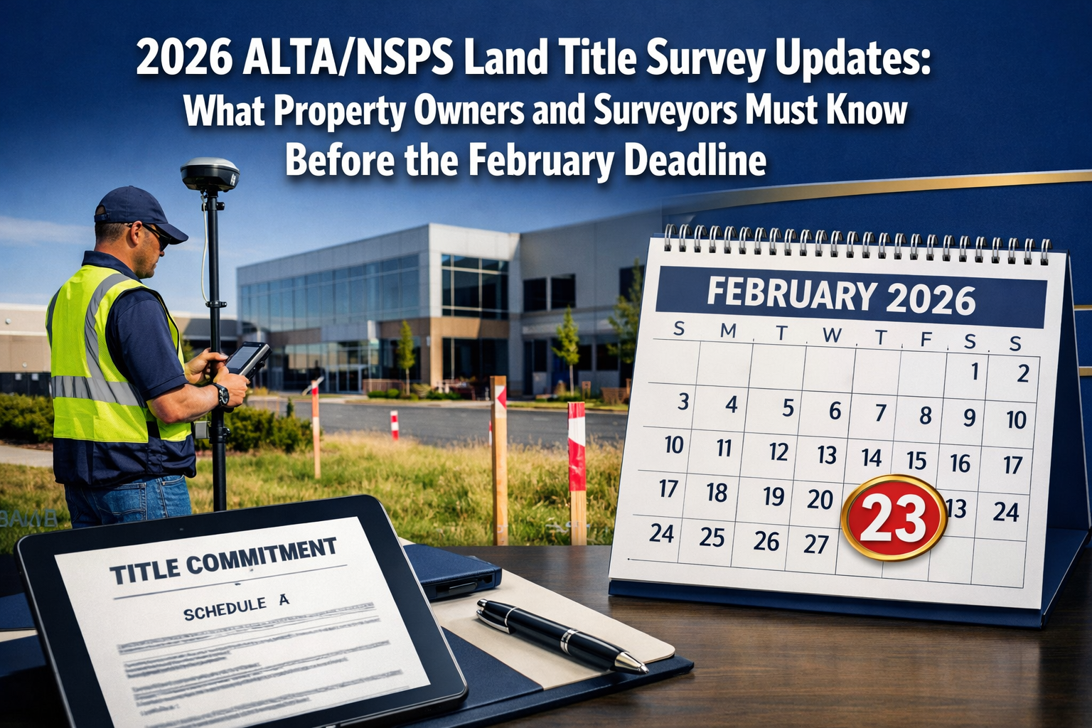
The clock is ticking. On February 23, 2026, the most significant changes to land title survey standards in years will take effect, fundamentally altering how property surveys are conducted, documented, and certified across the United States. The 2026 ALTA/NSPS Land Title Survey Updates: What Property Owners and Surveyors Must Know Before the February Deadline represent a watershed moment for real estate transactions, title insurance, and property rights documentation.
After more than three years of collaborative development between the American Land Title Association (ALTA) and the National Society of Professional Surveyors (NSPS), these updated standards were officially adopted in October 2025.[1] The changes aren't merely technical adjustments—they fundamentally reshape expectations around survey precision, documentation transparency, and professional accountability. Whether you're a property owner planning a commercial acquisition, a surveyor preparing for compliance, or a title professional navigating transaction requirements, understanding these updates is no longer optional.
The implications extend far beyond the surveying profession. Real estate transactions worth billions of dollars depend on accurate boundary determinations. Title insurance policies rely on survey certifications. Property disputes hinge on precise measurements. The 2026 standards address all these concerns with enhanced rigor, clearer communication protocols, and updated technical requirements that reflect modern surveying capabilities.
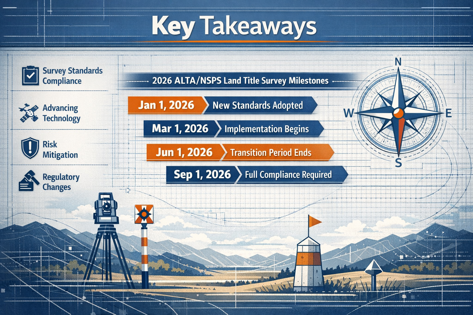
Key Takeaways
✅ February 23, 2026 is the mandatory compliance date—all survey contracts executed on or after this date must follow the 2026 Standards, with limited exceptions for pre-executed contracts.[1]
✅ Relative Positional Precision (RPP) definition has been clarified—the most significant technical change provides better explanation of boundary location accuracy for non-technical stakeholders while maintaining alignment with accepted measurement practices.[2]
✅ Title evidence requirements are now explicit—surveyors must be provided with the most recent title commitment or other satisfactory title evidence, eliminating previous ambiguity.[1]
✅ New Table A Item 20 promotes ongoing engagement—this optional item requires structured documentation of mandatory data, transforming the surveyor-client relationship from simple delivery to active collaboration.[1]
✅ "Updates" are technically new surveys—surveyors must certify compliance with all current standards regardless of prior work, though fees may reflect existing property knowledge.[1]
Understanding the 2026 ALTA/NSPS Land Title Survey Updates: What Property Owners and Surveyors Must Know Before the February Deadline
The Development Process and Timeline
The journey to the 2026 standards began more than three years ago when the Joint ALTA/NSPS Work Group convened to address evolving industry needs. Chaired by Todd D'Amico, PS of Oklahoma, this collaborative body brought together roughly equal numbers of professional surveyors and title professionals who met semi-annually throughout the development process.[1]
This balanced composition ensured that the resulting standards serve both technical accuracy requirements and practical business needs. The Work Group examined feedback from thousands of surveys conducted under previous standards, analyzed common points of confusion, and identified areas where clearer guidance would reduce disputes and improve transaction efficiency.
The official adoption in October 2025 gave the industry a four-month preparation window before the February 23, 2026 effective date. This timeline was deliberately chosen to allow:
- Surveyors to update their templates and procedures
- Title companies to revise their commitment language
- Real estate professionals to understand new requirements
- Educational programs to be developed and delivered
For those working with property surveyors, understanding this timeline is critical for transaction planning and risk management.
Why These Updates Matter for Real Estate Transactions
The 2026 standards aren't academic exercises—they directly impact every commercial and residential real estate transaction requiring an ALTA/NSPS survey. Here's why these changes matter:
🏢 Enhanced Transaction Security: Clearer documentation requirements reduce the risk of boundary disputes, encroachment issues, and title defects that can derail closings or create post-purchase liabilities.
💼 Improved Communication: The emphasis on transparency and structured documentation means property owners receive more comprehensible information about their boundaries and potential issues.
⚖️ Legal Clarity: Updated standards provide clearer guidance for resolving disputes about survey requirements, reducing litigation risk for all parties.
📊 Better Risk Assessment: Title insurers can make more informed underwriting decisions based on surveys that meet enhanced precision and documentation standards.
Similar to how common myths about property surveys can lead to costly misunderstandings, outdated knowledge about ALTA/NSPS standards can create transaction delays and unexpected expenses.
Key Changes in the 2026 ALTA/NSPS Standards
Revised Relative Positional Precision (RPP) Definition
The most significant technical change in the 2026 standards involves the Relative Positional Precision (RPP) definition. This statistical measurement of boundary location accuracy has been clarified to make it more accessible to those less familiar with surveying metrics while continuing to align with accepted measurement practices.[2]
What is RPP? Relative Positional Precision expresses the uncertainty in the location of boundary corners relative to each other. Think of it as a confidence interval—the surveyor is stating how accurate the measurements are within statistical parameters.
The 2026 Clarification provides:
- Clearer explanations for property owners, attorneys, and title professionals who need to understand survey accuracy without advanced technical knowledge
- Maintained technical rigor for professional surveyors who rely on precise statistical measurements
- Better documentation of how precision was achieved and what it means for boundary certainty
This change addresses a common complaint from non-surveyors: previous RPP language was technically accurate but practically incomprehensible. The updated definition bridges this gap without compromising measurement standards.
For context, precision requirements matter enormously in property transactions. A boundary uncertainty of several inches might be acceptable for a large rural parcel but could be critical for an urban commercial property where every square foot has significant value.
Enhanced Title Evidence Requirements (Section 4)
Section 4 of the 2026 standards now explicitly requires surveyors to be provided with a copy of the most recent title commitment or other title evidence satisfactory to the title insurer.[1] This seemingly simple change has profound implications:
Previous Ambiguity: Earlier standards implied this requirement but didn't mandate it explicitly, leading to situations where surveyors worked without complete title information.
2026 Clarity: The updated language removes any doubt—surveyors must have access to title evidence before completing the survey.
Why This Matters:
- Easement Identification: Surveyors can properly locate and depict recorded easements, rights-of-way, and other title encumbrances
- Ownership Verification: The survey reflects the correct legal description and ownership information
- Exception Coordination: Survey findings align with title commitment exceptions, reducing closing delays
- Liability Protection: Both surveyors and title insurers have clearer documentation of what was reviewed and certified
This change promotes better collaboration between surveyors and title professionals, similar to how chartered surveyors coordinate with various stakeholders in complex property assessments.
Modified Table A Item 15: Imagery-Based Survey Provision
Table A Item 15 underwent significant revision in the 2026 standards, reverting to its original intent while providing clearer guidance on when imagery can substitute for ground surveying.[1]
The Updated Provision allows imagery (such as aerial photography or drone imagery) rather than ground surveying to show certain features, subject to:
- Written agreement with the client, lender, and title insurer
- Specific limitations excluding boundaries and features in close proximity to boundaries
- Quality standards ensuring imagery provides sufficient detail and accuracy
What Can Be Shown via Imagery:
- Building locations (when not near boundaries)
- Parking areas and paving
- Landscape features
- General site improvements
What Requires Ground Survey:
- All boundary determinations
- Improvements within setback areas
- Features that could affect boundary or easement determinations
- Any element specifically requested by the title insurer
This modification acknowledges modern surveying technology while maintaining the integrity of critical boundary work. It can reduce survey costs and completion time for large properties where certain features are clearly distant from boundaries.
New Table A Item 20: Structured Documentation Requirement
Perhaps the most innovative addition to the 2026 standards is Table A Item 20, a newly developed optional item that requires surveyors to tabulate information already mandated by Sections 5 and 6 of the Standards.[1]
Purpose and Benefits:
This item transforms how survey information is presented by:
- Creating structured documentation of data already required but often scattered throughout the survey
- Promoting ongoing engagement between surveyor and client rather than simple document delivery
- Facilitating easier review by title professionals, attorneys, and property owners
- Standardizing presentation across different surveyors and projects
What Gets Tabulated:
- Basis of bearings used
- Datum information for elevations
- Coordinate system details
- Measurement methodology
- Precision specifications
- Monument types and conditions
Think of Item 20 as an executive summary for the technical aspects of the survey. While the information was always required, presenting it in tabular format makes it far more accessible and useful for decision-making.
This structured approach mirrors best practices in other property assessment disciplines where clear documentation prevents misunderstandings and disputes.
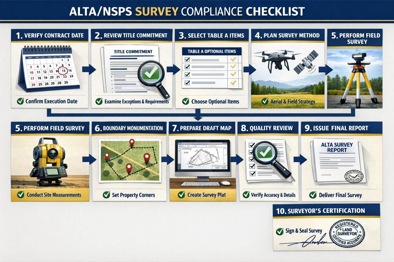
Compliance Checklist for the 2026 ALTA/NSPS Land Title Survey Updates: What Property Owners and Surveyors Must Know Before the February Deadline
For Professional Surveyors
📋 Pre-February 23, 2026 Preparation:
- ✅ Update all survey templates to reflect 2026 standard language, particularly RPP definitions and Section 4 requirements
- ✅ Revise contract language to specify which standards apply based on execution date
- ✅ Train staff on new requirements, especially regarding title evidence review and Table A modifications
- ✅ Review state-specific requirements for mandatory items (e.g., boundary monumenting)
- ✅ Update fee structures to account for additional documentation requirements
- ✅ Establish protocols for obtaining title commitments before fieldwork begins
- ✅ Develop Table A Item 20 templates for clients who select this optional item
📋 For Contracts Executed On or After February 23, 2026:
- ✅ Verify contract execution date to determine applicable standards
- ✅ Obtain title commitment or satisfactory title evidence before commencing survey work
- ✅ Discuss Table A options with client, explaining benefits of Item 20 and other optional items
- ✅ Confirm imagery use if applicable, obtaining written agreements from all required parties
- ✅ Apply updated RPP definition in all certifications and explanatory notes
- ✅ Document compliance with state-specific mandatory requirements
- ✅ Provide structured information if Table A Item 20 is selected
📋 For Pre-Executed Contracts Completing After February 23, 2026:
- ✅ Document contract execution date clearly in project files
- ✅ Complete under 2021 Standards if contract was executed before the deadline
- ✅ Exception for delayed closings: May complete under 2021 Standards if survey was anticipated to close before effective date but was delayed[1]
- ✅ Clarify with client which standards apply to avoid confusion
- ✅ Maintain clear records justifying standards version used
For Property Owners and Real Estate Professionals
📋 Transaction Planning Checklist:
- ✅ Identify contract execution date for any surveys ordered—this determines which standards apply
- ✅ Request Table A Item 20 for easier review of technical survey data
- ✅ Ensure surveyor receives title commitment promptly to avoid delays
- ✅ Understand RPP implications for your specific property type and transaction
- ✅ Discuss imagery options for large properties to potentially reduce costs
- ✅ Verify state-specific requirements that may make certain Table A items mandatory
- ✅ Build adequate time into transaction timeline for enhanced documentation requirements
📋 Risk Mitigation Steps:
- ✅ Engage qualified surveyors familiar with 2026 standards—ask about their preparation and training
- ✅ Review survey carefully using the structured documentation (especially if Item 20 is included)
- ✅ Coordinate with title company to ensure survey addresses all commitment requirements
- ✅ Address discrepancies immediately rather than waiting until closing
- ✅ Understand precision limitations and what they mean for your specific property use
- ✅ Document any agreed modifications to standard requirements in writing
- ✅ Retain survey records for future reference, refinancing, or property modifications
Much like the guidance provided in what to do when your property offer has been accepted, having a clear checklist prevents costly oversights during critical transaction phases.
For Title Insurance Professionals
📋 Underwriting Considerations:
- ✅ Update commitment language to reference 2026 standards for applicable transactions
- ✅ Provide title evidence to surveyors promptly per Section 4 requirements
- ✅ Review imagery agreements carefully if Table A Item 15 is utilized
- ✅ Assess RPP adequacy for the specific property and transaction type
- ✅ Verify surveyor certifications match current standards
- ✅ Coordinate exception language with survey findings
- ✅ Document standards version used for each survey in underwriting files
Understanding "Updates" Under the 2026 Standards
One critical clarification in the 2026 ALTA/NSPS standards concerns the concept of survey "updates." The Work Group explicitly addressed this common misconception: there is technically no such thing as an "update" to an ALTA/NSPS survey.[1]
Why "Updates" Don't Exist
When a surveyor is asked to "update" a previous ALTA/NSPS survey, they must actually perform a new survey that certifies current conditions comply with all current standard requirements. Here's why:
Certification Requirements: The surveyor must certify that the survey reflects current conditions as of the survey date. This certification cannot be limited to "changes only"—it encompasses the entire property.
Standards Compliance: The new survey must comply with whichever standards are in effect based on the contract execution date, which may differ from the original survey's standards.
Professional Liability: The surveyor assumes full liability for the accuracy of the entire survey, not just updated portions.
The Distinction That Matters
The only distinction between a so-called "update" and a completely new survey is that fees may be reduced because the surveyor has prior knowledge of the property from previous work.[1] This prior familiarity may allow:
- Faster fieldwork if monuments are known and undisturbed
- Reduced research time if title and record information is current
- Efficient data compilation using previous base mapping
However, the surveyor must still:
- Verify all previous boundary determinations
- Locate all current improvements
- Research any new recorded documents
- Certify complete compliance with current standards
This is similar to how building surveys must be comprehensive even when previous inspections exist—professional standards require complete current assessment.
Delayed Closing Exception
The 2026 standards do provide one limited exception for delayed transactions: surveyors may complete work under the 2021 Standards if the conveyance was anticipated to close before the February 23, 2026 effective date but was delayed.[1]
This exception requires:
- Documentation that closing was originally scheduled before the deadline
- Evidence that the delay was beyond the parties' control
- Clear communication with all parties about which standards apply
State-Specific Mandatory Requirements
A critical reminder emphasized by the Work Group: applicable state laws must be followed regardless of what the ALTA/NSPS standards designate as "optional."[1]
Boundary Monumenting Example
Table A Item 1 concerns setting boundary monuments. While this is listed as an optional item in the ALTA/NSPS standards, many states have laws requiring boundary monumenting in specific circumstances.
If your state mandates monumenting:
- Table A Item 1 becomes non-optional in that jurisdiction
- Surveyors must set monuments regardless of client preference
- Costs must include monumenting even if the client doesn't select Item 1
- Professional licensing boards may discipline surveyors who fail to comply
Other Potential State Requirements:
- Minimum precision standards exceeding ALTA/NSPS minimums
- Specific monument types or materials
- Recording requirements for surveys
- Additional certifications or stamps
- Particular language in legal descriptions
Verification Responsibility
Surveyors must research and comply with state-specific requirements as part of their professional duty.
Property owners and title professionals should ask surveyors about state-specific mandatory items that may affect costs and deliverables.
This state-law supremacy is similar to how construction regulations vary by jurisdiction, requiring local expertise beyond national standards.
Transition Period Considerations and Strategies
The transition from 2021 to 2026 standards creates both challenges and opportunities. Understanding how to navigate this period is essential for all stakeholders.
Contract Timing Strategies
For transactions with flexibility:
Before February 23, 2026: Executing survey contracts before the deadline allows completion under the more familiar 2021 standards, potentially reducing surveyor learning curve issues.
After February 23, 2026: Waiting until after the deadline ensures the survey reflects the most current standards, potentially providing better long-term value and reducing future "update" needs.
The decision factors:
- Transaction timeline and closing date
- Surveyor familiarity with 2026 standards
- Complexity of the property and title issues
- Lender or title insurer preferences
- Cost considerations
Managing Mixed-Standard Portfolios
Organizations with multiple properties or ongoing acquisition programs may have surveys under both 2021 and 2026 standards during the transition period.
Best Practices:
- Clearly label each survey with the standards version used
- Maintain separate files for pre- and post-deadline surveys
- Document decision rationale for which standards were applied
- Train staff to recognize differences between standards versions
- Update internal procedures to reflect new requirements
- Coordinate with regular surveyors to ensure consistency
Educational Resources and Support
The NSPS and ALTA have committed to supporting the transition through various educational initiatives:
Available Resources:[1]
- Updated FAQs on the NSPS website replacing 2021 FAQs
- State surveying society conferences featuring 2026 standards programs
- Virtual training sessions for remote participants
- Work Group guidance on specific implementation questions
- Industry publications with detailed analysis of changes
Recommended Actions:
- Attend training sessions before the deadline
- Review FAQs thoroughly
- Join professional organizations for ongoing updates
- Subscribe to industry publications
- Network with peers about implementation experiences
Implications for Different Property Types
The 2026 ALTA/NSPS Land Title Survey Updates affect different property types in distinct ways. Understanding these nuances helps with planning and budgeting.
Commercial Properties
Enhanced Impact Areas:
Boundary Precision: The clarified RPP definition is particularly important for commercial properties where boundary locations directly affect usable square footage and property value.
Title Evidence: Complex commercial properties often have multiple easements, restrictions, and encumbrances that require careful coordination between title evidence and survey depiction.
Table A Item 20: The structured documentation option is especially valuable for commercial transactions involving multiple stakeholders who need clear technical information.
Imagery Options: Large commercial sites may benefit significantly from Table A Item 15 modifications, reducing costs for depicting distant improvements.
Residential Properties
Key Considerations:
Simplified Explanations: The updated RPP definition helps homebuyers understand survey accuracy without technical expertise.
Boundary Clarity: Enhanced documentation requirements reduce common residential boundary disputes.
Cost Implications: Additional documentation requirements may slightly increase survey costs, but improved clarity can prevent expensive future disputes.
State Requirements: Residential properties are more likely to trigger state-mandated boundary monumenting requirements.
Industrial and Special-Purpose Properties
Unique Factors:
Complex Improvements: Industrial sites with numerous structures benefit from clearer guidelines on what requires ground survey versus imagery.
Easement Networks: Utility and access easements common to industrial properties require careful title evidence review under Section 4 updates.
Precision Needs: Manufacturing and distribution facilities often require higher precision than minimum standards, making RPP clarity essential.
Environmental Considerations: Special-purpose properties may have environmental restrictions requiring precise survey depiction.
Similar to how stock condition surveys vary based on property type and use, ALTA/NSPS survey requirements and costs differ significantly across property categories.
Cost Implications and Budgeting
Understanding how the 2026 standards affect survey costs helps with accurate transaction budgeting.
Factors Affecting Survey Costs
Increased Cost Drivers:
- Enhanced Documentation: Additional time required for structured information presentation
- Title Evidence Review: More thorough coordination with title commitments
- Learning Curve: Initial inefficiencies as surveyors adapt to new requirements
- Training Costs: Professional development expenses passed through to clients
- Software Updates: Technology investments to support new documentation formats
Potential Cost Reductions:
- Imagery Options: Table A Item 15 modifications may reduce fieldwork for certain features
- Clearer Standards: Reduced ambiguity may decrease time spent on interpretation
- Better Communication: Structured documentation may reduce follow-up questions and revisions
- Efficiency Gains: After initial transition, surveyors may complete work more efficiently
Budgeting Recommendations
For Property Buyers:
- Request quotes from multiple surveyors familiar with 2026 standards
- Ask for itemized pricing showing Table A optional items separately
- Discuss imagery options for large properties
- Budget 10-15% above 2021 standard survey costs during transition period
- Consider long-term value of enhanced documentation
For Lenders and Title Companies:
- Update fee schedules to reflect new requirements
- Communicate cost expectations to borrowers early
- Establish preferred surveyor networks trained on 2026 standards
- Monitor actual costs during transition to refine estimates
For Surveyors:
- Calculate true costs of enhanced documentation requirements
- Don't underprice to win work—ensure fees cover compliance costs
- Clearly explain value of new requirements to clients
- Offer tiered pricing based on Table A item selection
- Build efficiency over time through template development and workflow optimization
Risk Mitigation Strategies for Real Estate Transactions
The 2026 ALTA/NSPS standards create both risks and opportunities for transaction participants. Proactive risk mitigation is essential.
For Buyers and Sellers
Key Risks:
- Delayed closings due to surveyor unfamiliarity with new standards
- Unexpected costs from enhanced requirements
- Boundary disputes if precision requirements aren't properly specified
- Title issues if survey doesn't properly coordinate with commitment
Mitigation Strategies:
- Engage surveyors early in the transaction process
- Verify surveyor training on 2026 standards
- Build adequate timeline for survey completion and review
- Request Table A Item 20 for easier technical review
- Coordinate between surveyor and title company from the start
- Review surveys promptly upon receipt
- Address issues immediately rather than at closing
For Lenders
Key Risks:
- Collateral valuation uncertainty from boundary or easement issues
- Loan closing delays from survey problems
- Increased costs affecting borrower qualification
- Liability exposure from inadequate survey review
Mitigation Strategies:
- Update loan policies to reference 2026 standards
- Require surveys early in the approval process
- Establish minimum Table A requirements for different loan types
- Train loan officers on new standards implications
- Develop surveyor networks with verified 2026 competency
- Implement review protocols for survey adequacy
- Coordinate with title insurance requirements
For Title Insurance Companies
Key Risks:
- Increased claims from survey-related issues
- Underwriting errors from misunderstanding new requirements
- Surveyor coordination failures under Section 4 requirements
- Exception language mismatches with survey findings
Mitigation Strategies:
- Provide title evidence promptly per Section 4 requirements
- Review surveys against 2026 standards checklist
- Verify surveyor certifications match current requirements
- Update exception language to align with survey findings
- Train underwriters on new standards implications
- Establish surveyor communication protocols
- Document standards version for each transaction
These risk mitigation approaches parallel strategies used in property inspection and other due diligence processes where thoroughness prevents costly problems.
Technology and Innovation Considerations
The 2026 standards acknowledge modern surveying technology while maintaining professional standards. Understanding this balance is important for both surveyors and clients.
Imagery and Remote Sensing
The modified Table A Item 15 explicitly addresses imagery use, reflecting technological advances in:
Drone Technology: High-resolution aerial photography can accurately depict many site features at lower cost than ground survey.
Satellite Imagery: For very large properties, satellite data may supplement ground survey work.
LiDAR: Light Detection and Ranging technology provides detailed topographic information.
Photogrammetry: Advanced image processing creates accurate measurements from photographs.
Limitations Remain: Boundaries and features near boundaries still require traditional ground survey methods, maintaining the integrity of critical determinations.
Data Presentation and Accessibility
The emphasis on structured documentation (Table A Item 20) reflects modern expectations for data accessibility:
Digital Delivery: Surveys are increasingly delivered in digital formats with searchable, tabulated data.
GIS Integration: Structured data facilitates integration with Geographic Information Systems for property management.
Database Compatibility: Tabulated information can be imported into property databases and management systems.
Mobile Access: Digital formats allow field access to survey data via tablets and smartphones.
Future-Proofing Considerations
The 2026 standards balance current technology with flexibility for future innovations:
- Standards allow for technological advances without requiring frequent revisions
- Professional judgment remains paramount regardless of technology used
- Certification requirements ensure accountability despite changing methods
- Client communication requirements adapt to various delivery formats
This technological balance is similar to how modern topographic surveys leverage advanced equipment while maintaining professional standards.
International and Cross-Border Considerations
While ALTA/NSPS standards are U.S.-specific, they have implications for international transactions and cross-border property issues.
International Investors in U.S. Property
Foreign entities acquiring U.S. property must understand:
Standards Compliance: U.S. lenders and title insurers require ALTA/NSPS surveys regardless of buyer nationality.
Metric Conversions: International clients may need assistance understanding measurements in feet and acres.
Legal System Differences: The U.S. property rights system differs from many other countries' approaches.
Documentation Expectations: The structured approach of 2026 standards may differ from international norms.
U.S. Standards Influence Abroad
ALTA/NSPS standards often influence surveying practices in other countries:
Professional Standards: Many nations look to U.S. standards when developing their own requirements.
Title Insurance: Countries developing title insurance systems often adopt ALTA/NSPS survey concepts.
Best Practices: The emphasis on precision, documentation, and communication represents global best practices.
Border Properties
Properties near international borders (particularly U.S.-Mexico and U.S.-Canada borders) may require:
- Coordination with foreign survey systems
- Understanding of international boundary monuments
- Compliance with both U.S. and foreign requirements
- Special precision considerations for boundary determinations
Frequently Asked Questions About the 2026 ALTA/NSPS Land Title Survey Updates
What happens if my survey contract was signed before February 23, 2026, but the survey won't be completed until after that date?
Surveys contracted before the February 23, 2026 deadline can be completed under the 2021 Standards, even if the work is finished after that date.[1] The contract execution date determines which standards apply, not the completion date. However, maintain clear documentation of the contract date to justify using the older standards.
Are the 2026 standards more expensive than the 2021 standards?
Survey costs may increase modestly during the transition period due to enhanced documentation requirements, surveyor training costs, and initial inefficiencies. However, the imagery options in Table A Item 15 may reduce costs for certain properties. Long-term, clearer standards should improve efficiency and reduce costs associated with ambiguity and disputes.
Can I request a survey under the 2021 standards after February 23, 2026?
No. Any survey contract executed on or after February 23, 2026 must comply with the 2026 Standards.[1] The only exception is for delayed closings where the transaction was originally scheduled to close before the deadline but was postponed.
What is Table A Item 20 and should I select it?
Table A Item 20 is a new optional item requiring surveyors to provide structured, tabulated documentation of technical information already required by the standards.[1] It's particularly valuable for complex properties, commercial transactions, or situations with multiple stakeholders who need clear access to technical data. The modest additional cost is often worthwhile for the improved clarity.
Do the 2026 standards affect residential surveys differently than commercial surveys?
The standards apply equally to all property types, but the practical impact differs. Commercial properties often benefit more from the structured documentation and imagery options, while residential properties benefit from clearer RPP explanations that help homebuyers understand survey accuracy.
What if my state has different requirements than the ALTA/NSPS standards?
State law always takes precedence.[1] If your state mandates certain requirements (like boundary monumenting), those items become non-optional regardless of the ALTA/NSPS designation. Your surveyor should identify and comply with all applicable state requirements.
How do I verify that my surveyor is prepared for the 2026 standards?
Ask directly about their training and preparation. Qualified surveyors should be able to explain the key changes, demonstrate updated templates and procedures, and provide references from surveys completed under the 2026 standards. Professional surveying organizations also provide directories of members who have completed specific training programs.
Conclusion: Preparing for the Future of Land Title Surveys
The 2026 ALTA/NSPS Land Title Survey Updates: What Property Owners and Surveyors Must Know Before the February Deadline represent more than technical adjustments—they signal a fundamental shift toward greater transparency, enhanced precision, and improved communication in property boundary determination. As the February 23, 2026 deadline approaches, preparation and understanding are no longer optional for anyone involved in real estate transactions.
Key Implementation Priorities
For Surveyors: The time for preparation is now. Update templates, train staff, revise contracts, and establish protocols for obtaining title evidence before fieldwork begins. Your professional reputation and liability exposure depend on smooth compliance with the new standards.
For Property Owners: Engage qualified surveyors early in your transaction timeline. Request Table A Item 20 for complex properties. Build adequate time for survey completion and review. Understand that modest cost increases during the transition period represent investments in clearer, more defensible property documentation.
For Title Professionals: Provide title evidence promptly per Section 4 requirements. Update commitment language to reference 2026 standards. Train underwriters on new requirements. Establish clear communication protocols with surveyors to ensure coordination from the start of each transaction.
For Lenders: Update loan policies and procedures to reflect new standards. Require surveys early in the approval process. Establish minimum Table A requirements appropriate for different loan types. Build surveyor networks with verified 2026 competency.
Actionable Next Steps
-
Mark Your Calendar: February 23, 2026 is the firm deadline—plan all survey contracts with this date in mind.
-
Educate Your Team: Whether you're a surveying firm, title company, or real estate organization, ensure all relevant staff understand the changes and their implications.
-
Review Your Procedures: Update templates, checklists, and workflows to incorporate 2026 requirements.
-
Establish Partnerships: Build relationships with professionals who understand the new standards—surveyors, title companies, and real estate attorneys who are prepared for the changes.
-
Budget Appropriately: Account for potential cost increases during the transition period and the long-term value of enhanced documentation.
-
Communicate Proactively: Discuss standards requirements with all transaction participants early to avoid surprises and delays.
-
Stay Informed: Monitor NSPS and ALTA resources for updated FAQs, training opportunities, and implementation guidance.
The Bigger Picture
Beyond compliance checklists and technical requirements, the 2026 standards reflect an industry commitment to professionalism, accuracy, and client service. The emphasis on clearer communication, structured documentation, and enhanced precision serves everyone involved in property transactions—from individual homebuyers to major commercial investors.
The February 23, 2026 deadline isn't just a compliance date—it's an opportunity to elevate standards, reduce disputes, and build confidence in property boundary determinations that underpin billions of dollars in real estate transactions. Those who prepare thoroughly will navigate the transition smoothly and provide better service to their clients and partners.
For comprehensive property assessment services and expert guidance on survey requirements, professional property surveyors can provide the expertise necessary to navigate these evolving standards successfully.
The countdown to February 23, 2026 is underway. The question isn't whether to prepare—it's whether your preparation will be thorough enough to turn these changes into competitive advantages. Start today, and ensure your organization is ready when the deadline arrives.
References
[1] The 2026 Minimum Standard Detail Requirements For Alta Nsps Land Title Surveys – https://amerisurv.com/2026/02/01/the-2026-minimum-standard-detail-requirements-for-alta-nsps-land-title-surveys/
[2] New 2026 Minimum Standard Detail 3684174 – https://www.jdsupra.com/legalnews/new-2026-minimum-standard-detail-3684174/
[3] 2026 Alta Nsps Land Title Survey Standards – https://www.partneresi.com/resources/references/standards-regulations/2026-alta-nsps-land-title-survey-standards/
[4] Alta Standards Updated – https://cretelligent.com/alta-standards-updated/