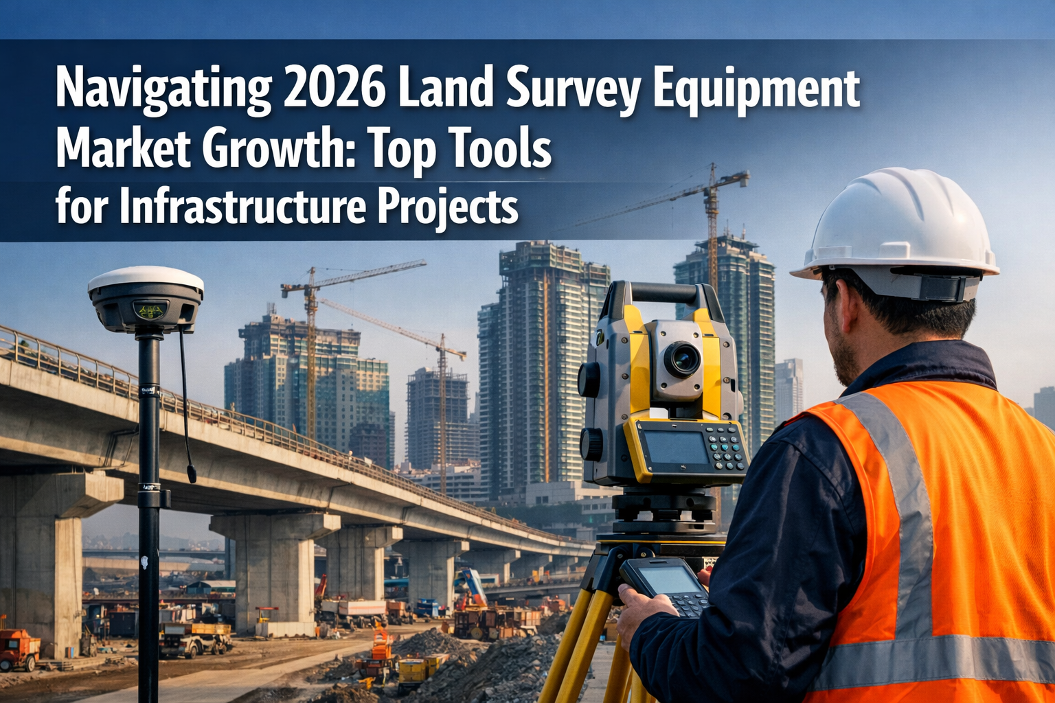
The global construction industry stands at a pivotal moment. With infrastructure projects multiplying across continents and urbanization accelerating at unprecedented rates, the demand for precision measurement technology has never been greater. Navigating 2026 Land Survey Equipment Market Growth: Top Tools for Infrastructure Projects reveals a sector poised to reach $13.2 billion by 2036, driven by construction booms and technological innovation that's transforming how professionals measure, map, and manage land development[1][5].
From GPS-enabled total stations that can complete in hours what once took days, to autonomous drones capturing millions of data points across mining operations, today's surveying equipment represents a quantum leap beyond the theodolites and measuring chains of previous generations. The convergence of artificial intelligence, cloud computing, and precision sensors is creating tools that deliver centimeter-level accuracy while dramatically reducing labor costs and project timelines.
Key Takeaways
🎯 Market Expansion: The land survey equipment market is valued between $9.47 billion and $10.29 billion in 2026, with projections reaching $12.47–$15.21 billion by 2032–2034 at a CAGR of 5.7–6.3%[1][3][5][8]
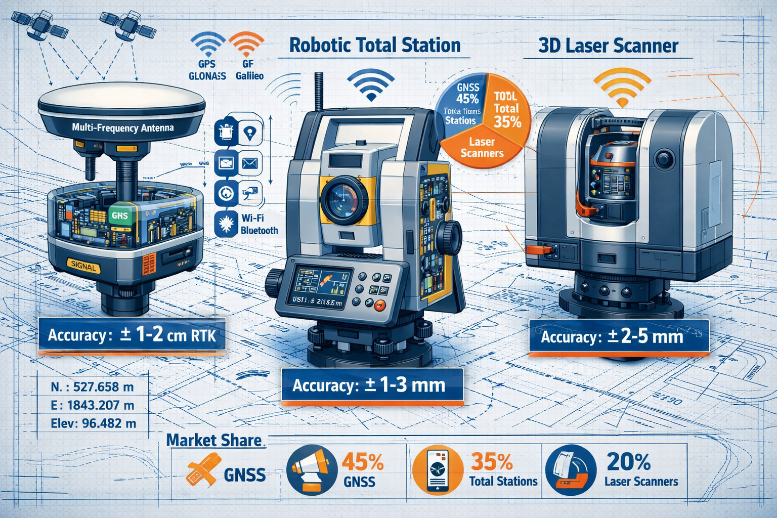
📡 GPS & GNSS Dominance: GPS and GNSS technologies command 30.24% market share in 2026 and represent the fastest-growing segment, with multi-frequency receivers enabling real-time data collection in challenging environments[1]
🤖 Productivity Revolution: Robotic total stations enable one operator to complete work requiring two traditional surveyors, doubling efficiency to approximately 200 survey points per day[2]
🚁 Drone Integration: UAV/LiDAR platforms show the fastest expansion at 21.2% CAGR, reaching 12.80% market share in 2025 and transforming large-area mapping applications[3]
💼 Business Model Innovation: Hardware-as-a-service subscription models are shifting equipment costs from capital to operational budgets while enabling predictive maintenance and remote updates[3]
Understanding the 2026 Land Survey Equipment Market Landscape
The land survey equipment market has evolved from a niche technical sector into a critical enabler of global infrastructure development. As governments worldwide commit trillions to transportation networks, renewable energy installations, and urban expansion, the tools that ensure precise boundary work, elevation mapping, and construction layout have become indispensable.
Market Size and Growth Projections
Current market valuations place the 2026 land survey equipment sector between $9.47 billion and $10.29 billion, depending on forecast methodologies and regional inclusion criteria[1][3]. This substantial market base reflects decades of steady adoption across construction, mining, agriculture, and government applications.
Looking ahead, analysts project robust growth trajectories:
- Conservative estimates forecast the market reaching $12.47 billion by 2032 at a CAGR of 5.7%[2]
- Moderate projections anticipate $13.2 billion by 2034 with steady infrastructure investment[5]
- Optimistic scenarios predict $15.21 billion by 2032, driven by accelerated technology adoption and emerging market expansion[8]
These growth rates significantly outpace general GDP expansion, indicating that surveying equipment represents an increasing share of construction and development budgets as precision requirements intensify and labor costs rise.
Key Market Drivers
Several fundamental forces are propelling market expansion:
Infrastructure Development Boom: Governments across Asia-Pacific, the Middle East, and North America have announced multi-year infrastructure programs totaling trillions of dollars. From India's Smart Cities Mission to the United States' Infrastructure Investment and Jobs Act, these initiatives require extensive surveying for planning, construction, and ongoing maintenance[4].
Urbanization Acceleration: The United Nations projects that 68% of the global population will live in urban areas by 2050, up from 55% in 2018. This urban migration necessitates constant land surveying for residential developments, commercial centers, and supporting infrastructure[5].
Precision Agriculture Expansion: Modern farming increasingly relies on land surveying technology for field mapping, drainage planning, and irrigation optimization. GNSS-equipped tractors and drones enable precision planting and harvesting that maximizes yields while minimizing resource waste[1].
Regulatory Compliance: Stricter building codes, environmental regulations, and safety standards demand more frequent and detailed surveying throughout project lifecycles. Digital documentation requirements further drive adoption of advanced equipment capable of producing comprehensive as-built records[3].
Regional Market Dynamics
Geographic distribution of market share reveals distinct patterns:
| Region | 2026 Market Share | Growth Rate | Key Drivers |
|---|---|---|---|
| Asia-Pacific | 38-42% | 6.8-7.2% CAGR | Infrastructure investment, urbanization |
| North America | 28-31% | 5.2-5.6% CAGR | Technology adoption, replacement cycles |
| Europe | 22-25% | 4.8-5.1% CAGR | Precision requirements, sustainability |
| Middle East & Africa | 6-8% | 7.5-8.2% CAGR | Mega-projects, resource development |
| Latin America | 3-5% | 5.9-6.4% CAGR | Mining expansion, urban development |
Asia-Pacific dominates both current market share and future growth potential, driven by China's Belt and Road Initiative, India's infrastructure modernization, and Southeast Asian urbanization. The region's combination of large-scale projects and emerging technology adoption creates ideal conditions for equipment manufacturers[4].
North America maintains strong market presence through equipment replacement cycles and early adoption of cutting-edge technologies like autonomous drones and AI-powered data processing. The region's mature construction industry increasingly values productivity gains over initial equipment costs[2].
Top Land Survey Equipment Tools Driving Infrastructure Projects in 2026
Navigating 2026 Land Survey Equipment Market Growth: Top Tools for Infrastructure Projects requires understanding the specific technologies capturing market share and solving real-world challenges for surveyors, engineers, and construction managers.
Total Stations: The Workhorse of Precision Surveying
Total stations retain the largest revenue slice at 33.80% of 2025 market revenue, testament to their versatility and reliability across diverse applications[3]. These integrated instruments combine electronic distance measurement (EDM) with angular measurement capabilities, delivering comprehensive positioning data from a single setup.
Modern total station capabilities include:
- Robotic tracking systems that follow prism reflectors automatically, enabling single-operator workflows
- Automated scanning modes that capture thousands of points for detailed topographic mapping
- Embedded imaging sensors that overlay measurement data on photographs for enhanced documentation
- Wireless connectivity for real-time data transfer to CAD software and cloud platforms
- Reflectorless measurement using laser technology for inaccessible points
The productivity impact of robotic total stations cannot be overstated. Traditional surveying required a two-person crew: one operating the instrument and another positioning the prism at measurement points. Robotic systems enable one operator to complete work requiring two traditional surveyors, doubling efficiency on approximately 200 survey points per day[2]. This labor reduction translates directly to cost savings on projects where surveying represents a significant budget component.
Infrastructure applications particularly suited to total stations include:
- Bridge construction: Precise pier positioning and deck alignment verification
- Highway layout: Horizontal and vertical curve stakeout for roadway construction
- Building construction: Column placement and elevation control for multi-story structures
- As-built documentation: Verification that constructed elements match design specifications
GPS & GNSS Systems: Global Positioning Revolution
GPS and Global Navigation Satellite System (GNSS) technologies claim 30.24% market share in 2026 and represent the fastest-growing segment in the surveying equipment market[1]. This growth reflects the maturation of satellite constellations beyond the original U.S. GPS system to include Russia's GLONASS, Europe's Galileo, China's BeiDou, and regional augmentation systems.
Multi-frequency receivers have become the industry standard, offering several advantages over earlier single-frequency models:
- Improved signal strength in challenging environments with tree canopy, urban canyons, or atmospheric interference
- Faster initialization times reducing the wait before achieving centimeter-level accuracy
- Real-time kinematic (RTK) positioning delivering instant coordinates without post-processing
- Network RTK services that eliminate the need for base station setup by connecting to correction networks
The practical impact on infrastructure projects is transformative. Where traditional surveying methods required line-of-sight between instrument and target, GNSS receivers can establish positions anywhere with clear sky view. This capability proves invaluable for:
- Linear infrastructure projects: Highway corridors, pipelines, and transmission lines spanning hundreds of kilometers
- Large-scale site development: Shopping centers, industrial parks, and residential subdivisions requiring extensive boundary and topographic surveys
- Mining operations: Stockpile volume calculations and haul road layout across vast open-pit facilities
- Agricultural land management: Field boundary mapping and drainage planning across expansive farmland
For those interested in how surveying technology applies to property assessment, our guide on professional surveyor services explores the intersection of traditional and modern techniques.
Laser Scanners: 3D Reality Capture
Terrestrial laser scanners (TLS) and mobile mapping systems represent the cutting edge of surveying technology, capturing millions of measurement points per second to create detailed three-dimensional models of existing conditions. While representing a smaller market share than total stations or GNSS systems, laser scanning shows robust growth driven by digital twin initiatives and Building Information Modeling (BIM) adoption.
Key laser scanning technologies include:
Terrestrial Laser Scanners: Tripod-mounted instruments that capture complete spherical point clouds from stationary positions, ideal for detailed documentation of complex structures, industrial facilities, and heritage sites.
Mobile Mapping Systems: Vehicle-mounted or backpack-worn scanners that capture continuous data while moving, enabling efficient corridor mapping for highways, railways, and utility networks.
Handheld Scanners: Portable devices that combine SLAM (Simultaneous Localization and Mapping) technology with laser ranging for rapid indoor scanning of buildings and confined spaces.
Infrastructure applications driving laser scanner adoption include:
- Bridge inspection: Detailed geometry capture for structural analysis and maintenance planning
- Tunnel construction: As-built verification and clearance envelope documentation
- Industrial plant modernization: Accurate measurements of existing piping, equipment, and structures for retrofit design
- Historic preservation: Non-contact documentation of culturally significant buildings and monuments
The data-rich output from laser scanners creates new possibilities for project stakeholders. Engineers can extract precise dimensions from point clouds months after field collection. Contractors can detect clashes between existing conditions and proposed designs before mobilizing equipment. Facility managers can maintain permanent digital records for future renovation planning.
UAV/Drone-LiDAR Platforms: Aerial Perspective
UAV/drone-LiDAR platforms represent the fastest-expanding equipment type with a 21.2% CAGR, reaching 12.80% market share in 2025[3]. This explosive growth reflects the unique combination of aerial perspective, rapid data collection, and decreasing equipment costs that drones bring to surveying applications.
Modern survey drones integrate multiple sensor technologies:
- LiDAR sensors that penetrate vegetation to capture ground surface beneath forest canopy
- High-resolution cameras for orthophoto generation and visual documentation
- Multispectral imaging for vegetation analysis and environmental monitoring
- Thermal cameras for infrastructure inspection and energy auditing
The productivity advantages of drone surveying are particularly dramatic for large-area mapping. A single drone flight can capture topographic data across hundreds of acres in hours—work that would require weeks using traditional ground-based methods. This efficiency makes drones ideal for:
- Mining operations: Regular stockpile volume measurements and pit progression monitoring
- Forestry management: Timber inventory and harvest planning across extensive tracts
- Quarry operations: Material volume calculations and highwall stability assessment
- Coastal erosion monitoring: Repeated surveys documenting shoreline changes over time
Inspection applications emerge as the fastest-growing segment (2025–2032), enhanced by drone integration for real-time visual data collection with minimal human involvement[1]. Inspectors can now examine bridge undersides, transmission tower components, and building roofs without scaffolding, rope access, or aerial lifts—dramatically reducing safety risks and inspection costs.
Levels and Theodolites: Traditional Tools Reimagined
While advanced technologies capture headlines, digital levels and electronic theodolites continue serving essential roles in construction surveying. These instruments have evolved significantly from their mechanical predecessors, incorporating electronic sensors, digital displays, and data logging capabilities.
Digital levels automate elevation measurements using bar-coded leveling rods, eliminating reading errors and accelerating data collection. Applications include:
- Foundation elevation verification ensuring proper drainage
- Floor flatness assessment for warehouse and manufacturing facilities
- Benchmark establishment for vertical control networks
- Settlement monitoring of structures and embankments
Electronic theodolites provide precise angular measurements for alignment and orientation tasks:
- Tunnel boring machine guidance maintaining design alignment
- Antenna tower plumbness verification
- Machine installation alignment in industrial facilities
- Property boundary angle measurements
Though representing mature product categories with modest growth rates, these instruments remain essential components of surveying equipment fleets, particularly for contractors focused on vertical construction and site development.
Navigating 2026 Land Survey Equipment Market Growth: Emerging Technologies and Business Models
The surveying equipment market in 2026 extends beyond hardware innovations to encompass transformative software platforms, subscription services, and artificial intelligence applications that are reshaping how professionals approach measurement and mapping challenges.
Hardware Segment Dominance with Software Acceleration
The hardware segment dominates with 67.79% market share in 2026, reflecting the capital-intensive nature of precision instruments and the replacement cycles that drive recurring revenue for manufacturers[1]. However, software represents the fastest-growing segment during the forecast period, indicating a fundamental shift in value creation within the industry.
This software growth encompasses several categories:
Data Processing Software: Applications that convert raw survey data into deliverable formats—CAD drawings, GIS databases, BIM models, and engineering design files. Cloud-based processing enables collaboration among distributed teams and eliminates the need for high-performance workstations at every office.
Project Management Platforms: Integrated systems that track equipment utilization, manage field crews, schedule maintenance, and generate client invoices. These platforms increasingly incorporate AI-powered analytics that identify productivity bottlenecks and optimization opportunities.
Visualization Tools: Software that transforms point clouds and survey data into immersive 3D experiences, enabling stakeholders to explore proposed designs in virtual reality or overlay digital models on physical sites through augmented reality applications.
Quality Control Systems: Automated routines that validate survey data against design specifications, flagging discrepancies that require field verification and ensuring deliverables meet accuracy standards before submission.
The integration of hardware and software creates ecosystem lock-in effects that benefit manufacturers offering comprehensive solutions. A contractor who invests in a manufacturer's total stations, GNSS receivers, and laser scanners gains significant efficiency by using that same manufacturer's integrated software platform—creating switching costs that enhance customer retention.
Hardware-as-a-Service: Subscription Models Transform Procurement
Hardware-as-a-service subscription models are proliferating among regional contractors and agricultural cooperatives, shifting expenditure from capital budgets to operational accounts while enabling predictive maintenance and remote firmware updates[3]. This business model innovation addresses several pain points that have historically limited surveying equipment adoption:
Capital Constraints: Small and medium contractors often lack the cash reserves or credit capacity to purchase $50,000+ total stations or laser scanners outright. Monthly subscription fees of $1,500-$3,000 make advanced equipment accessible to firms that would otherwise rely on outdated technology.
Technology Obsolescence: Surveying equipment traditionally had 7-10 year useful lives, but accelerating innovation cycles now render instruments outdated in 3-5 years. Subscription models transfer obsolescence risk to manufacturers, who provide equipment upgrades as part of ongoing service agreements.
Maintenance Burden: Precision instruments require regular calibration, repairs, and technical support. Subscription agreements typically include comprehensive maintenance, eliminating unexpected repair costs and ensuring equipment remains in optimal condition.
Utilization Optimization: Contractors with seasonal workloads can scale equipment fleets up during busy periods and down during slow seasons, paying only for what they use rather than maintaining underutilized assets year-round.
For equipment manufacturers, subscription models create predictable recurring revenue streams that financial markets value more highly than lumpy equipment sales. The ongoing customer relationships also generate data on equipment usage patterns, failure modes, and feature preferences that inform product development priorities.
Artificial Intelligence and Machine Learning Integration
AI, machine learning, and autonomous survey drones emerge as key adoption trends, alongside 3D mapping and digital twin technologies for urban planning and resource management[4]. These technologies are moving beyond experimental applications into production workflows that deliver measurable value.
Automated Feature Extraction: Machine learning algorithms trained on millions of images can automatically identify and classify objects in aerial photography and LiDAR point clouds—distinguishing buildings from trees, roads from sidewalks, and utility poles from street signs. This automation reduces the manual labor required to convert raw survey data into usable GIS databases.
Predictive Maintenance: Equipment sensors continuously monitor performance parameters—laser power output, motor temperatures, battery health, and calibration drift. AI algorithms analyze these data streams to predict component failures before they occur, enabling proactive maintenance that prevents costly downtime.
Autonomous Flight Planning: Survey drones equipped with AI can dynamically adjust flight paths in response to changing conditions—avoiding obstacles, optimizing overlap for photogrammetric processing, and ensuring complete coverage of complex terrain without human intervention.
Quality Assurance: Neural networks trained on correctly processed survey data can identify anomalies, outliers, and processing errors that might escape human review, particularly in large datasets containing millions of measurement points.
The integration of AI capabilities differentiates premium equipment offerings from budget alternatives, creating pricing power for manufacturers that invest in software development. As AI algorithms improve through exposure to more training data, equipment becomes more valuable over time—a reversal of traditional depreciation patterns.
Digital Twin and BIM Integration
The convergence of surveying technology with Building Information Modeling (BIM) and digital twin platforms represents a fundamental shift in how infrastructure projects are planned, constructed, and operated. Rather than producing static drawings that quickly become outdated, modern surveying workflows create living digital models that evolve throughout project lifecycles.
Design Phase: Laser scans and drone surveys capture existing conditions with millimeter precision, providing accurate base data for engineering design. Designers can identify conflicts between proposed elements and existing features before construction begins, eliminating costly field changes.
Construction Phase: Regular drone surveys document construction progress, enabling automated comparison between as-built conditions and design intent. Project managers can identify deviations early when corrections remain inexpensive rather than discovering problems during final inspection.
Operations Phase: Facility managers maintain digital twins that combine as-built survey data with operational information—equipment specifications, maintenance histories, energy consumption, and space utilization. This integration enables predictive maintenance, space optimization, and efficient renovation planning.
For surveyors, BIM integration expands the value proposition beyond traditional measurement services. Firms that can deliver survey data in BIM-compatible formats and integrate that data with project models command premium fees and develop sticky client relationships that extend across multiple project phases.
Those interested in understanding how survey data informs property decisions may find our article on building evaluation helpful for connecting technical measurements to practical outcomes.
Application Segment Analysis
Understanding which applications drive equipment demand helps manufacturers prioritize product development and helps contractors identify growth opportunities:
Mining & Construction Sector accounts for 23.45% market share in 2026, utilizing surveying equipment for mineral exploration, mine planning, and infrastructure development[1]. This sector values rugged equipment capable of operating in harsh environments with minimal maintenance requirements.
Precision Agriculture emerges as the fastest-growth application (2025–2032 forecast), leveraging GNSS systems, drones, and total stations for land leveling and irrigation planning[1]. Agricultural applications typically emphasize ease of use and integration with farm management software over ultimate precision, creating opportunities for simplified equipment offerings.
Oil & Gas Exploration: Seismic survey layout, pipeline routing, and facility construction require surveying equipment capable of operating in remote locations with extreme temperatures and limited infrastructure support.
Environmental Monitoring: Coastal erosion tracking, wetland delineation, and forest inventory applications increasingly rely on drone-based LiDAR and multispectral imaging for repeated measurements over time.
Utilities and Transportation: Linear infrastructure projects—power transmission, telecommunications, highways, and railways—consume significant surveying resources for route selection, right-of-way mapping, and construction stakeout.
The diversity of application segments creates opportunities for specialized equipment optimized for specific use cases rather than general-purpose instruments. Manufacturers increasingly offer application-specific bundles that combine hardware, software, and training tailored to particular industries.
Strategic Considerations for Equipment Selection and Market Participation

For contractors, engineering firms, and government agencies navigating 2026 land survey equipment market growth, strategic equipment selection requires balancing immediate project needs against long-term technology trends and business model evolution.
Total Cost of Ownership Analysis
Purchase price represents only one component of equipment costs over useful life. Comprehensive analysis must consider:
Acquisition Costs: Equipment purchase price, financing charges, delivery fees, and initial training expenses.
Operating Costs: Field crew labor (influenced by single-operator vs. multi-operator requirements), vehicle fuel for transportation, consumables like batteries and prisms, and software licensing fees.
Maintenance Costs: Annual calibration services, repair parts, manufacturer support contracts, and downtime opportunity costs when equipment requires service.
Obsolescence Costs: Residual value at replacement time and the frequency of replacement cycles driven by technology advancement.
For a $60,000 robotic total station with 5-year useful life, total ownership costs might break down as:
- Acquisition: $60,000 (equipment) + $5,000 (training) = $65,000
- Operating: $25,000/year labor savings vs. two-person crew
- Maintenance: $3,000/year calibration and support contracts = $15,000
- Obsolescence: $15,000 residual value after 5 years = $45,000 net cost
This analysis reveals a net cost of $110,000 over five years offset by $125,000 in labor savings—a positive return even before considering productivity benefits like faster project completion and enhanced data quality.
Build vs. Buy vs. Subscribe Decision Framework
Organizations face three fundamental approaches to equipment acquisition:
Outright Purchase makes sense when:
- Project pipelines provide consistent equipment utilization (>60% of available time)
- Capital is available at reasonable cost
- Technical staff can manage maintenance and calibration
- Equipment technology is mature with slow obsolescence rates
Rental/Leasing works best when:
- Project demand is seasonal or unpredictable
- Multiple equipment types are needed for short durations
- Cash preservation is a priority
- Testing new technologies before committing to purchase
Subscription Services offer advantages when:
- Predictable monthly costs simplify budgeting
- Comprehensive maintenance and support are valued
- Regular technology upgrades are important
- Equipment utilization varies significantly across months
Many organizations adopt hybrid approaches—owning core equipment that sees constant use while renting specialized instruments for occasional applications and subscribing to software platforms that integrate data from multiple hardware sources.
Workforce Development and Training
Advanced surveying equipment delivers value only when operators possess the skills to use it effectively. The industry faces a persistent challenge: experienced surveyors who mastered traditional methods often resist adopting new technologies, while recent graduates with strong technical skills lack the field judgment that comes from experience.
Successful equipment implementation programs address this gap through:
Manufacturer Training: Taking full advantage of included training courses that cover basic operation, advanced features, and troubleshooting procedures.
Mentorship Programs: Pairing experienced surveyors with technology-savvy junior staff to transfer both technical knowledge and field judgment.
Certification Programs: Pursuing manufacturer certifications that validate operator competency and unlock access to technical support resources.
Continuous Learning: Allocating time for operators to experiment with new features, test different workflows, and share discoveries with colleagues.
Organizations that invest in workforce development realize higher returns on equipment investments through better utilization rates, fewer operator errors, and faster adoption of productivity-enhancing features.
Data Management and Cybersecurity
Modern surveying equipment generates enormous data volumes—a single day of laser scanning can produce hundreds of gigabytes requiring storage, processing, and long-term archival. Effective data management strategies address:
Field Data Backup: Redundant storage of raw survey data before leaving project sites, protecting against equipment loss, damage, or theft.
Processing Workflows: Standardized procedures for converting raw data into deliverable formats, ensuring consistency across projects and operators.
Quality Control: Validation routines that verify data completeness and accuracy before considering field work complete.
Long-term Archival: Organized storage systems that enable retrieval of historical survey data for future reference, legal disputes, or change detection analysis.
Cybersecurity: Protection of survey data and equipment from unauthorized access, particularly important for critical infrastructure projects and government applications.
Cloud-based platforms increasingly handle these requirements through automated backup, processing pipelines, and access controls—but introduce dependencies on internet connectivity and subscription services that must be factored into operational planning.
For property professionals seeking to understand how survey data integrates with broader assessment processes, our guide on real estate appraisal provides valuable context.
Competitive Landscape and Vendor Selection
The land survey equipment market features a mix of established multinational corporations and specialized niche manufacturers:
Major Global Vendors (Trimble, Leica Geosystems, Topcon, Hexagon) offer comprehensive product portfolios spanning GNSS receivers, total stations, laser scanners, and drones, along with integrated software platforms. These vendors provide advantages including:
- Worldwide service and support networks
- Seamless data integration across product lines
- Financial stability and long-term viability
- Extensive training resources and user communities
Specialized Manufacturers focus on specific equipment categories or application niches, often offering:
- Innovative features not yet available from major vendors
- Competitive pricing for performance-focused buyers
- Responsive customer service and customization options
- Agile product development cycles
Emerging Competitors from China and other developing markets increasingly offer capable equipment at significantly lower prices, though with questions about long-term support, software quality, and intellectual property practices.
Vendor selection should consider not just current equipment specifications but long-term factors like upgrade paths, data portability, and the vendor's commitment to ongoing product development in relevant application areas.
Future Outlook: Market Trends Shaping the Next Decade
As the land survey equipment market progresses toward the projected $13.2 billion valuation by 2036, several trends will shape competitive dynamics and technology development priorities.
Sustainability and Environmental Considerations
Infrastructure development increasingly faces scrutiny regarding environmental impacts and carbon footprints. Surveying equipment manufacturers respond through:
Energy Efficiency: Battery technology improvements extending field runtime while reducing charging frequency and energy consumption.
Sustainable Materials: Incorporating recycled components and designing for end-of-life disassembly and material recovery.
Carbon-Neutral Operations: Offsetting manufacturing emissions through renewable energy investments and reforestation programs.
Digital Workflows: Reducing paper consumption through digital data collection and electronic deliverable formats.
Clients increasingly factor sustainability into procurement decisions, creating competitive advantages for manufacturers that demonstrate environmental leadership.
Regulatory Evolution and Standards Development
Government regulations and industry standards will continue shaping equipment requirements:
Accuracy Standards: Increasingly stringent specifications for infrastructure projects requiring equipment with better precision and verification capabilities.
Data Formats: Standardization of survey data exchange formats enabling interoperability across software platforms and project stakeholders.
Operator Certification: Potential licensing requirements for surveying equipment operators, particularly for safety-critical applications like drone flights.
Privacy Regulations: Restrictions on data collection in populated areas and requirements for anonymizing captured imagery.
Manufacturers that participate in standards development processes can influence requirements in ways that favor their technical approaches while ensuring products remain compliant as regulations evolve.
Consolidation and Ecosystem Development
Market consolidation continues as major manufacturers acquire specialized competitors, software developers, and service providers to create comprehensive ecosystems. This trend creates both opportunities and challenges:
For Buyers: Integrated ecosystems offer seamless workflows and single-vendor accountability but may limit flexibility and create vendor lock-in.
For Manufacturers: Ecosystem development requires substantial investment but creates competitive moats and recurring revenue streams.
For Specialized Vendors: Acquisition by major players offers exit opportunities but may reduce market diversity and innovation.
The optimal strategy depends on organization size and priorities—large enterprises may benefit from comprehensive ecosystems while smaller firms might prefer best-of-breed component selection.
Emerging Applications and Market Expansion
New applications continue expanding the addressable market for surveying equipment:
Autonomous Vehicles: Self-driving cars require high-definition maps created through mobile LiDAR scanning of road networks.
Smart Cities: Urban management platforms integrate survey data with IoT sensors for traffic optimization, infrastructure monitoring, and service delivery.
Renewable Energy: Wind and solar farm development requires extensive surveying for site assessment, installation layout, and ongoing monitoring.
Disaster Response: Rapid survey capabilities enable damage assessment and reconstruction planning following natural disasters.
These emerging applications often require equipment modifications or entirely new product categories, creating opportunities for innovation and market share gains.
Understanding how surveying integrates with comprehensive property assessment can enhance decision-making—our article on expert building evaluation explores these connections in detail.
Practical Implementation: Getting Started with Modern Survey Equipment
For organizations ready to upgrade surveying capabilities, a structured implementation approach maximizes return on investment while minimizing disruption to ongoing operations.
Assessment Phase
Begin by documenting current state and future requirements:
Equipment Inventory: Catalog existing instruments, their age, condition, capabilities, and utilization rates.
Project Analysis: Review recent projects to identify bottlenecks, inefficiencies, and opportunities where better equipment could have delivered value.
Capability Gaps: Determine which applications current equipment cannot address or handles inefficiently.
Budget Parameters: Establish available funding for equipment acquisition and ongoing operational costs.
Timeline Constraints: Identify upcoming projects that could benefit from new equipment and establish implementation deadlines.
Technology Selection
With requirements documented, evaluate specific technologies:
Prioritization: Rank potential equipment acquisitions by expected return on investment, considering both cost savings and revenue opportunities.
Vendor Evaluation: Request demonstrations from multiple manufacturers, comparing capabilities, ease of use, and support quality.
Reference Checks: Contact existing users of shortlisted equipment to understand real-world performance and support experiences.
Trial Programs: Negotiate evaluation periods or rental arrangements to test equipment on actual projects before committing to purchase.
Total Cost Analysis: Calculate complete ownership costs including training, software, maintenance, and obsolescence factors.
Implementation Planning
Successful equipment deployment requires careful planning:
Training Schedule: Arrange manufacturer training before equipment delivery, ensuring operators are prepared when instruments arrive.
Workflow Integration: Modify field procedures and office processing routines to leverage new equipment capabilities.
Quality Control: Establish validation procedures that verify new equipment delivers expected accuracy and reliability.
Transition Management: Plan gradual migration from old to new equipment, maintaining backup capabilities during the transition period.
Performance Monitoring: Track utilization rates, project efficiency, and client satisfaction to validate investment decisions.
Optimization and Scaling
After initial implementation, focus on maximizing value:
Feature Adoption: Ensure operators utilize advanced capabilities rather than reverting to familiar but less efficient methods.
Workflow Refinement: Continuously improve procedures based on field experience and operator feedback.
Capacity Planning: Monitor utilization to identify when additional equipment or operators are needed to handle growing demand.
Technology Refresh: Plan equipment replacement cycles that balance depreciation, obsolescence, and capability requirements.
Organizations that approach equipment acquisition strategically rather than opportunistically achieve better outcomes and higher returns on technology investments.
Conclusion: Positioning for Success in the Growing Survey Equipment Market

The land survey equipment market in 2026 presents compelling opportunities for manufacturers, service providers, and infrastructure developers. With market valuations approaching $10 billion and growth trajectories pointing toward $13.2 billion by 2036, the sector demonstrates both current vitality and future potential[1][3][5].
Navigating 2026 Land Survey Equipment Market Growth: Top Tools for Infrastructure Projects requires understanding that success depends not merely on acquiring the latest technology but on strategic alignment between equipment capabilities, workforce skills, client needs, and business models.
Total stations remain essential workhorses, with robotic capabilities delivering dramatic productivity gains. GPS and GNSS systems provide the fastest-growing technology segment, enabling positioning anywhere with clear sky view. Laser scanners create detailed 3D models that support digital twin and BIM workflows. Drone platforms capture aerial data at unprecedented speed and scale, transforming large-area mapping economics.
Beyond hardware, software platforms and subscription business models are reshaping how organizations acquire and utilize surveying equipment. Artificial intelligence and machine learning applications automate data processing and quality control, while digital twin integration extends survey data value across entire project lifecycles.
Actionable Next Steps
For organizations looking to capitalize on market growth:
-
Conduct comprehensive assessment of current equipment capabilities, project requirements, and workforce skills to identify high-value upgrade opportunities
-
Evaluate business models including outright purchase, rental, and subscription services to determine optimal acquisition approaches for different equipment categories
-
Invest in workforce development through manufacturer training, certification programs, and mentorship initiatives that ensure operators can fully utilize advanced equipment capabilities
-
Develop data management strategies that address field backup, processing workflows, quality control, archival, and cybersecurity requirements
-
Monitor technology trends including AI integration, autonomous systems, and digital twin platforms to anticipate future capability requirements
-
Build vendor relationships with manufacturers that demonstrate commitment to ongoing product development, customer support, and technology innovation
-
Participate in industry organizations that shape standards, regulations, and best practices affecting surveying equipment and applications
The surveying equipment market's robust growth reflects its fundamental importance to infrastructure development, urbanization, and precision agriculture. Organizations that strategically invest in modern equipment, develop operator capabilities, and optimize workflows will capture disproportionate value from this expanding market.
Whether measuring boundaries for property development, mapping corridors for transportation infrastructure, or capturing as-built conditions for facility management, the tools available in 2026 deliver unprecedented combinations of precision, productivity, and value. The challenge—and opportunity—lies in selecting the right tools, implementing them effectively, and continuously adapting to technological advancement.
For professionals seeking to deepen their understanding of how survey data supports property decisions, exploring resources on building inspection and house inspection can provide valuable complementary perspectives.
The future of land surveying combines cutting-edge technology with timeless principles of precision measurement and professional judgment. Organizations that master this combination will thrive as infrastructure investment accelerates and surveying equipment markets continue their upward trajectory toward 2036 and beyond.
References
[1] Land Survey Equipment Market 103329 – https://www.fortunebusinessinsights.com/land-survey-equipment-market-103329
[2] Land Surveying Equipment Market Industry Analysis – https://www.technavio.com/report/land-surveying-equipment-market-industry-analysis
[3] Land Survey Equipment Market – https://www.mordorintelligence.com/industry-reports/land-survey-equipment-market
[4] Global Land Survey Equipment Market – https://www.kenresearch.com/industry-reports/global-land-survey-equipment-market
[5] Land Survey Equipment Market To Reach Us 15 0 Bn By 2032 Says Persistence Market Research – https://www.einpresswire.com/article/889890983/land-survey-equipment-market-to-reach-us-15-0-bn-by-2032-says-persistence-market-research
[6] The Future Of Land Surveying Technology And Upcoming Trends In 2026 – https://metricop.com/blogs/land-surveying/the-future-of-land-surveying-technology-and-upcoming-trends-in-2026
[7] Future Land Surveying 2026 – https://haller-blanchard.com/future-land-surveying-2026/
[8] Land Survey Equipment Global Market Report – https://www.thebusinessresearchcompany.com/report/land-survey-equipment-global-market-report